Giant hail and damaging winds in Texas

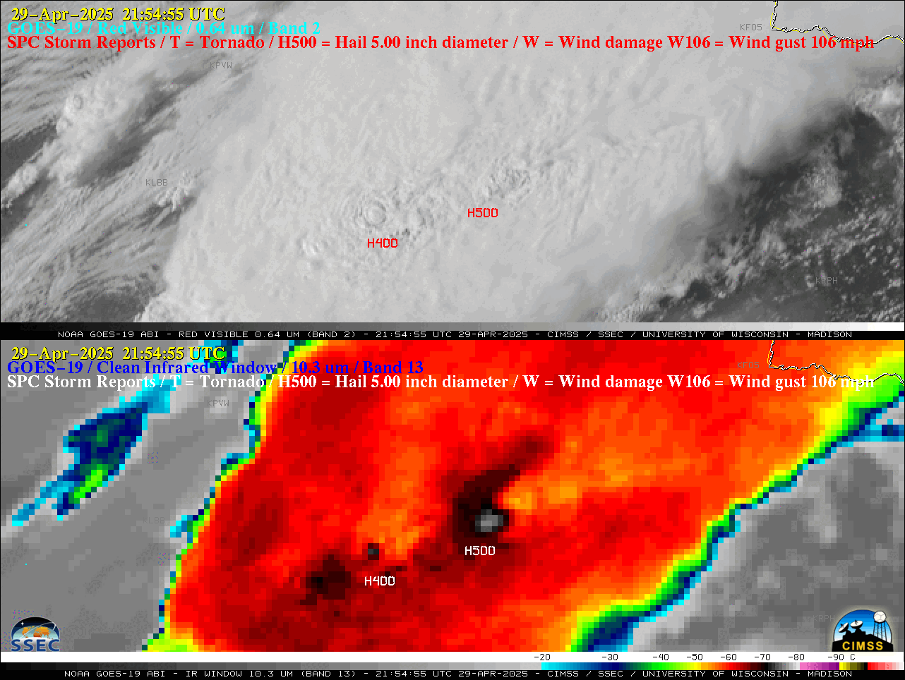
1-minute GOES-19 “Red” Visible (0.64 µm, top) and “Clean” Infrared Window (10.3 µm, bottom) images with time-matched (+/- 3 minutes) SPC Storm Reports plotted in red/white, from 1920 UTC on 29 April to 0010 UTC on 30 April [click to play animated GIF | MP4]
According to a plot of rawinsonde data (source) from Fort Worth, Texas at 0000 UTC on 30 April (below), the coldest GOES-19 cloud-top infrared brightness temperature of -78ºC represented a ~1.5 km overshoot of the Most Unstable air parcel Equilibrium Level (MU EL).
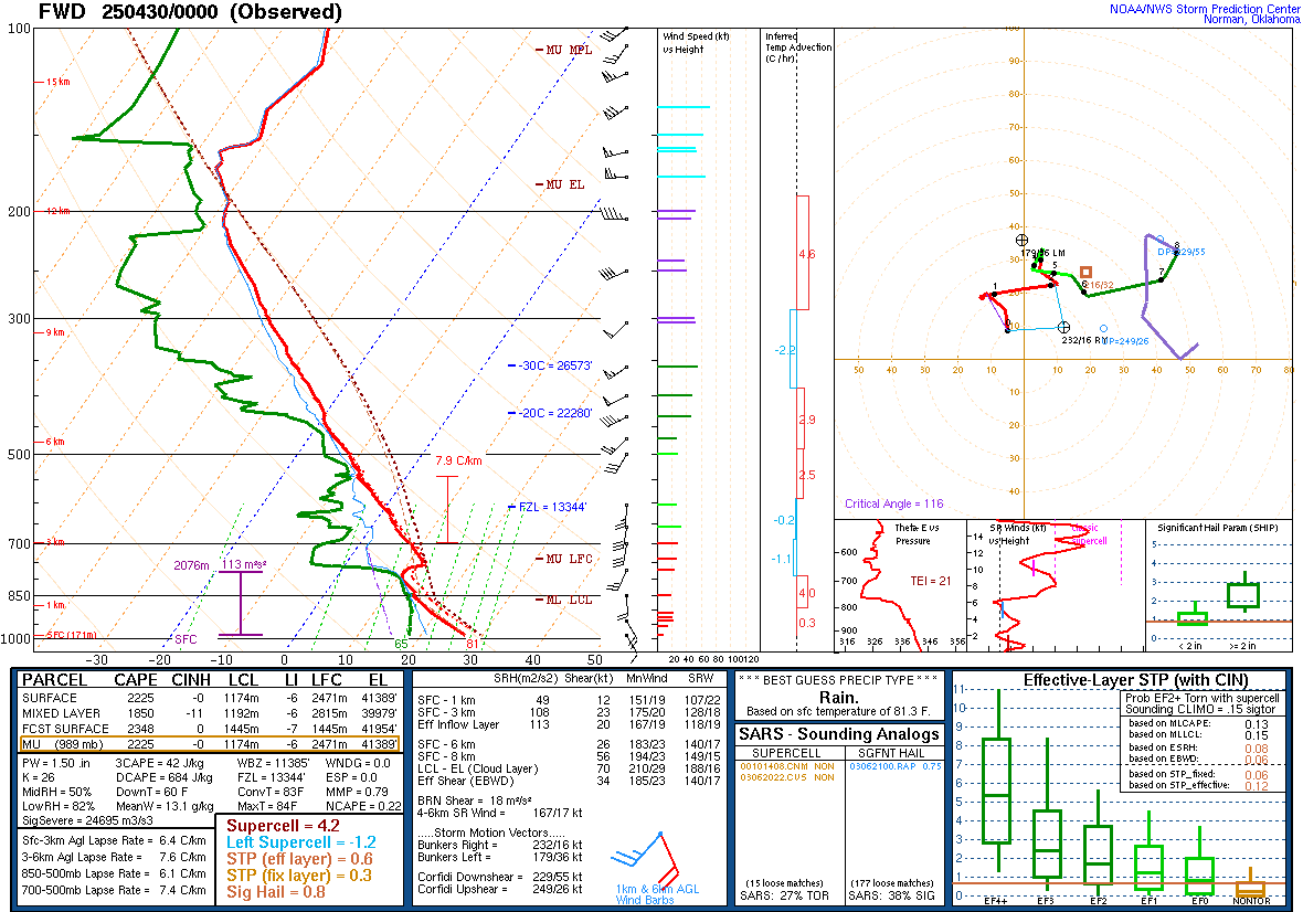
Plot of rawinsonde data from Fort Worth, Texas at 0000 UTC on 30 April [click to enlarge]
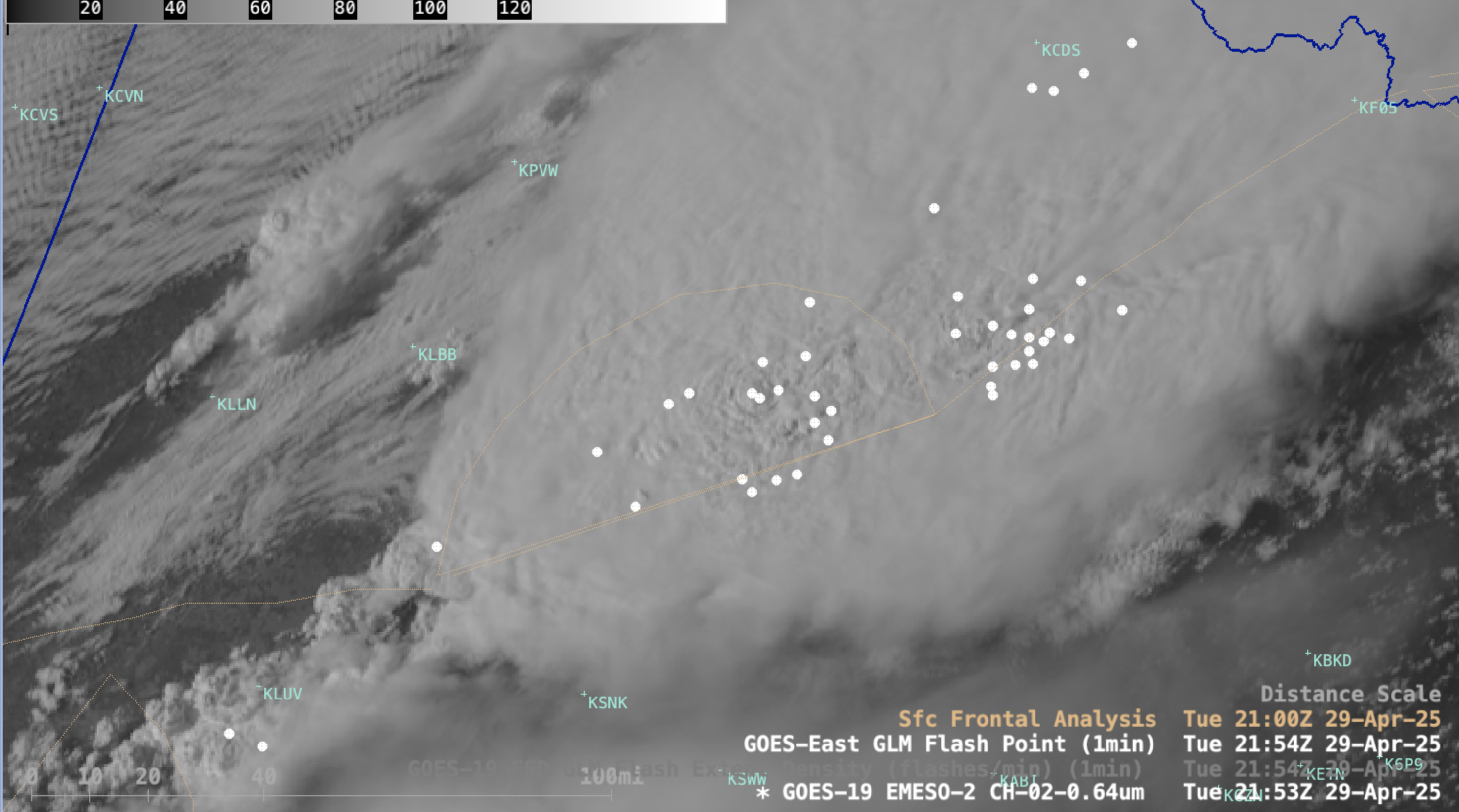
1-minute GOES-19 Visible (0.64 µm) images with plots of 1-minute GOES-19 GLM Flash Points, from 1910 UTC on 29 April to 0009 UTC on 30 April [click to play MP4 animation]