Blowing dust behind a cold front moving across New Mexico, Texas and Mexico
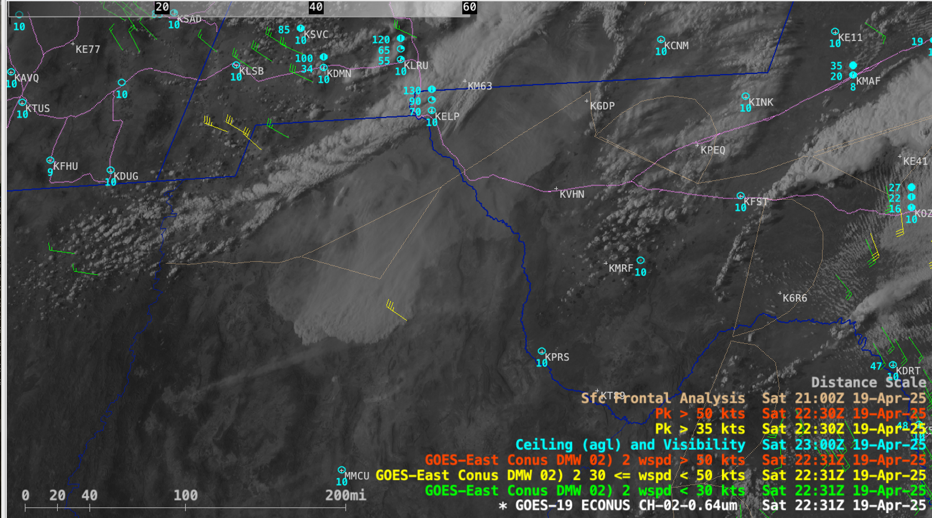
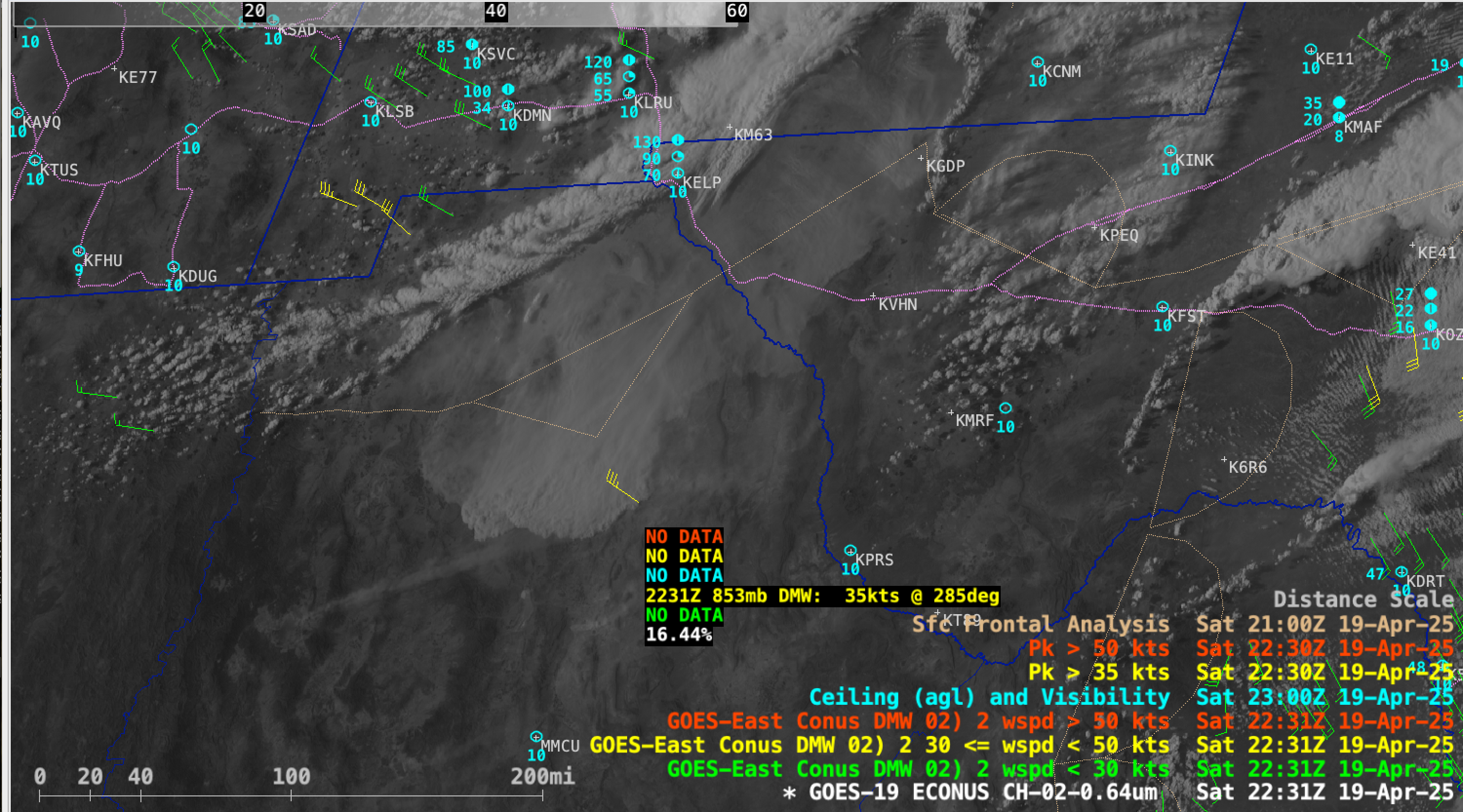
5-minute GOES-19 Red Visible (0.64 µm) images with plots of 15-minute GOES-19 Derived Motion Winds (yellow/red), hourly Ceiling/Visibility/Weather (cyan), 30-minute Peak Wind Gusts (yellow/red) and 3-hourly Surface Fronts (beige), from 1826 UTC on 19 April to 0101 UTC on 20 April; Interstate highways are plotted in violet [click to play MP4 animation]
Several Blowing Dust Warnings were issued by the NWS Forecast Offices in El Paso and Midland (below), which at times covered parts of Interstates 10 and 20 in New Mexico and Texas.
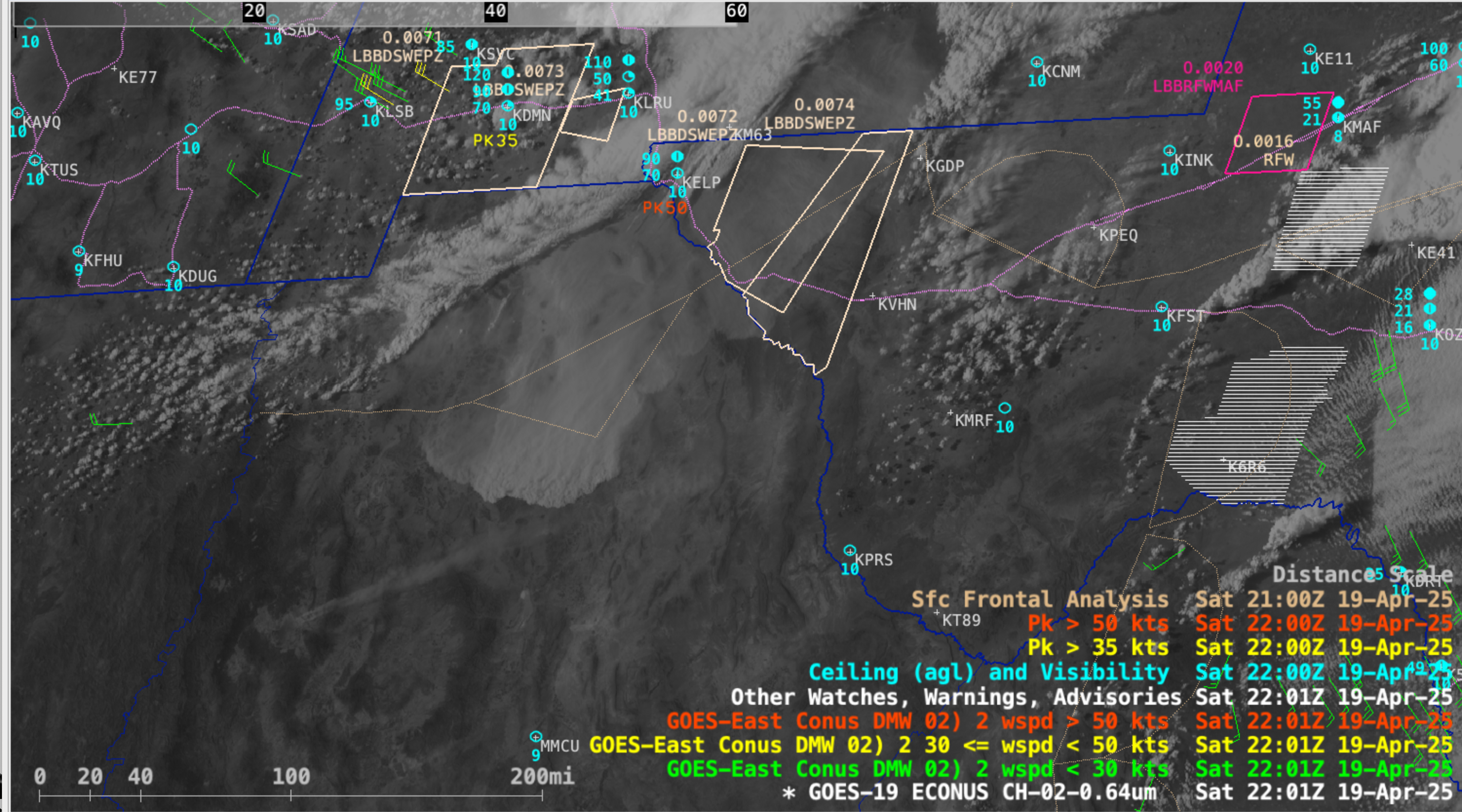
Same GOES-19 imagery and overlays as above, but including plots of Dust Storm Warning polygons (light brown) [click to play MP4 animation]

5-minute GOES-19 daytime True Color RGB + nighttime Dust RGB images, from 1801 UTC on 19 April to 0601 UTC on 20 April [click to play animated GIF | MP4]