Strong winds into the Gulf of Tehuantepec
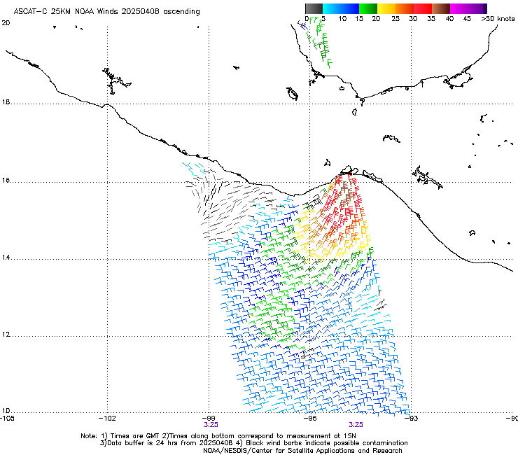
Advanced Scatterometry (ASCAT) plots derived from MetopB and MetopC, above, shows a pulse of winds associated with a Gulf of Tehuantepec wind event. Gales are widespread, and winds up to 45 knots are plotted. When Tehuano Gap Winds occur in clear skies (as in this example), the effect on the sea state can become apparent in visible imagery. On 9/10 April, high clouds masked the view of the ocean as shown in the animation of CSPP Geosphere true color imagery on 9 April 2025, below. You can see, however, the rapid motion of the clouds over the narrow Isthmus of Tehuantepec and the dissipation of those clouds in their descent towards the ocean.
The strong winds forced the development of large waves, as shown below in the plot of Significant Wave Heights.
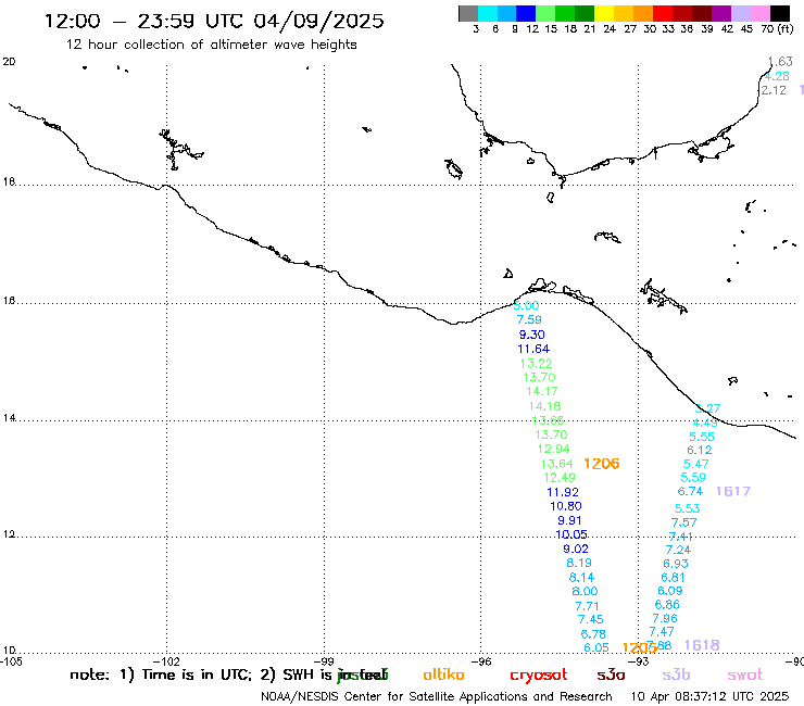
Scatterometry plots and altimetric wave heights are available at this website. These are derived from microwave observations that are not affected by the widespread clouds.