Severe thunderstorm in southern Arizona
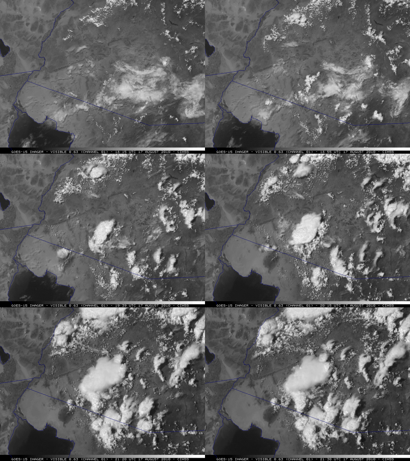
An isolated thunderstorm over southwestern Arizona during the afternoon hours on 17 August 2010 was responsible for a report of surface winds of 79 knots (91 mph) along with 0.80 inch of rain in 45 minutes near Ajo (SPC storm reports). McIDAS images of 1-km resolution GOES-15 0.63 µm visible channel data (above) showed the rapid development of this thunderstorm (along with several other storms across Arizona) — the time and location of the surface wind gust is annotated as “G79” on the 20:30 UTC image.
GOES-15 is currently providing imagery during its Post Launch Science Test; real-time GOES-15 imagery is available for viewing on the SSEC Geostationary Image Browser.
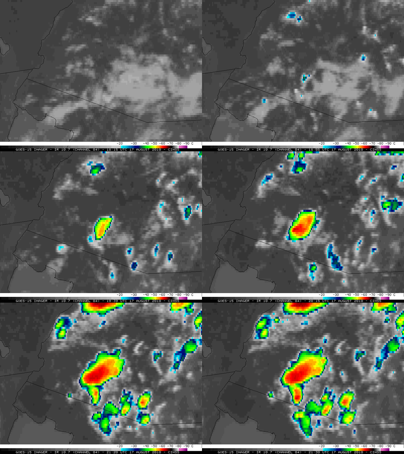
The corresponding 4-km resolution GOES-15 10.7 µm IR images (below) revealed that cloud top temperatures quickly cooled to -60º C and colder (red color enhancement).
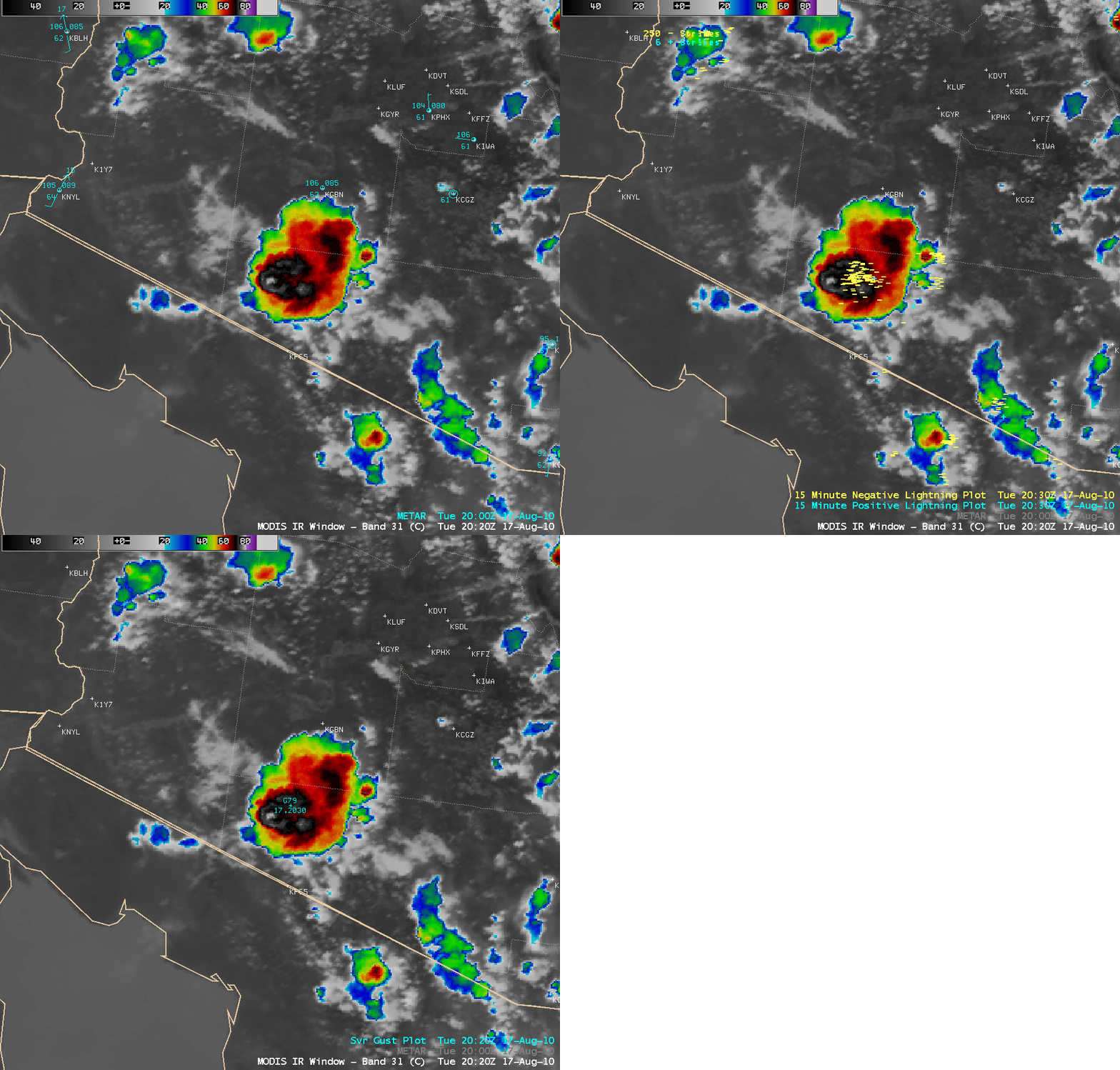
An AWIPS image of the 1-km resolution MODIS 11.0 µm IR channel data (below) shortly before the report of strong surface winds indicated that this storm exhibited a subtle “enhanced-v” storm top signature, with a minimum IR brightness temperature of -80º C. There was also a cluster of numerous cloud-to-ground lightning strikes (primarily negative in charge) just east of the vertex of the enhanced-v signature.
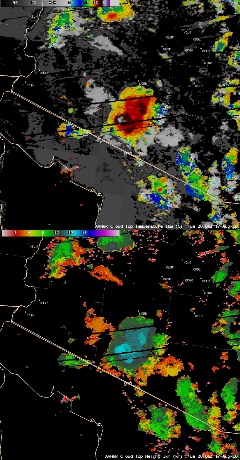
About a half hour before the report of the strong surface winds, the 1-km resolution AVHRR Cloud Top Temperature product indicated a minimum value of -80º C, with a maximum Cloud Top Height of 16 km (below).


