Fast-moving wildfires produce pyrocumulonimbus clouds over South Korea

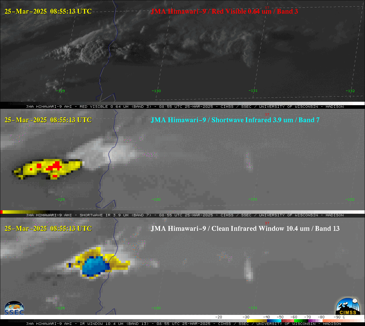
2.5 minute JMA Himawari-9 “Red” Visible (0.64 µm, top), Shortwave Infrared (3.9 µm, center) and “Clean” Infrared Window (10.4 µm, bottom) images, from 0200-1047 UTC on 25 March [click to play animated GIF | MP4]

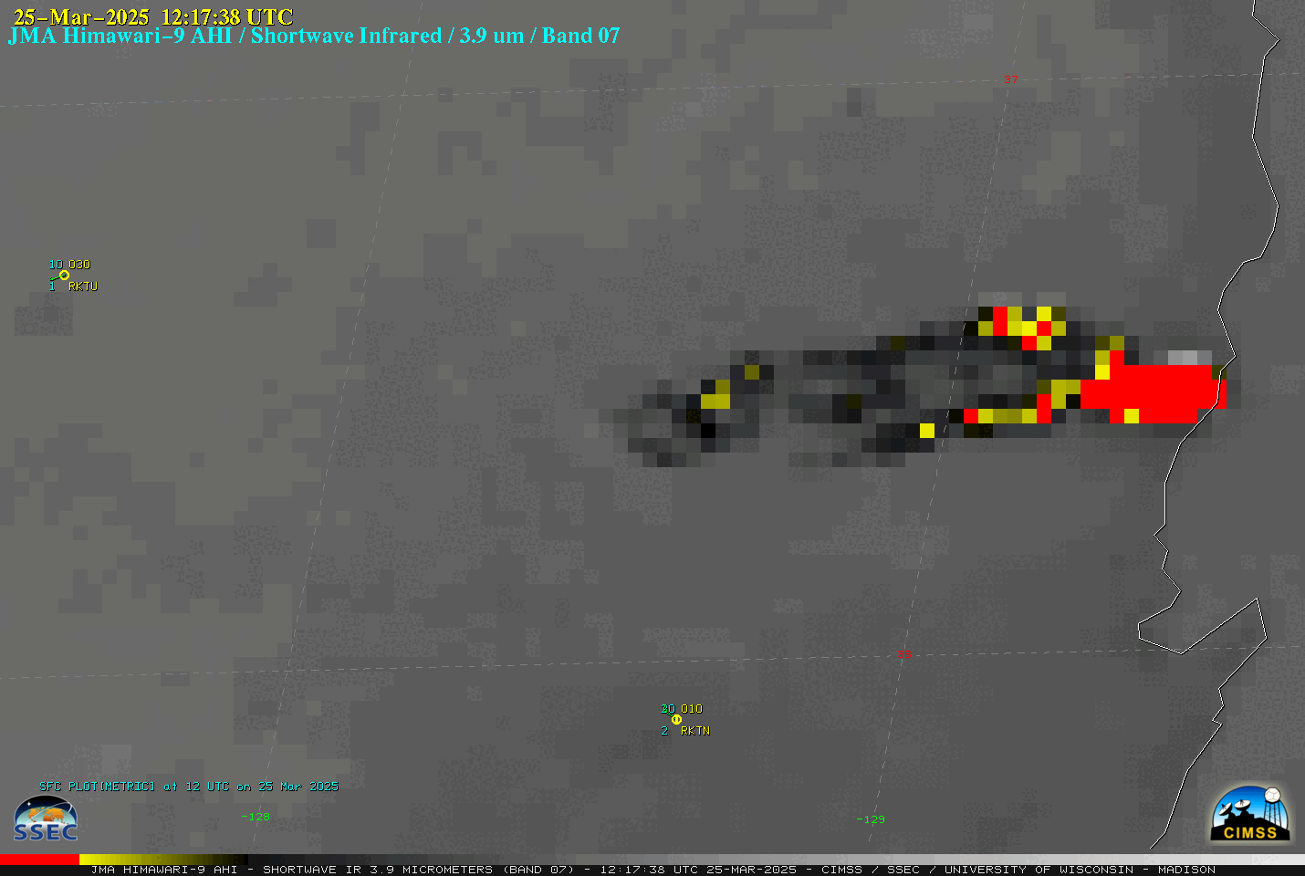
2.5-minute JMA Himawari-9 Shortwave Infrared (3.9 µm) images, from 0300-1402 UTC on 25 March [click to play animated GIF | MP4]
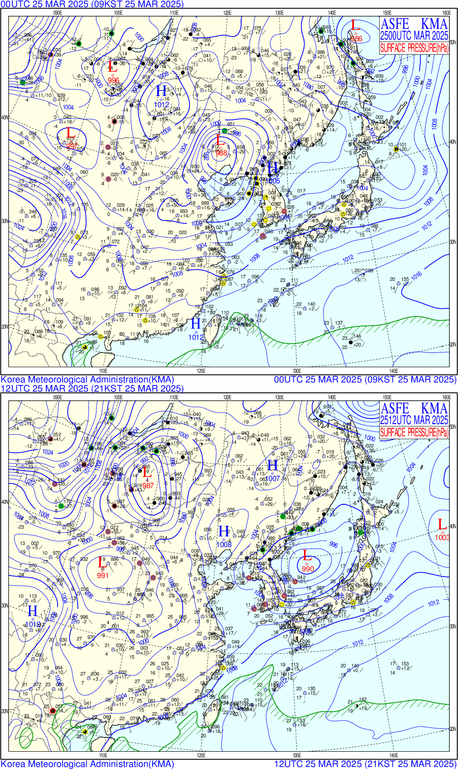
A toggle between surface analyses at 0000 UTC and 1200 UTC (below) indicated that a low pressure system had moved from northeastern China to the Yellow Sea — and tightly spaced isobars behind the low across the Korean Peninsula at 1200 UTC supported the presence of strong winds that were responsible for the rapid eastward run of the wildfire complex that produced the pyroCb clouds. As the cold front associated with this low pressure passed Cheongju Air Base (RKTU, located west-northwest of the fires) there was a wind gust to 43 kts (49 mph) at 0606 UTC — while at Daegu (RKTN, located south of the fires) there was a wind gust to 30 kts (35 mph) at 0900 UTC.
10-minute Himawari-9 True Color RGB images created using Geo2Grid (below) also revealed the hazy signature of Asian blowing dust that was streaming eastward across the Korean Peninsula — including a SW-to-NE oriented band of dense airborne dust focused along the aforementioned cold front (0700 UTC image). The pyroCb cloud was just crossing the coast of Korea at 0900 UTC.

10-minute JMA Himawari-9 True Color RGB images, from 0000-0910 UTC on 25 March [click to play animated GIF | MP4]


