Large Mesoscale Convective System over the Missouri River Valley region

POES AVHRR visible, IR, and IR + severe weather reports
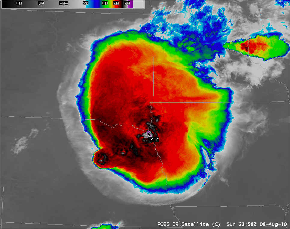
A large Mesoscale Convective System (MCS) initially developed over Nebraska and quickly grew in size as it propagated eastward across the Missouri River Valley region of the north-central US on 08 August 2010. AWIPS images of 1-km resolution POES AVHRR 0.63 µm visible and 10.8 µm IR channel data (above) revealed an impressive back-sheared anvil structure, along with well-defined overshooting tops and very cold cloud top IR brightness temperatures (as cold as -91º C). SPC storm reports showed a number of hail an damaging winds associated with this MCS, as well as one tornado.
An alternative view of the storm can be seen using a false color Red/Green/Blue (RGB) image using POES AVHRR channels 1, 2, and 4 (below).
 false color image")
POES AVHRR Red/Green/Blue (RGB) false color image
On the back-sheared portion of the anvil, note how warm the IR brightness temperatures were on the AVHRR 10.8 µm IR image — due to the very thin nature of the cirrus shield, radiation from the warm ground below contributed to the IR brightness temperatures being warmer than -20º C on that portion of the cirrus shield. However, the more accurate AVHRR Cloud Top Temperature (CTT) product (below) gave a much more accurate CTT of -40 to -50º C.

POES AVHRR 10.8 µm IR image + AVHRR Cloud Top Temperature product