Atmospheric River Bringing Significant Moisture to the Pacific Northwest
Hazardous weather conditions associated with winter storms and flooding can be seen throughout the northwestern continental United States due to the presence of an atmospheric river brining significant amounts of moisture from the eastern Pacific to the North American shore. Alerts include winter storm warnings in western Washington and flood warnings, watches, and advisories in northern Idaho and western Montana. Flood conditions are already primed by temperatures exceeding freezing in this part of the United States thus ensuring that meltwater is significant and surfaces are saturated.
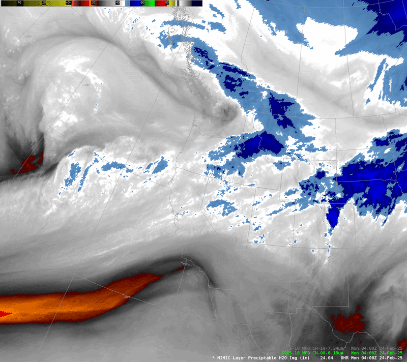
Atmospheric rivers are long, narrow bands of enhanced moisture transport. Depending on their strength, they can provide positive impacts like bringing desperately needed rain to regions of drought or fire. However, they can also have negative impacts by creating flooding, mudslides, and other hazardous conditions. Satellites, of course, are an excellent tool for diagnosing the position and strength of atmospheric rivers. The water vapor imagery from geostationary satellites provides a simple way to identify where the rivers are and how quickly they are flowing. In this example from AWIPS, the 6.19 micron brightness temperature shows a band of enhanced water vapor content streaming in from the Pacific toward the west coast of the continental US. It’s even possible to see the river helping to feed the development of an offshore extratropical cyclone that is approaching the Oregon coast.
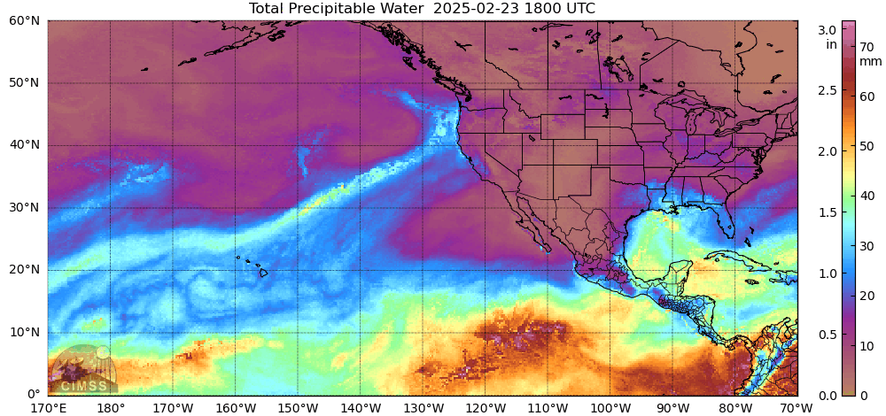
The river is even more easily seen in the Morphed Infrared Microwave Imagery at CIMSS (MIMIC) total precipitable water (TPW) product. Since microwave sounders are currently only present aboard polar-orbiting platforms, derived products often contain gaps between overpasses. MIMIC takes the snapshot view of a TPW swath and uses numerical weather prediction winds to move the observed field in space so that it can be matched to and blended with adjacent TPW swaths. This creates a near-seamless view of the global TPW field at an hourly temporal resolution. In this case, MIMIC clearly identifies the position of the river and its origin from the warm, moist air near Hawaii. Real time imagery from MIMIC is available here.
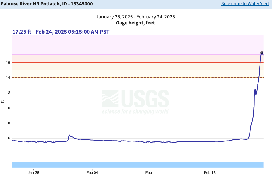
As noted above, the impact of all this moisture as it hits shore can be significant. One impact is local streamflow rates. The following image shows the past month of stream observations from the Palouse River near the Idaho/Washington border. The river swelled to nearly triple its depth in the last 48 hours, and has reached a level that is by far the greatest it has experienced in the last year. Numerous similar examples can be seen on the USGS streamflow gauge site.