There is a new Tropical Storm in the Atlantic Basin: Colin
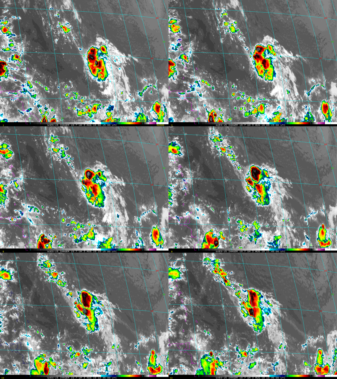
The image loop above shows GOES-15 11-micron imagery every half hour as Tropical Depression #4 in the Atlantic strengthened to become a minimal Tropical Storm, gaining the name Colin in the process. The infrared imagery shows periodic bursts of convection with brightness temperatures colder than -70 C near the center of the storm, outflow to the northwest and to the south of the storm and brisk motion to the west-northwest. The National Hurricane Center forecasts limited strengthening of the storm, and a path that takes the storm north of the islands in the Caribbean, east of the mainland United States and west of Bermuda.
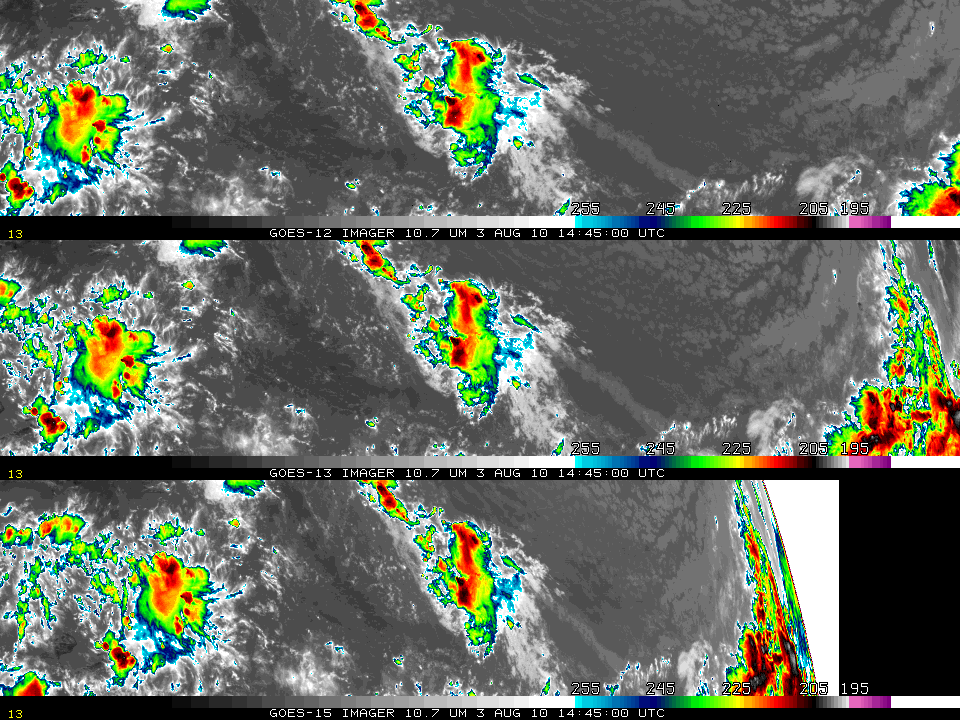
Colin’s placement in the tropical Atlantic means it can be viewed by three Geostationary satellites: GOES-12, over the Equator at 60 W, GOES-13, over the Equator at 75 W and GOES-15 over the Equator near 90 W. Careful inspection of the three images shows that GOES-15 brightness temperatures over Colin are colder than GOES-13 or GOES-12 brightness temperatures. This is because of the more oblique viewing angle from GOES-15, which is farther west than the other two satellites. Thus, the path from the cloud top to GOES-15 traverses more of the (colder) upper troposphere than the path from cloud top to GOES-13 or GOES-12, and that coldness shows up in the computed brightness temperature. The same behavior exists for one satellite as the zenith angle changes. This link shows GOES-13 weighting functions for a standard (clear) tropical atmosphere; note that the brightness temperature decreases as the viewing angle (zenith angle: ZEN in the figures) increases. Again, that’s because the path from surface to the satellite traverses more of the colder upper troposphere as the zenith angle increases.
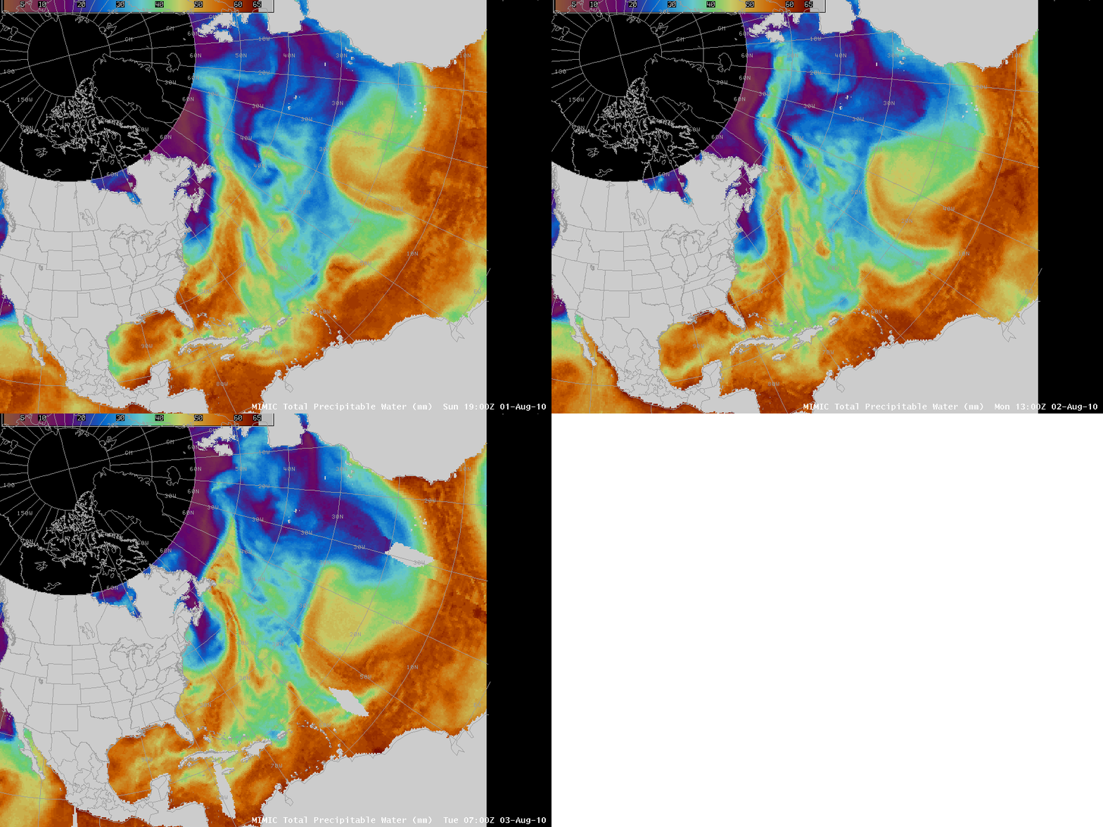
The impulse in the tropical atmosphere that created an environment favorable for tropical cyclongenesis was easily trackable from the coast of Africa westward using Total Precipitable Water (TPW) as observed over the ocean by microwave instruments onboard POES satellites. The loop above shows the environment rich in moisture (an arc of large values of Total Precipitable Water) moving eastward across the tropical Atlantic.
For more information on Colin, refer to the CIMSS tropical website or to the National Hurricane Center. Wind shear plots at the CIMSS site suggest that Colin is moving towards a region of stronger shear (click here for the image from 1200 UTC on 3 August 2010); the more strongly-sheared environment should limit strengthening.
Update, late in the day on 3 August: Colin has lost its closed circulation and is no longer a tropical storm.


