Palisades Fire in Southern California

1-minute GOES-18 Shortwave Infrared (3.9 µm) images (left) and Red Visible (0.64 µm) + Fire Mask derived product (right), with 15-minute METAR surface reports plotted in yellow, from 1801 UTC on 7th January to 0000 UTC on 8th January; Interstate highways are plotted in red [click to play MP4 animation]
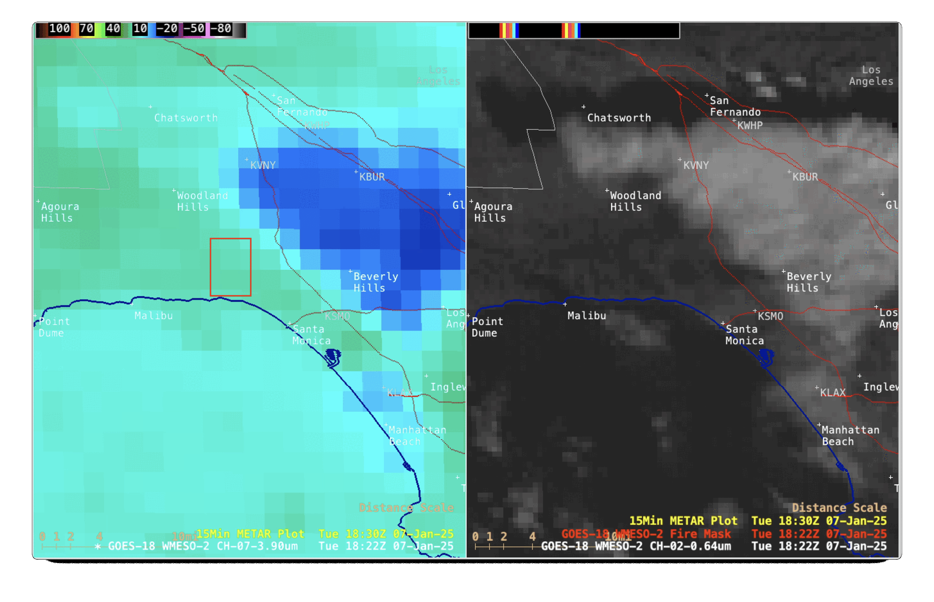
1-minute GOES-18 Shortwave Infrared (3.9 µm) images (left) and Red Visible (0.64 µm) + Fire Mask derived product (right), from 1822-1826 UTC on 7th January; Interstate highways are plotted in red [click to enlarge]

1-minute GOES-18 True Color RGB images, from 1824 UTC on 7th January to 0000 UTC on 8th January [click to play MP4 animation]
===== 8th January Update =====
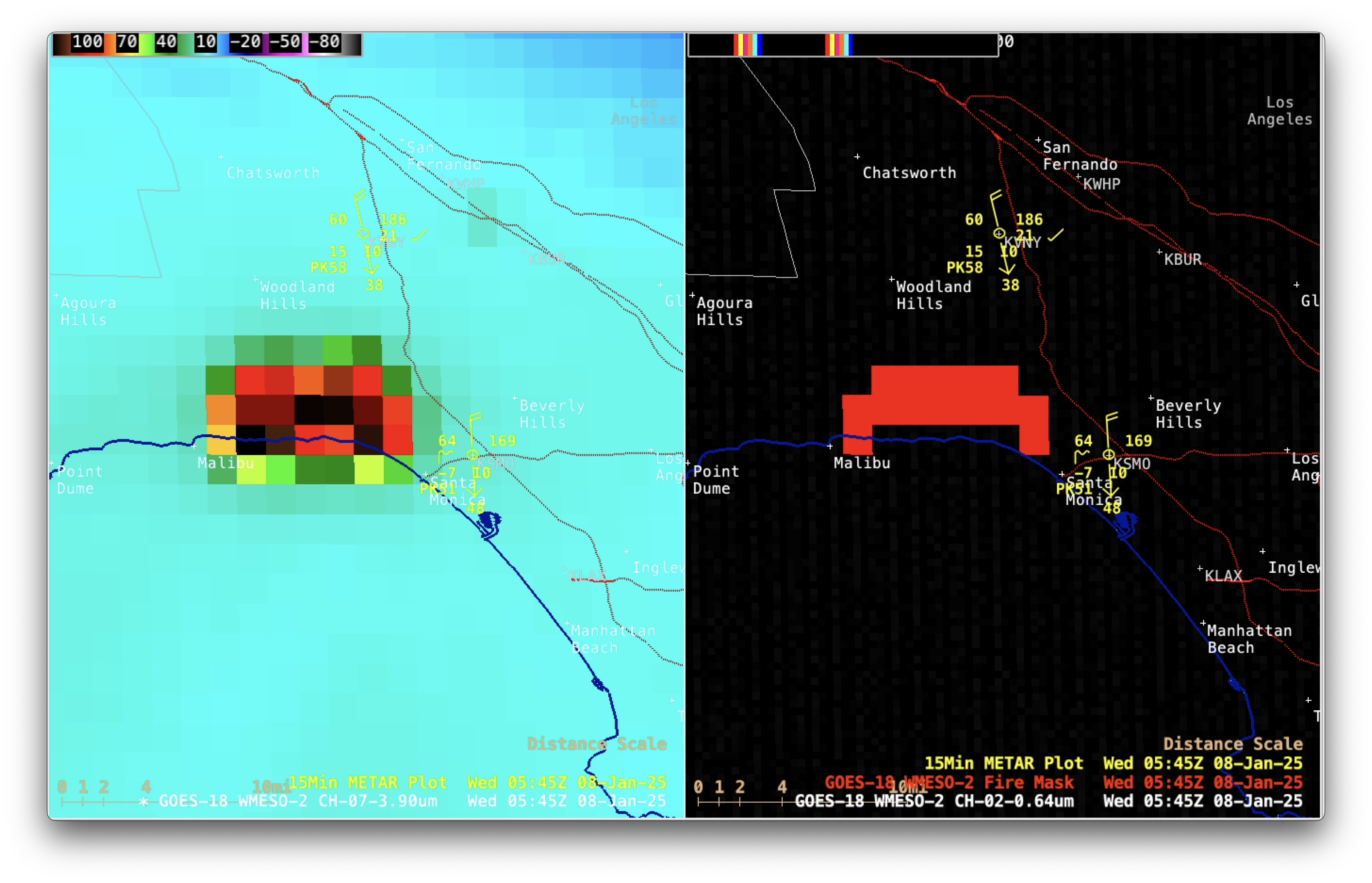
1-minute GOES-18 Shortwave Infrared (3.9 µm) images (left) and Red Visible (0.64 µm) + Fire Mask derived product (right), from 0000-1200 UTC on 8th January [click to play MP4 animation]