Severe weather across the Bay Area of California
1-minute GOES-18 Mid-level Water Vapor (6.9 µm) images, with plots of SPC Storm Reports of Severe Wind Gusts (cyan), hourly METAR site Peak Wind Gusts (red), GLM Flash Points (white) and 3-hourly Surface Fronts (beige); a Tornado Warning issued for the San Francisco area is depicted by a red polygon [click to play MP4 animation]
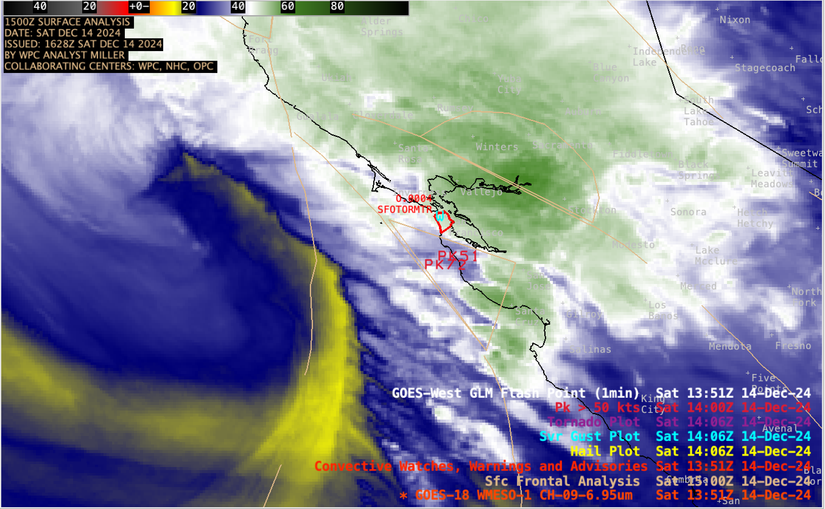
1-minute Mesoscale Domain Sector GOES-18 (GOES-West) Water Vapor (6.9 µm) images (above) showed a mid-tropospheric shortwave trough that was moving inland across central/northern California — along with associated surface warm and cold frontal features on 14th December 2024. Sporadic lightning activity within a few bands of convection was indicated by GLM Flash Points. Of particular interest was the Tornado Warning (red polygon) that was issued for San Francisco (possibly the first Tornado Warning issued for San Francisco proper?). There were several reports of strong winds across the Bay Area, most notably a gust to 72 knots (83 mph) at San Francisco International Airport.

1-minute GOES-18 Clean Infrared Window (10.3 µm) images, with time-matched (+/- 3 minutes) SPC Storm Reports plotted in red [click to play animated GIF | MP4]
1-minute GOES-18 Infrared (10.3 µm) images (above) included plots of SPC Storm Reports across the area.
Later in the day, a low-topped thunderstorm produced an EF1-rated tornado at Scotts Valley, the location of which was shown in 1-minute GOES-18 Visible (0.64 µm) and Infrared images (below).

1-minute GOES-18 Red Visible (0.64 µm, left) and Clean Infrared Window (10.3 µm, right) images, with time-matched (+/- 3 minutes) SPC Storm Report of a tornado (T) plotted in red [click to play animated GIF | MP4]