Lake effect clouds (producing light snow) in North Dakota

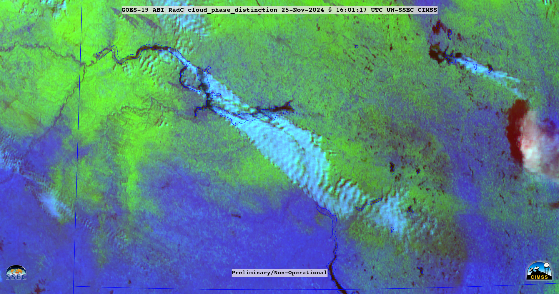
GOES-19 (Preliminary/Non-operational) Day Cloud Phase Distinction RGB images, from 1431-2216 UTC on 25th November [click to play animated GIF | MP4]
GOES-19 (Preliminary/Non-operational) Day Cloud Phase Distinction RGB images (above) — created using Geo2Grid — displayed supercooled “lake effect” clouds (shades of white) streaming southeast off Lake Sakakawea in northwestern North Dakota on 25th November 2024. A smaller cloud plume was also seen streaming southeast off Devils Lake in northeastern North Dakota. Existing snow cover appeared as shades of green in the RGB images, with bare ground appearing as shades of blue.
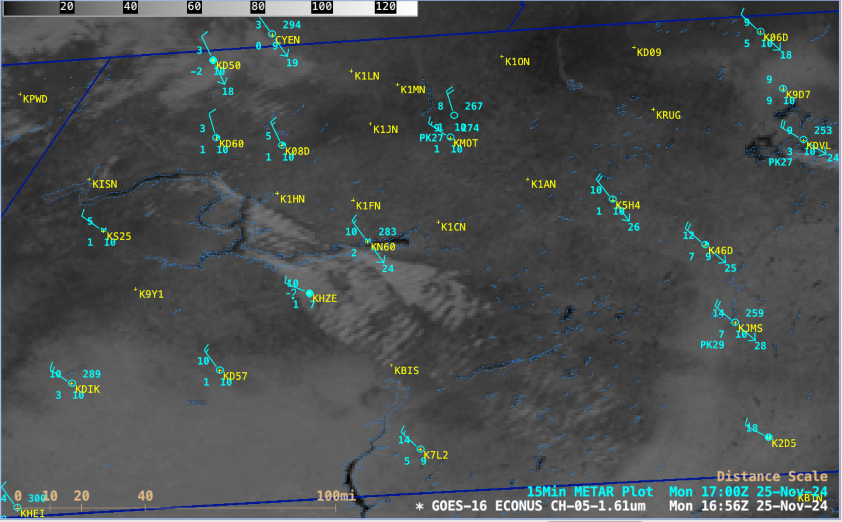
GOES-16 (GOES-East) Near-Infrared “Snow/Ice” (1.61 µm) images (below) included 15-minute plots of METAR surface reports — which showed brief periods of light snow at Hazen (KHZE) and Bismarck (KBIS). Snow cover appeared as darker shades of gray to black in the Snow/Ice imagery. Note the cold air — having temperatures in the single digits to teens F — that was flowing across the still-unfrozen reservoirs of the Missouri River (in addition to Devils Lake). Water surface temperatures on Lake Sakakawea were in the middle to upper 40s F.

GOES-16 Near-Infrared “Snow/Ice” (1.61 µm) images, with 15-minute METAR surface reports plotted in cyan, from 1416-2231 UTC on 25th November [click to play animated GIF | MP4]

