Snow in Texas, Oklahoma, Arkansas, and Missouri
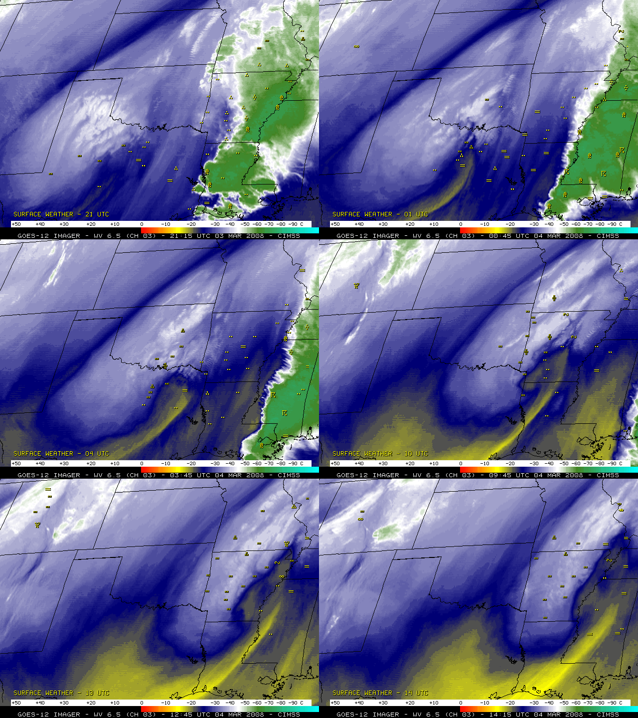
Several inches of snow fell in parts of Texas, Oklahoma, Arkansas, and Missouri during the evening of 03 March 2008 into the morning of 04 March 2008 — snowfall amounts included 8.5 inches at Springfield, Missouri, 8.0 inches at Broken Arrow, Oklahoma, 6.0 inches at Bella Vista, Arkansas, and 5.0 inches at Pottsville, Texas. Snow was even reported briefly at Shreveport in far northwestern Louisiana, and the 1.0 inch of snow at Dallas-Ft. Worth in Texas set a new daily snowfall record for 03 March. GOES-12 6.5 µm water vapor images (above) show that many of the reports of snow (along with some rain and freezing rain) were occurring along the periphery of a well-defined dry slot that was advancing northeastward from Texas into Arkansas. In addition, a deformation zone just northwest of the dry slot was also acting to help organize the southwest-to-northeast oriented banded structure of the resulting precipitation.
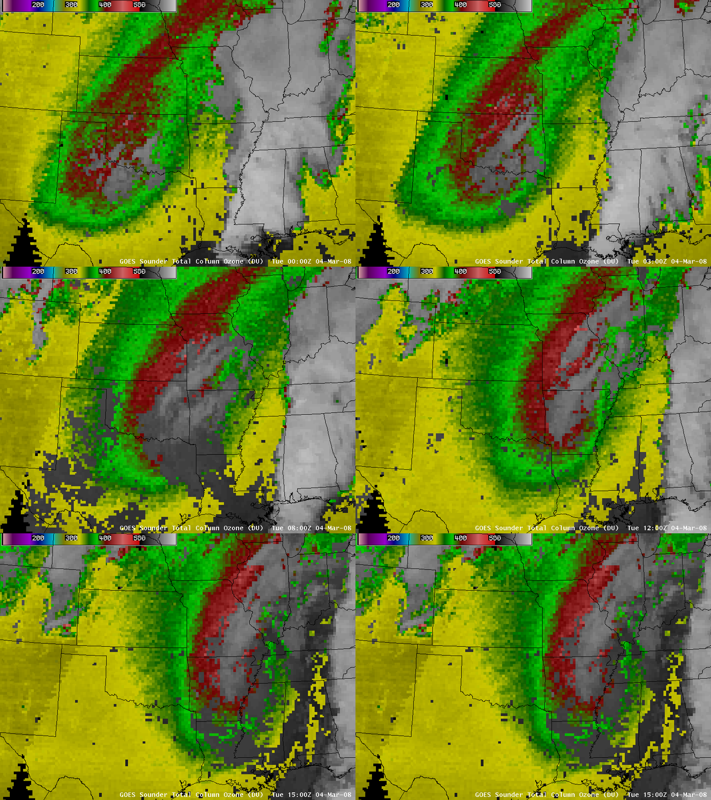
AWIPS images of the GOES sounder Total Column Ozone product (below) depicted a lobe of high values of ozone (greater than 400 Dobson units, red colors) associated with the sharp trough aloft that was swinging eastward across the southern and central Plains. Such elevated ozone levels are often seen in regions where the tropopause altitude is quite low — in fact, the NAM fields indicated that the “dynamic tropopause” (taken to be the pressure level of the 1.5 Potential Vorticity Unit surface) was as low as the 700 hPa pressure level at 12:00 UTC.
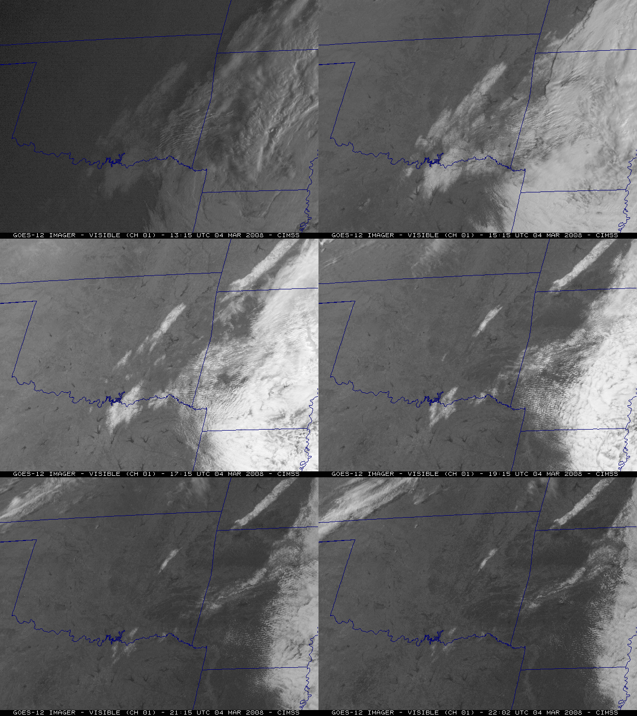
GOES-12 visible images from the following morning (below) revealed several large patches of snow-covered ground as the clouds began to retreat eastward. Note the aforementioned southwest-to-northeast orientation of the bands of snow cover in Oklahoma, Arkansas, and Missouri. The snow on the ground melted quickly under the warmth of the March sun, eroding quickly from the edges inward on the visible satellite imagery. Also, if you look closely, you can see a small puff of smoke move northward from a fire that was burning briefly in west-central Oklahoma (toward the end of the animation).
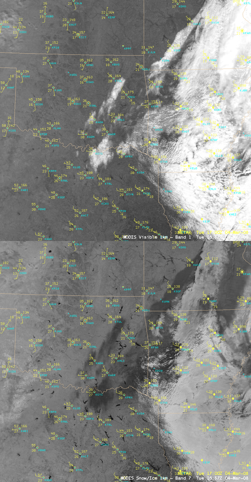
If we compare AWIPS images of the MODIS visible channel and the 2.1 µm near-IR “snow/ice channel” at 16:57 UTC 0r 11:57 am local time (below), we see that both clouds and patches of snow cover appear as brighter white features on the visible channel image; however, on the snow/ice image the snow cover features appear much darker (in contrast to the much lighter appearance of supercooled water droplet clouds). Cloud features in Missouri and Arkansas that were composed of ice crystals also appear darker on the snow/ice channel image.


