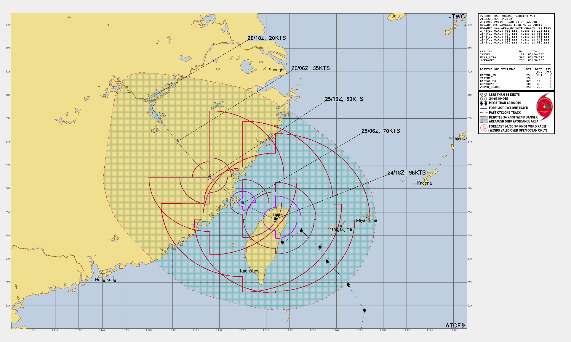
Typhoon Gaemi and Taiwan
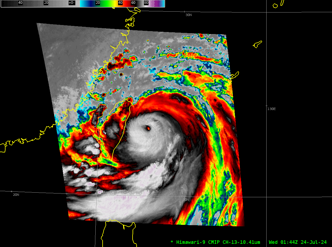
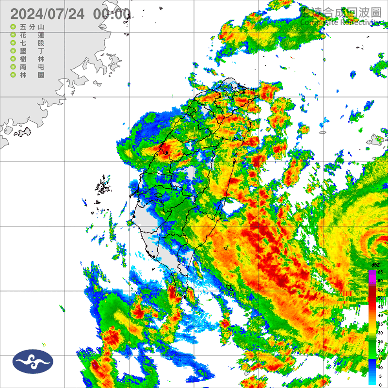
Typhoon Gaemi took a very unusual path on its route to a landfall along the eastern shore of Taiwan on 24 July 2024. HImawari-9 Clean Window infrared (Band 13, 10.4 µm) target scene imagery, below, (here is a shorter animation (animated gif) animation than the mp4 below) shows the storm moving northwest, then west, then south along the east coast of Taiwan before looping into the coast and making landfall. By the end of the animation (2252 UTC on 24 July), the storm has moved off the northwest coast of Taiwan. The unusually wobbly path is also very apparent in this radar animation (courtesy Brian McNoldy (Univ of Miami))
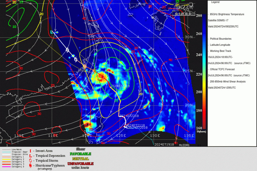
Microwave imagery at 0923 UTC on 24 July 2024, below, taken from the SSEC Tropical Weather Website, show a well-defined eye with rainbands surrounding the storm. Shear values (850-200 mb) are also plotted on the image and are small over the storm.
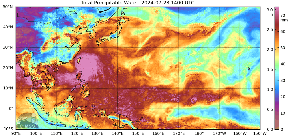
Total Precipitable Water fields (source) for the 24 hours ending at 1300 UTC on 24 July 2024 show Gaemi embedded within a region of rich moisture over the Western Pacific Ocean basin. However, by the end of the animation, dryer air from Asia is starting to wrap into the southern part of the storm circulation.
Gaemi’s future path takes it over mainland China.