Aircraft contrails over the Upper Midwest
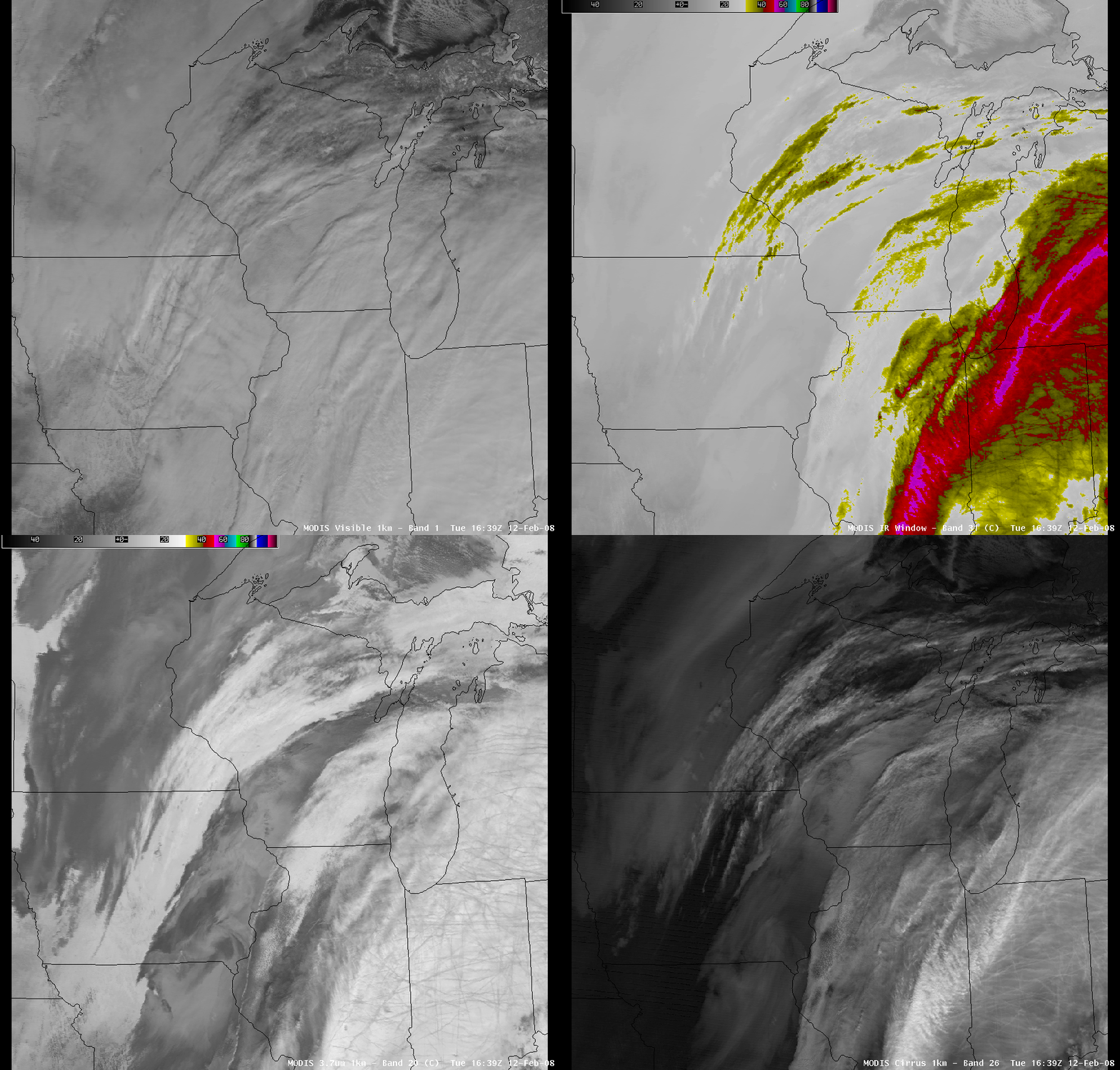
Comparing AWIPS images of the MODIS visible channel, 11.0µm “IR window” channel, 3.7µm “shortwave IR” channel, and 1.6µm near-IR “cirrus channel” (above) showed how certain satellite channels are very useful in the detection of a broad area of aircraft contrails that existed over parts of Illinois, Indiana, and lower Michigan (likely resulting primarily from air traffic to/from Chicago and Detroit) on the morning of 12 February 2008. The 3.7µm shortwave IR and the 1.6µm cirrus channels offered the best depiction of the actual areal coverage of these contrails; the contrail features exhibited a slightly darker signal on the shortwave IR image (due to the smaller ice particle size of the contrails compared to the surrounding cirrus clouds), while they appeared slightly brighter in the cirrus image (since the smaller particles comprising the contrails were better scatterers than those comprising the surrounding cirrus clouds).
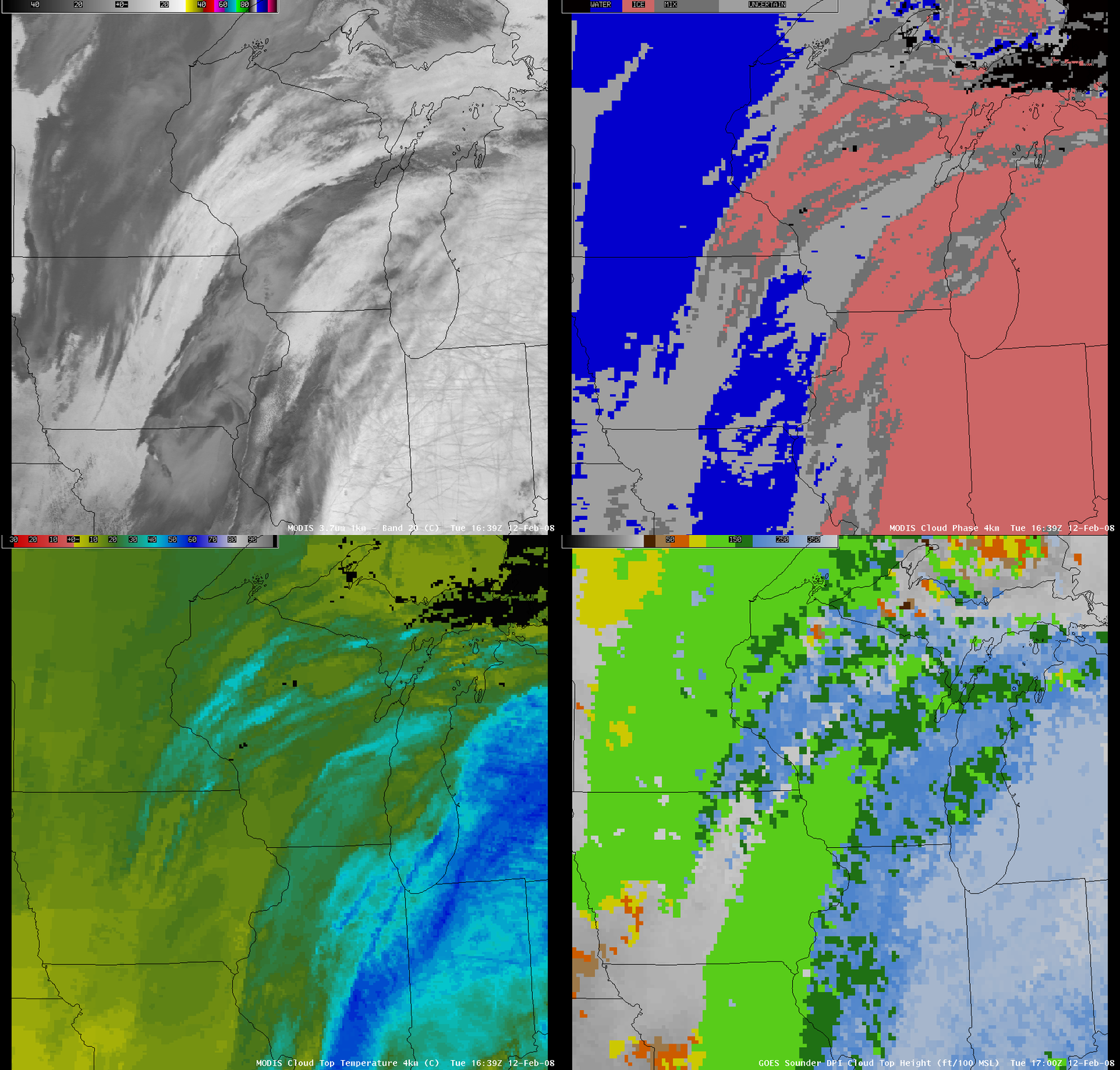
Examining other satellite products such as the MODIS Cloud Phase product, MODIS Cloud Top Temperature product, and the GOES sounder Cloud Top Height product (below) from that same time period confirmed that these aircraft contrails existed in an environment that consisted primarily of ice phase clouds (light red enhancement) which exhibited rather cold MODIS cloud top temperatures (-40º to -60º C, cyan to dark blue enhancement) and fairly high GOES sounder cloud top height values (30,000-39,000 feet above ground level, light blue to white enhancement).


