Water Vapor channel “weighting functions”: helping to explain the complexity of water vapor image interpretation
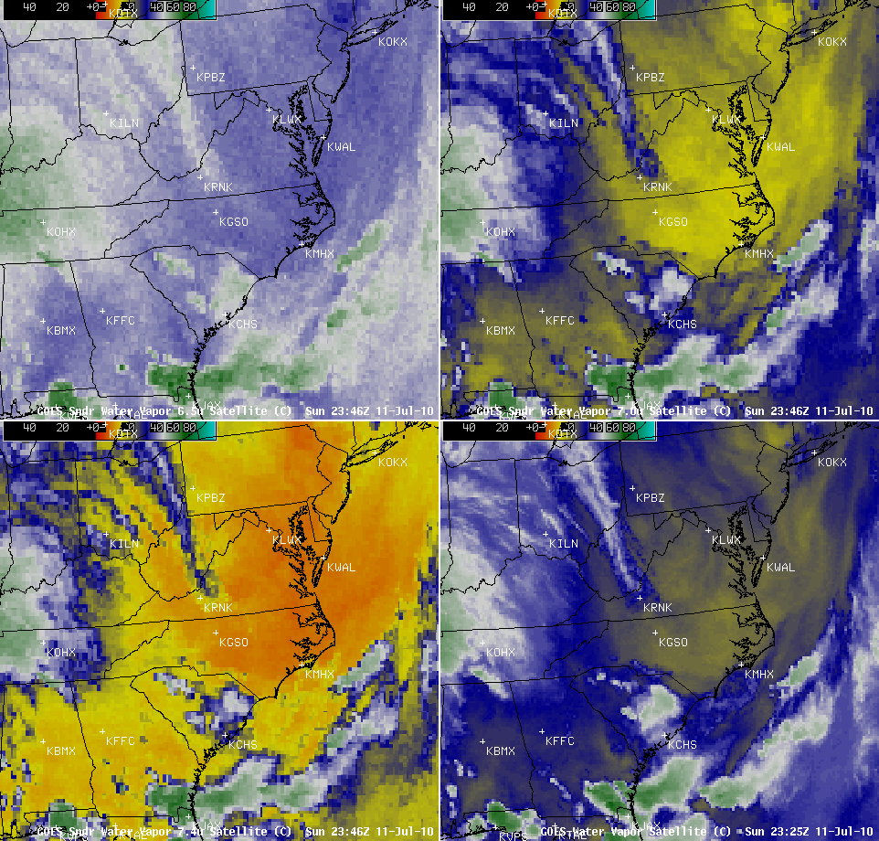
An AWIPS 4-panel display of the three GOES-13 Sounder water vapor channel images along with the single GOES-13 Imager water vapor channel image (above) revealed that a pocket of warm brightness temperatures (denoting dryer air aloft) was in place over much of eastern Virginia and North Carolina around 00 UTC on 12 July 2010.
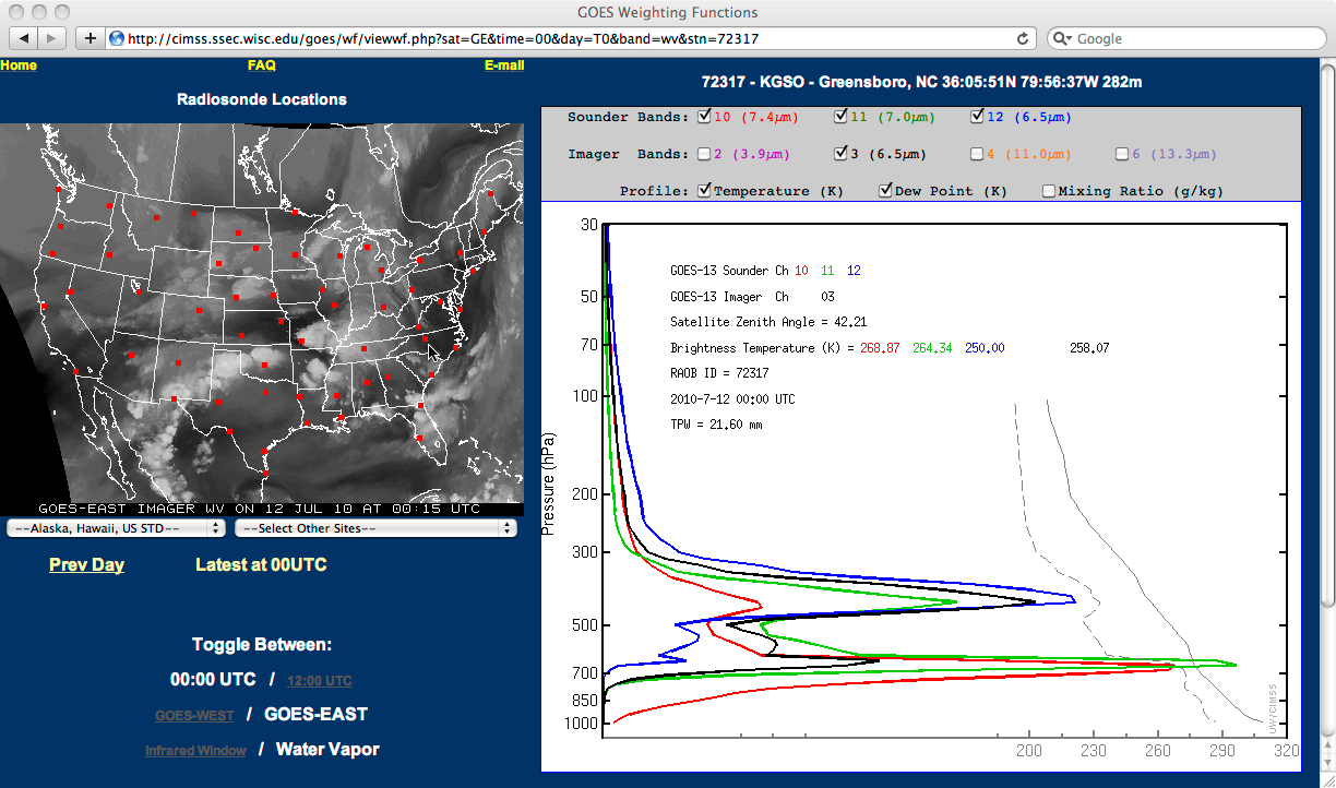
The corresponding plots of the GOES-13 Sounder (red, green, and blue plots) and GOES-13 Imager (black plot) water vapor channel weighting functions (below, calculated using 00 UTC rawinsonde data from Greensboro, North Carolina) showed a relatively uncommon “bi-modal” structure — this indicated that there were significant contributions from two distinct layers, such that the actual altitude of the features being displayed on the water vapor imagery over that region at that time would be difficult to ascertain.
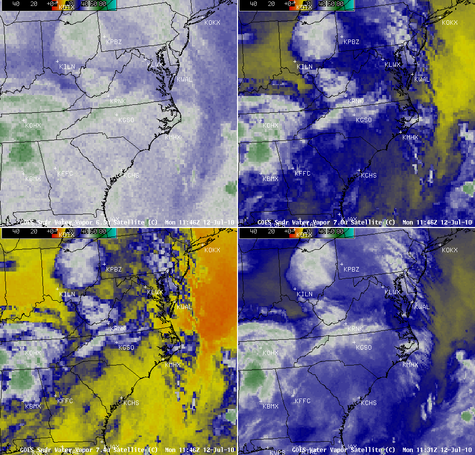
However, 12 hours later, the same AWIPS 4-panel display of water vapor imagery around 12 UTC (below) showed that significant amounts of moisture and cloudiness had moved into the region that was relatively dry at 00 UTC.
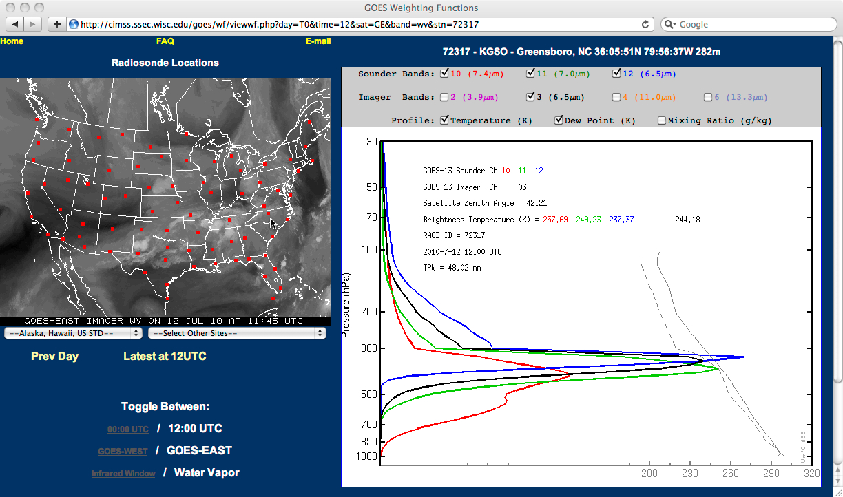
With the increased middle and upper tropospheric moisture, note that the 12 UTC water vapor weighting function plots (below, calculated using 12 UTC rawinsonde data from Greensboro NC) all peaked at significantly higher altitudes — and by the shape of the weighting function plots, it was easier to tell the layer of the troposphere that was being sampled by each of the individual water vapor channels.
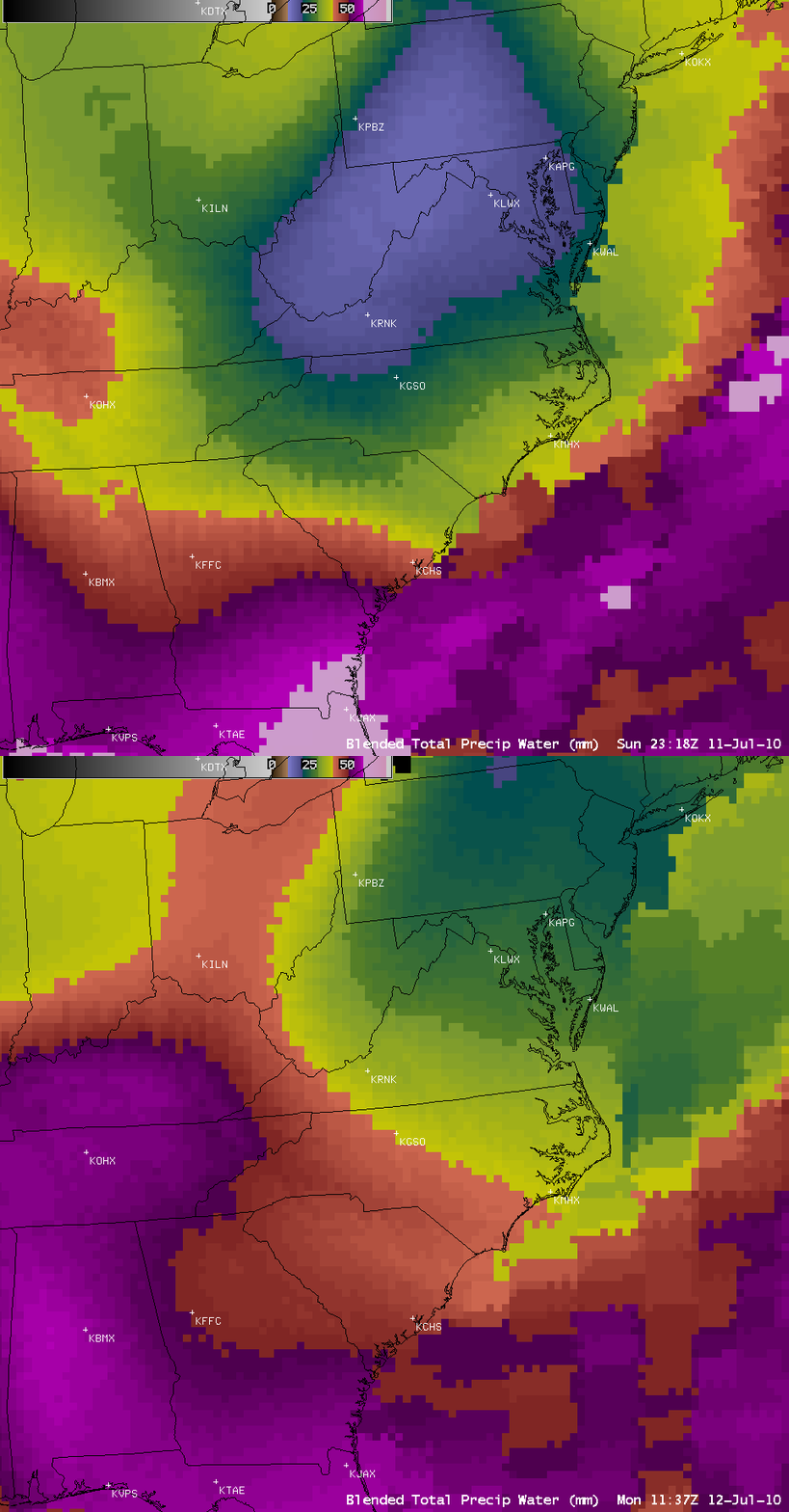
AWIPS images of the Blended Total Precipitable Water product (below) confirmed that there was a significant increase in total column moisture content over the Greensboro NC region during that 12-hour period. TPW values rose from about 21 mm to around 40 mm over Greensboro during that time.


