McDonald Fire in Alaska produces 2 pyrocumulonimbus clouds
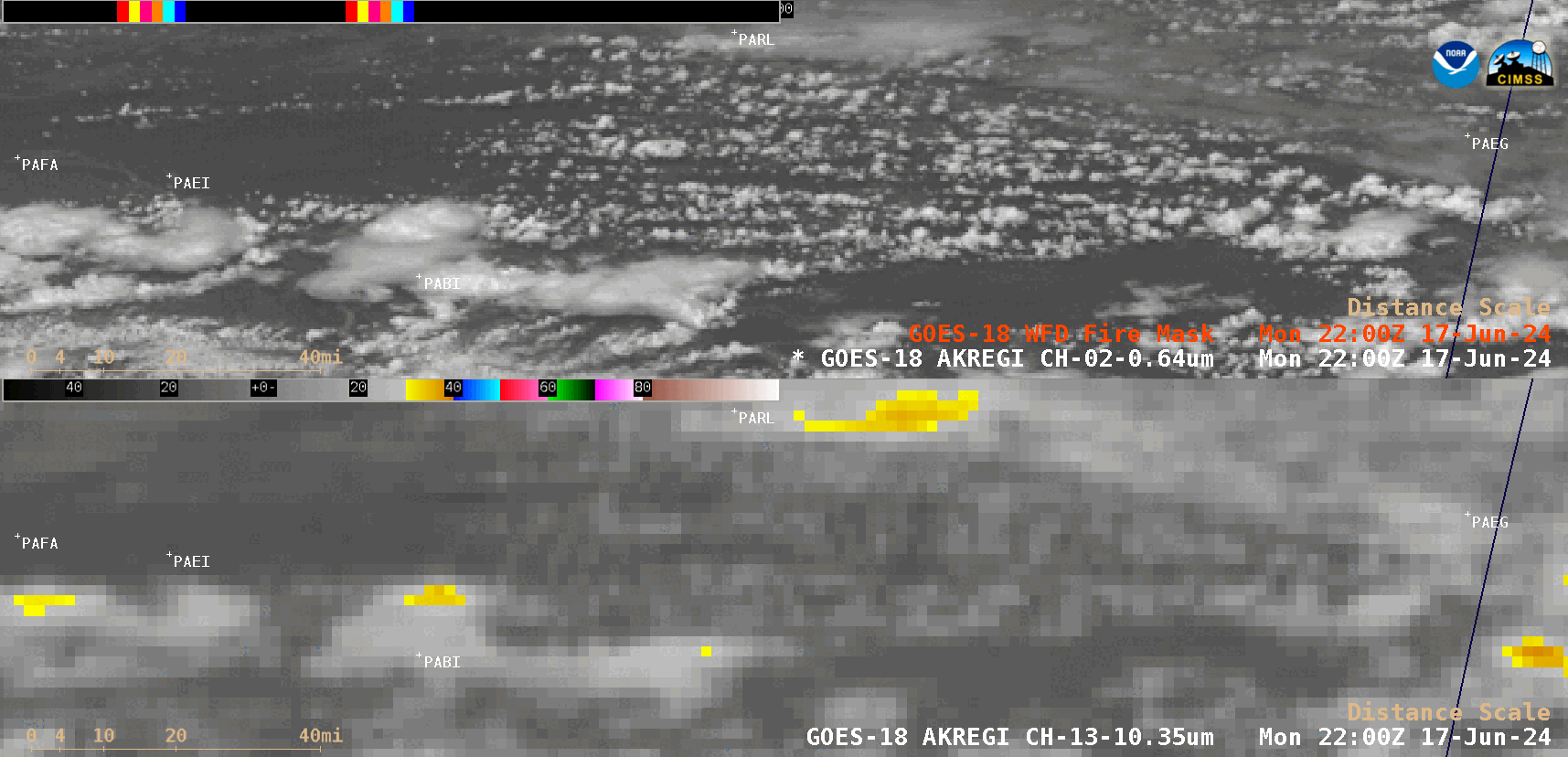
GOES-18 “Red” Visible (0.64 µm) images with an overlay of the Fire Mask derived product (top) and “Clean” Infrared Window (10.3 µm) images (bottom) [click to play animated GIF | MP4]
A Suomi-NPP Infrared Window (11.45 µm) image valid at 2319 UTC on 17 June (below) captured the first pyroCb cloud not long after its formation — and included a cursor sample of cloud-top brightness temperatures for both the 11.45 µm (-55.58ºC) and the underlying 3.74 µm Shortwave Infrared image (+25.10ºC). During the daytime, pyroCb cloud tops will usually exhibit significantly warmer Shortwave Infrared brightness temperatures, due to enhanced reflection of solar radiation off the smaller ice crystals found in the pyroCb anvil (reference).
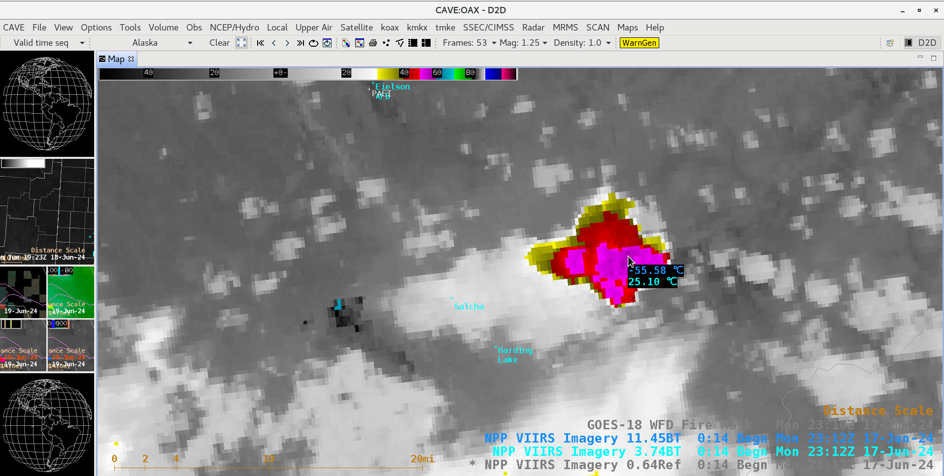
Suomi-NPP Infrared Window (11.45 µm) image valid at 2319 UTC on 17 June, with a cursor sample of cloud-top brightness temperatures for both the 11.45 µm and the underlying 3.74 µm Shortwave Infrared image [click to enlarge]
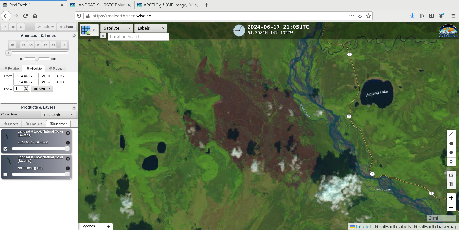
Landsat-9 Natural Color RGB image at 2105 UTC on 17 June [click to enlarge]