Corral Fire in California

GOES-18 Day Fire RGB (top left), Shortwave Infrared (3.9 µm, top right), Fire Temperature RGB (bottom left) and “Red” Visible (0.64 µm) images with overlays of the Fire Power and Fire Mask derived products (bottom right), from 2101 UTC on 01 June to 0201 UTC on 02 June [click to play animated GIF | MP4]
A longer animation of GOES-18 Shortwave Infrared images (below) showed that the wind-driven grass fire quickly approached I-580 south of Tracy — forcing a portion of that Interstate highway (from the Alameda County line to the Stanislaus County line) to be closed for several hours on 02 June. Mandatory evacuations were also issued for parts of Tracy.
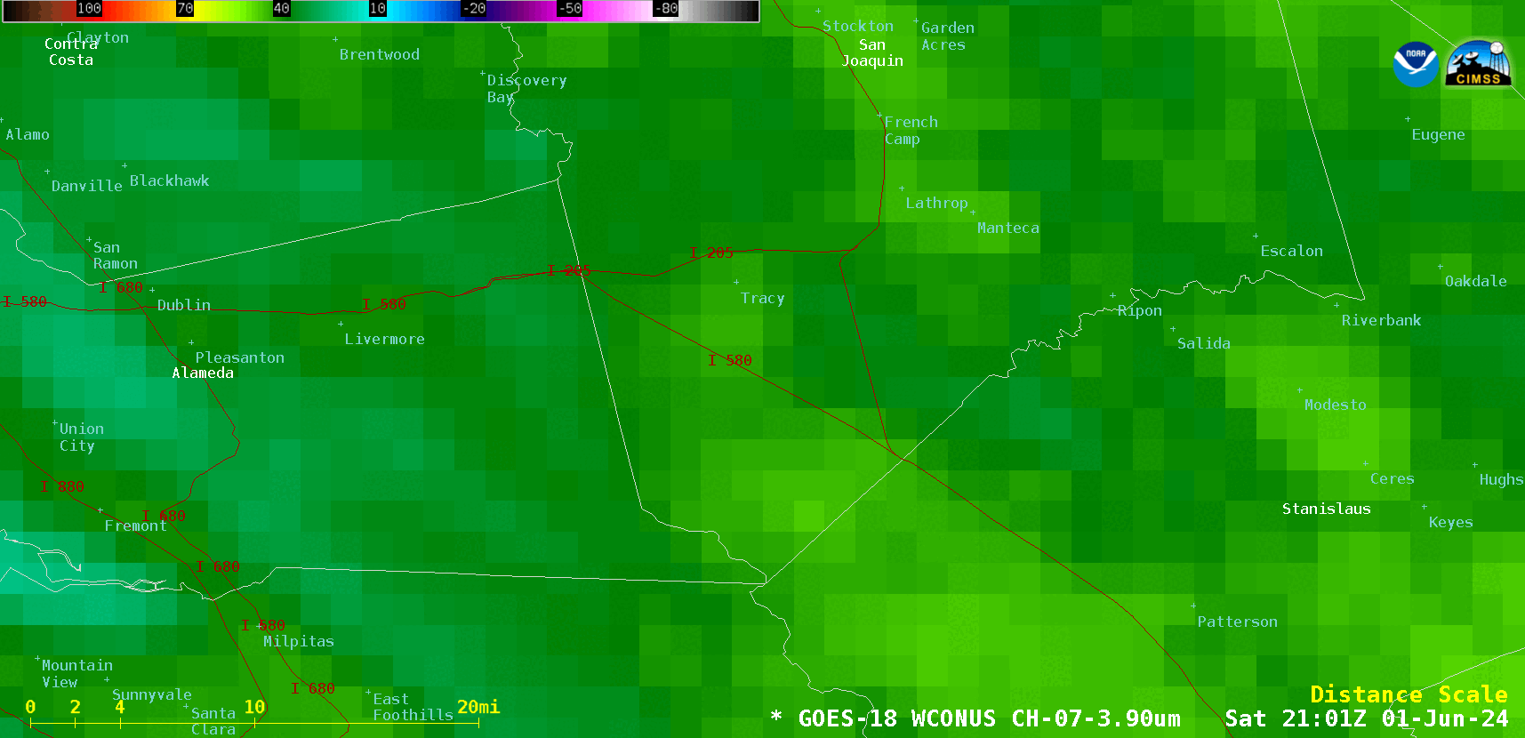
GOES-18 Shortwave Infrared (3.9 µm) images, from 2101 UTC on 01 June to 1901 UTC on 02 June [click to play animated GIF | MP4]

GOES-18 True Color RGB images, from 1331-2201 UTC on 02 June [click to playMP4animation]
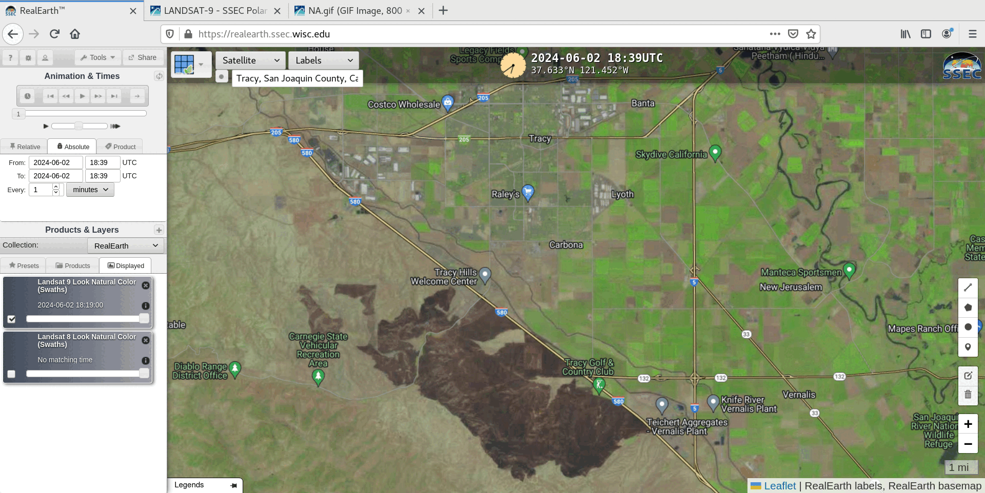
Landsat-9 Natural Color RGB image at 1839 UTC on 02 June [click to enlarge]
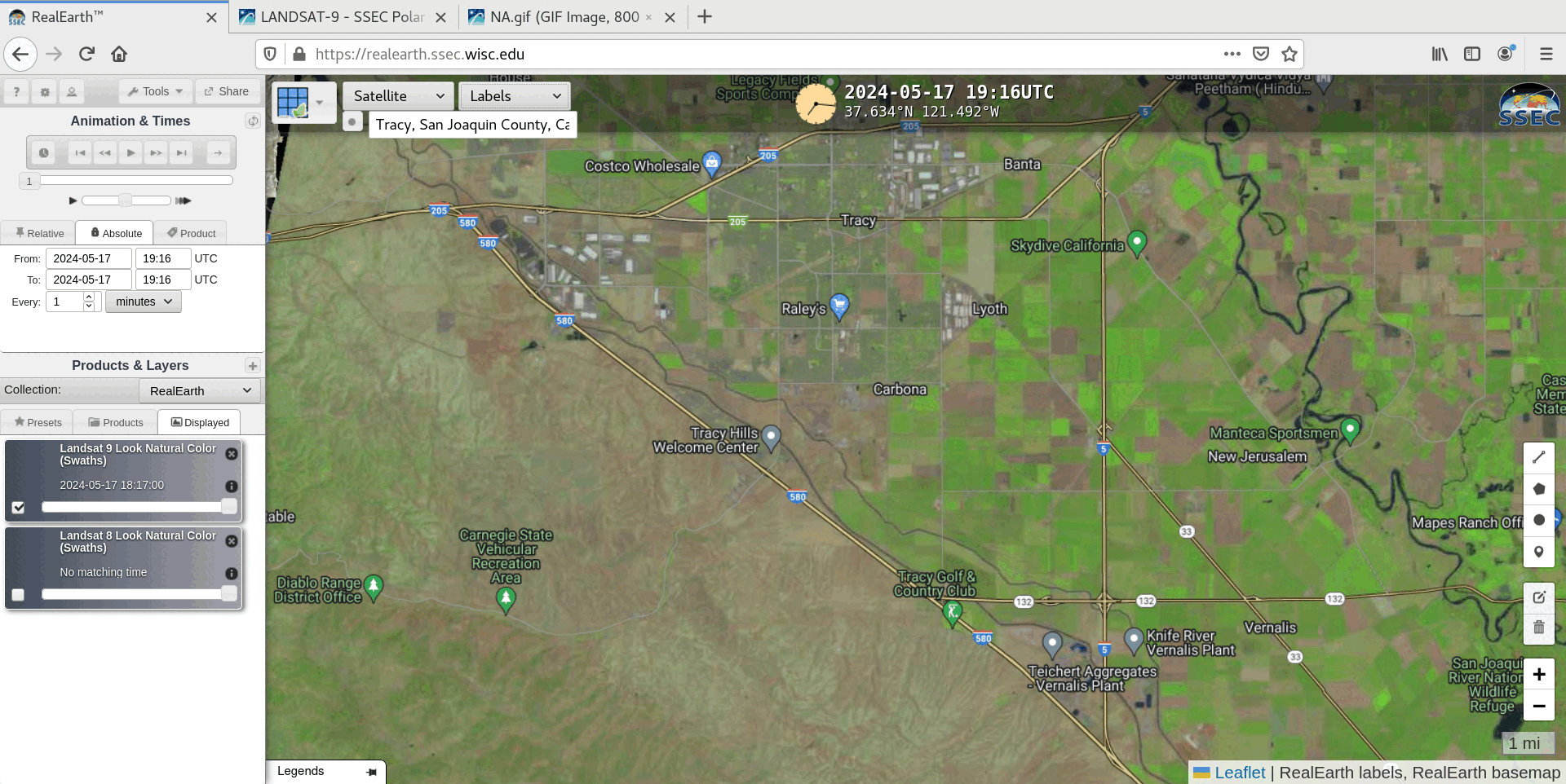
Before (17 May) and after (02 June) Landsat-9 Natural Color RGB images [click to enlarge]