Ice in the Upper Midwest
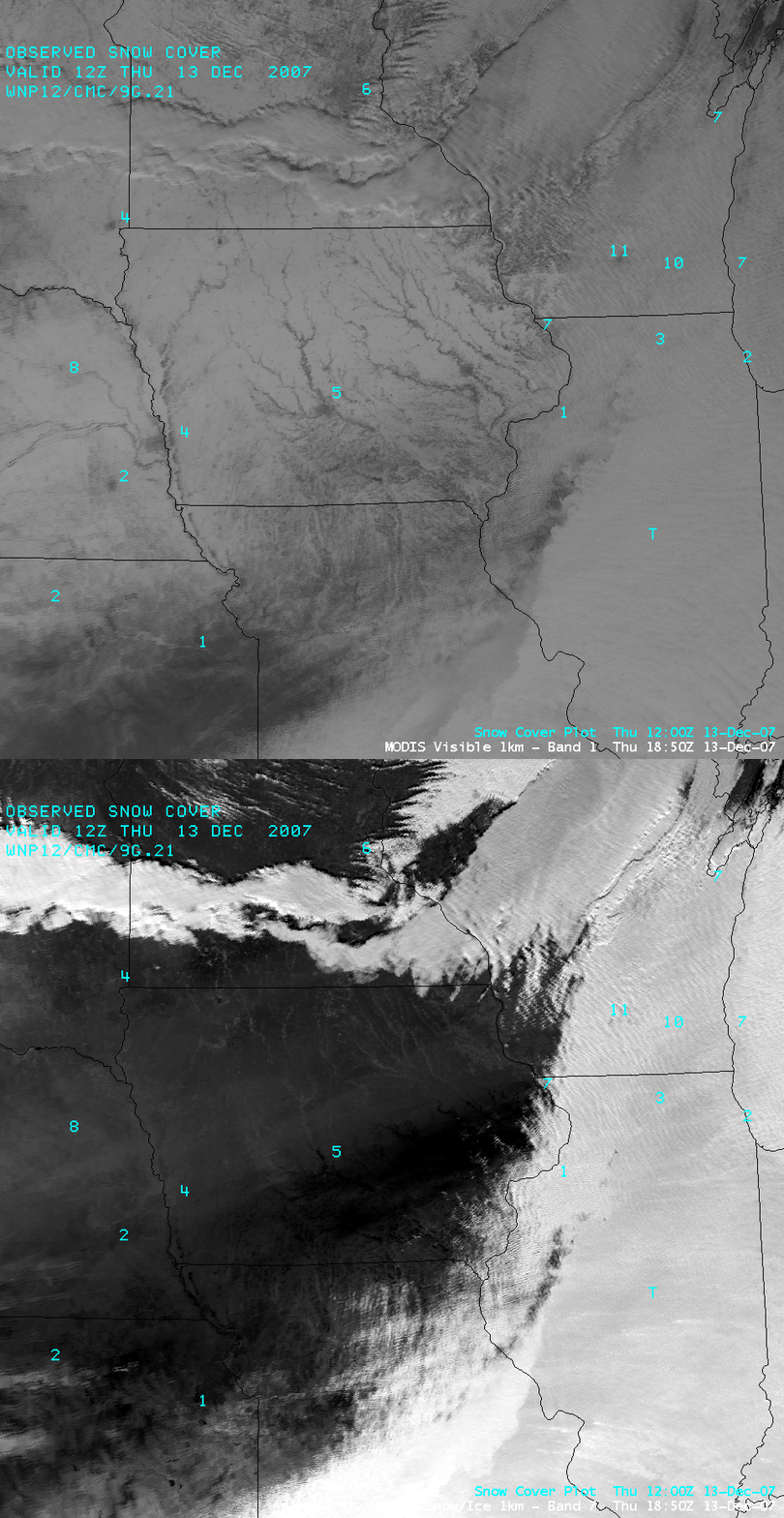
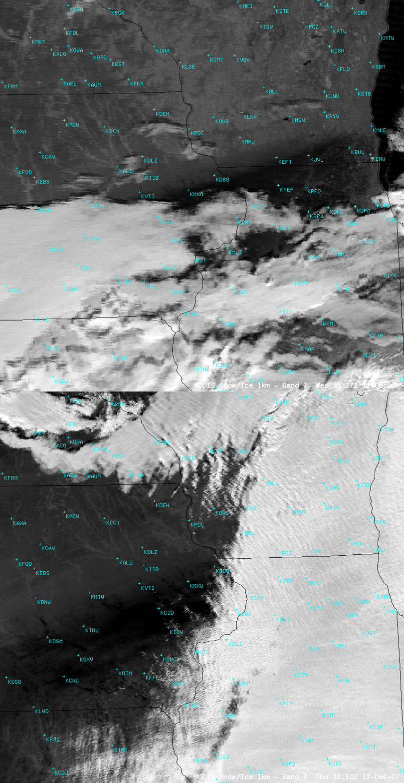
AWIPS images of the MODIS visible and “snow/ice” channels from 13 December 2007 (above; closer view) reveal that much of the southeastern half of Iowa received a significant glazing of ice (0.25 to 1.0 inch) during a freezing drizzle/freezing rain event on 10-11 December. Snow and ice particles are very strong absorbers at the 1.6 µm wavelength of the MODIS snow/ice channel [Baum et al., 2000], so the thick coating of ice on top of existing snow cover shows up as a very dark feature on those images (even darker than adjacent areas to the north which had more snow cover but did not receive significant amounts of freezing rain). In contrast, supercooled water droplet clouds show up as much brighter features on the MODIS snow/ice channel image.
A false-color RGB composite using the MODIS visible and 1.6 µm images (below) shows the region of significant ice glazing as the transition to deeper red colors.
A comparison with the MODIS snow/ice channel image from the previous day (below) shows that the significant ice accumulation (darker black enhancement) also extended to the northeast, covering parts of northern Illinois and extreme southern/southeastern Wisconsin. It is interesting to compare this event with another case of significant ice glazing that was seen on MODIS imagery in the southern Plains back in February 2002.
For photos of the ice accumulation in extreme northwestern Missouri, see the website from storm chaser Mike Hollingshead.
Reference: Baum, B.A., P.F. Soulen, K.I. Strabala, M.D. King, S.A. Ackerman, W. P. Menzel, and P. Yang: Remote sensing of cloud properties using MODIS airborne simulator imagery during SUCCESS, J. Geophys. Res., 105, 11781-11792, 2000.


