|
|
|
|
|
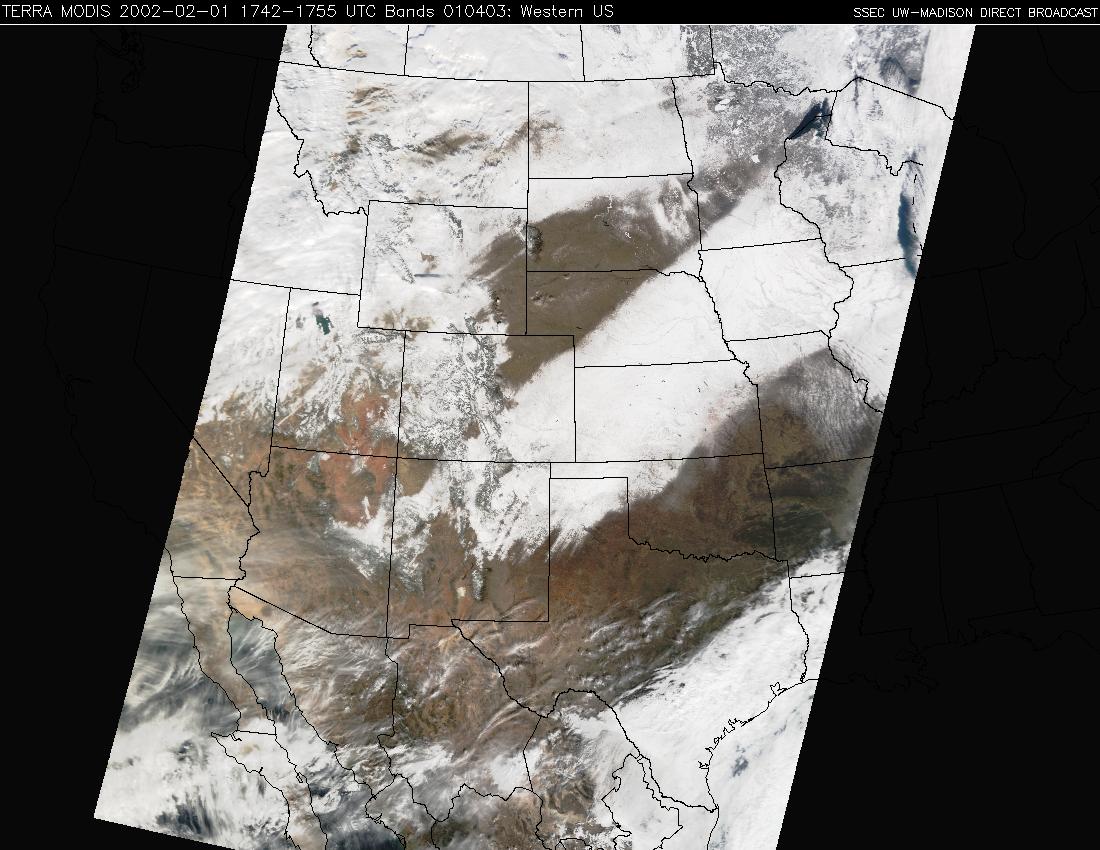
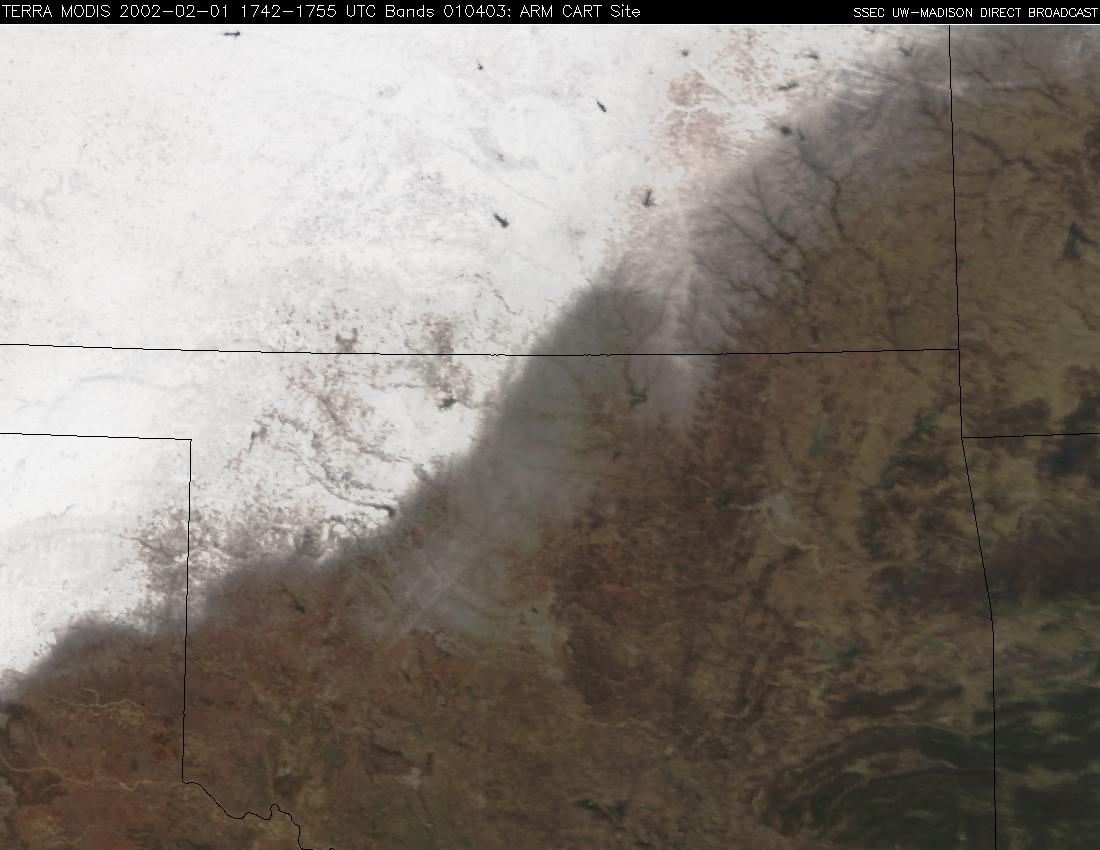
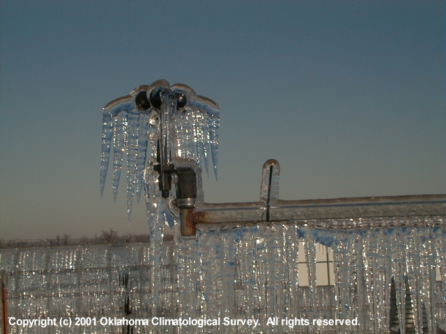
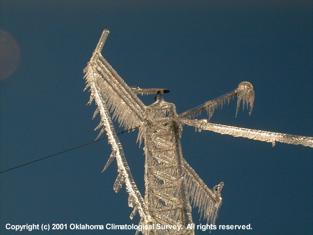
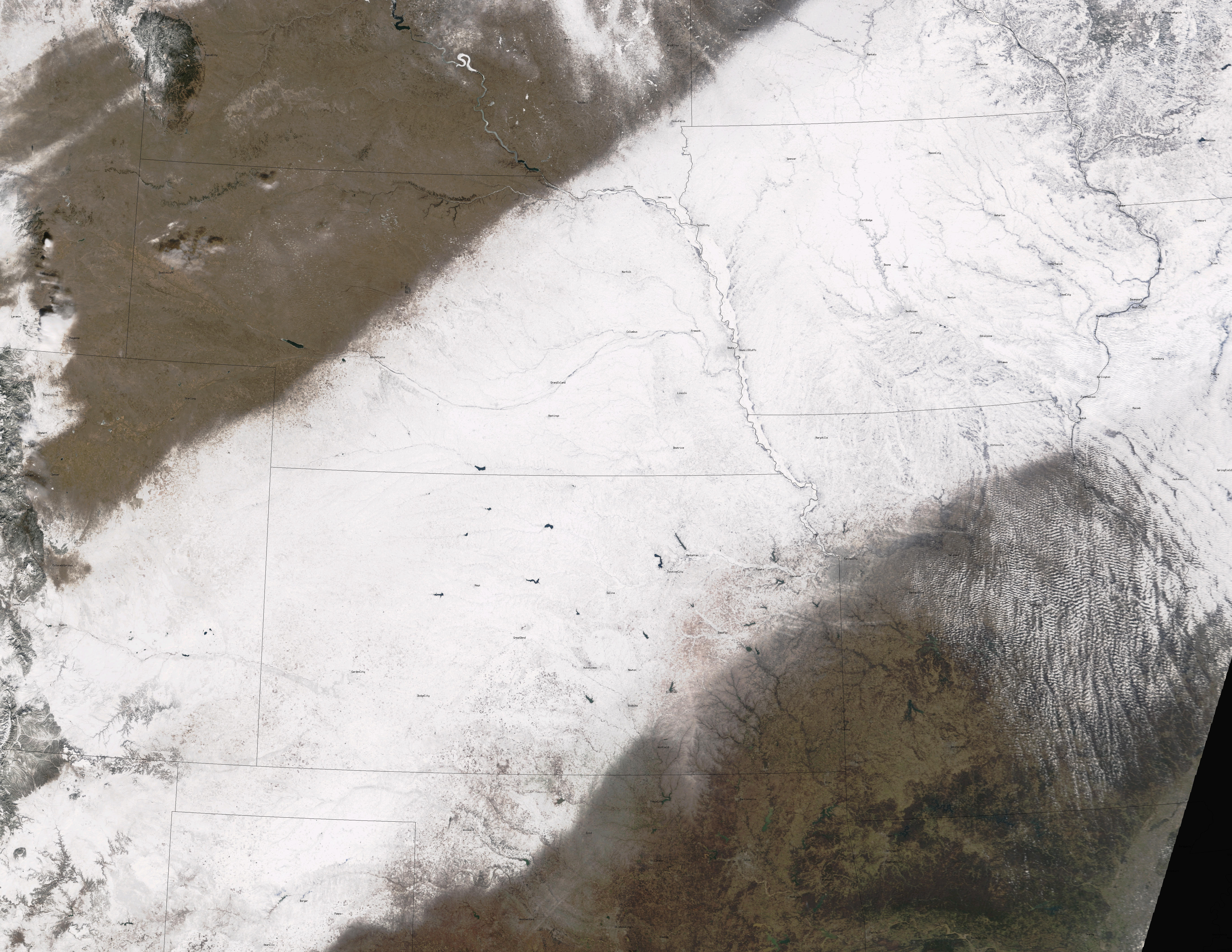
Terra MODIS imagery acquired and processed by the University of Wisconsin-Madison Space Science and Engineering Center (SSEC) MODIS Direct Broadcast facility shows an unusually wide swath of significant snow cover (above, left) that resulted from a series of winter storms moving northeastward across the central United States during the 29-31 January 2002 period. Storm total snowfall accumulations across the Great Plains, Midwest, and Great Lakes regions were as high as 6-18 inches in each of the affected states. Along the southeastern edge of the heavy snow band, significant freezing rain resulted in a 1-3 inch coating of ice across parts of Oklahoma, Kansas, and Missouri. The translucent nature of this thick ice coating across parts of Oklahoma, Kansas, and Missouri is quite evident on the MODIS true color composite imagery (above, right, and also on this 3.2 MB JPEG image with city names overlaid), in contrast to the brighter white appearance of the snow covered regions immediately to the northwest. This was one of the worst ice storms in Oklahoma history, downing 4000 electric power poles and causing loss of power to a quarter of a million homes and businesses.
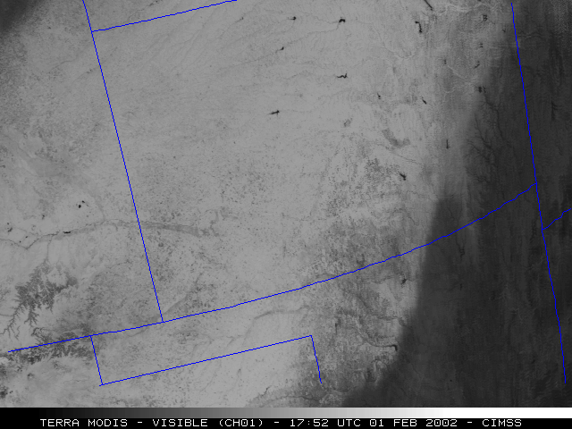
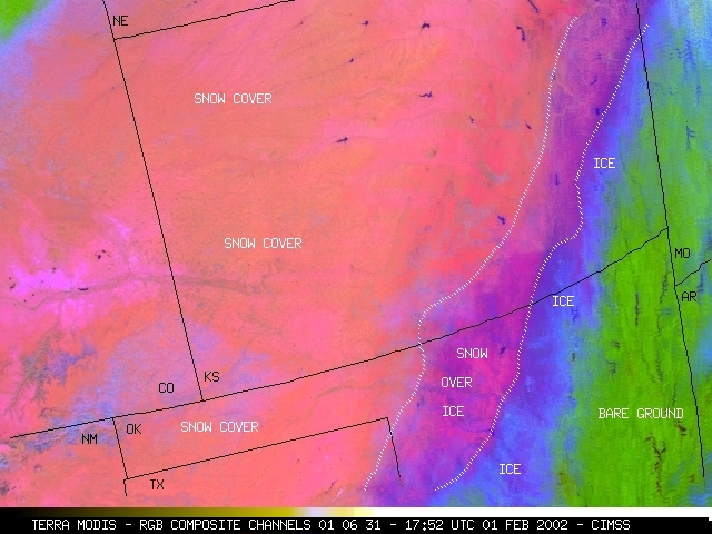
Some of the ice-covered ground later received some snow cover, making those areas similar in appearance on the visible channel data (below left) to the snow-cover-only areas farther to the northwest. However, the 1.6 micrometer near-IR data shows the true areal extent of the ice-covered ground (black enhancement, below center, and blue enhancement on the composite image, below right),including the ice-covered ground that was later covered with some snow.
|

|
|
|
|
One tell-tale indication of significant freezing rain is prolonged periods of calm winds recorded by mesonet stations (above). Images courtesy of the Oklahoma Climatological Survey.
