Prescribed burning in the Flint Hills of Kansas and Oklahoma
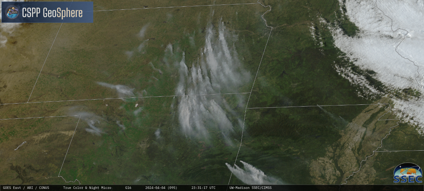
GOES-16 True Color RGB images, from 1501 UTC on 04 April to 0016 UTC on 05 April [click to play MP4 animation]
GOES-16 “Red” Visible (0.64 µm) images with an overlay of the Fire Mask derived product (a component of the GOES Fire Detection and Characterization Algorithm FDCA) depicted the areal coverage and diurnal behavior of the fire thermal signatures (below). A similar animation using the GOES-16 Fire Power derived product is available here: GIF | MP4.

GOES-16 “Red” Visible images + an overlay of the GOES-16 Fire Mask (with/without surface plots of Ceiling and Visibility), from 1401 UTC on 04 April to 0016 UTC on 05 April [click to play animated GIF | MP4]
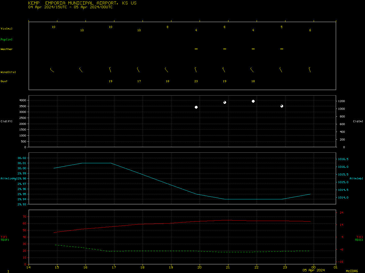
Plot of surface report data from Emporia, Kansas [click to enlarge]
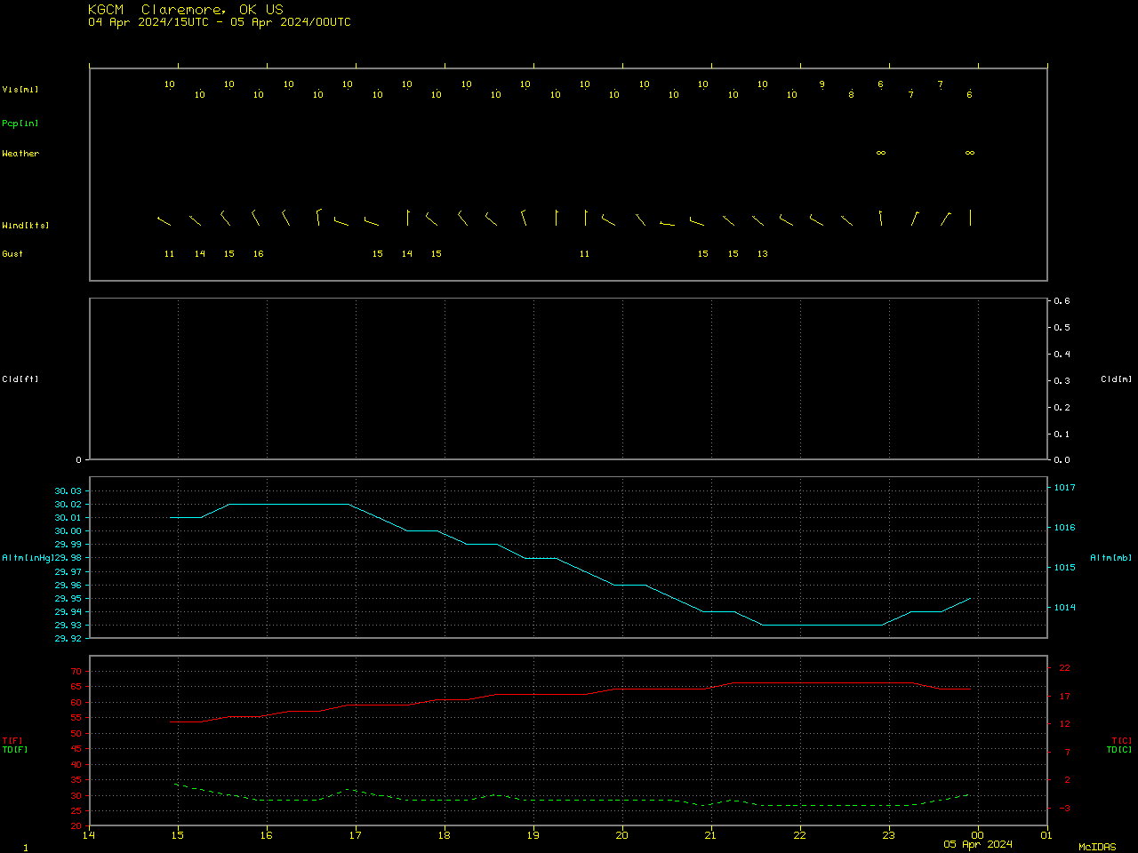
Plot of surface report data from Claremore, Oklahoma [click to enlarge]