Pyrocumulonimbus clouds in Sichuan, China
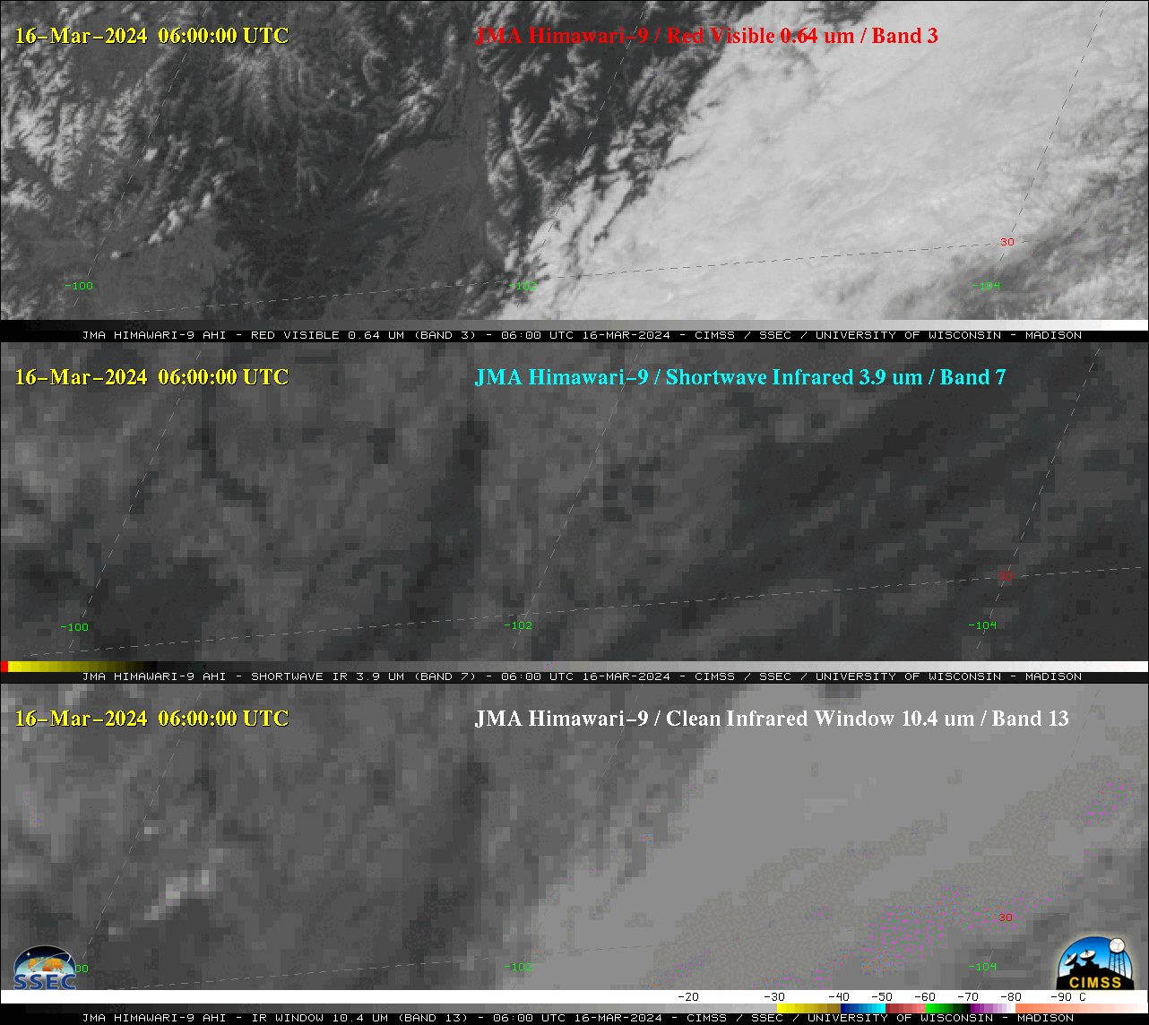
Himawari-9 “Red” Visible (0.64 µm, top), Shortwave Infrared (3.9 µm, middle) and “Clean” Infrared Window (10.4 µm, bottom) images, from 0600-1100 UTC on 16 March [click to play animation | MP4]
Himawari-9 True Color RGB images created using Geo2Grid (below) showed the east-northeast transport of the wildfire smoke plume, with its embedded pyroCb cloud.
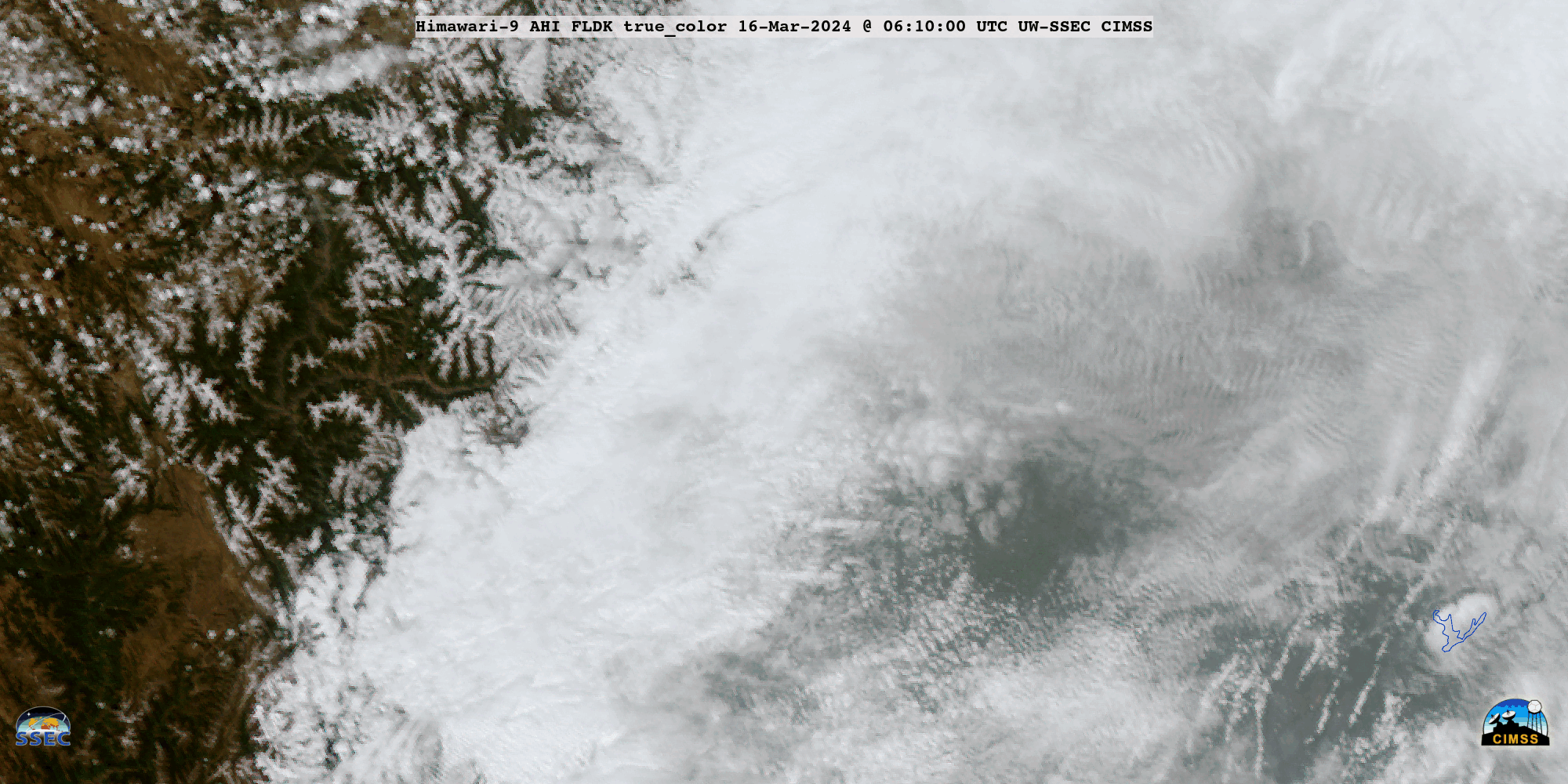
JMA Himawari-9 True Color RGB images, from 0610-1050 UTC on 16 March [click to play animated GIF | MP4]