Lake Effect in South Dakota

(Image source: The CIMSS/SSEC MODIS Today Page)
Lake effect clouds and snows are a common wintertime occurrence downwind of the warm waters of the Great Lakes, and such weather events have been discussed frequently on this blog (See here, here, and here, for example) and elsewhere. When cold air moves over a warm water surface, the air is warmed via convection and moistened via evaporation, and that input heat and moisture can be sufficient to generate cumuliform clouds downwind of the moisture source. If Lake waters are about 13 C warmer than the temperature at 850 mb, then clouds and snow occur downwind of the Great Lakes.
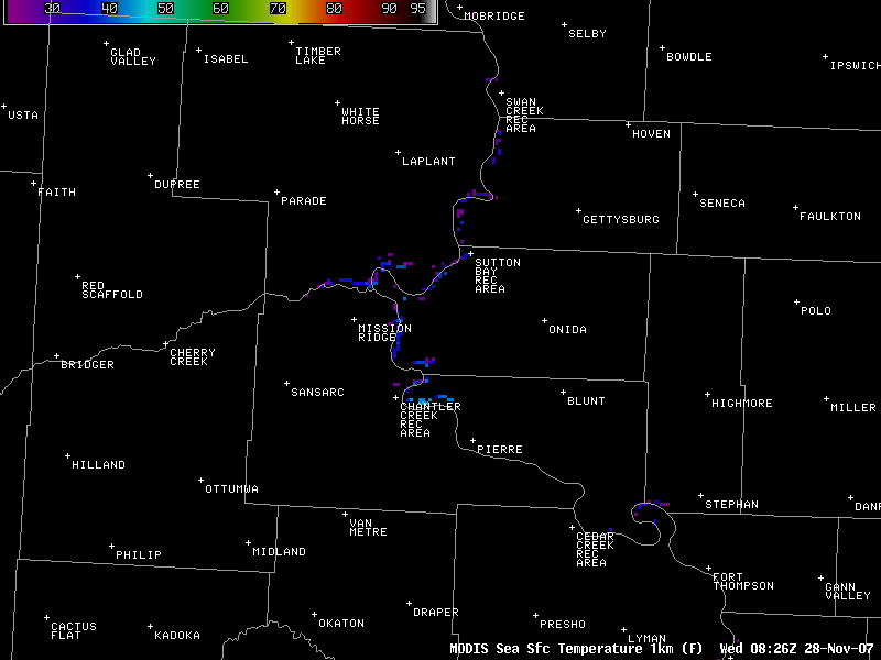
Lake Oahe is a large artificial impoundment of water on the Missouri River in central South Dakota. It is sufficiently large that, given the right wind trajectory, clouds can form downwind of the lake. Even in late November, it retains some warmth, as noted in the MODIS-derived “Sea” surface temperature product here. Note the pixels that suggest water temperatures in the 40s in the region where the clouds formed today.
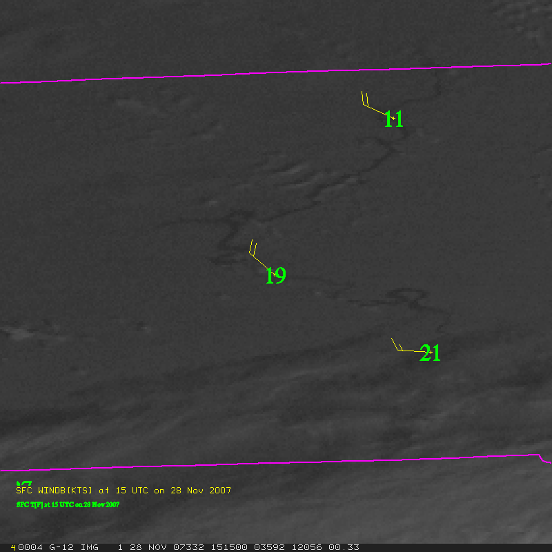
A loop of the GOES-12 (GOES-EAST) imagery from today clearly shows the region where the Lake Effect clouds formed. Note how the cloud streets align themselves with the wind direction as reported at PIR (the station in central South Dakota); the other stations are Chamberlain to the southeast and Mobridge to the northeast. As the temperatures warm during the day, the thermal differences that support the cloud development weaken and the cumuliform clouds dissipate as mid-level clouds move in from the west.
Another intriguing feature in the MODIS true-color imagery above is the smear of white near Fort Thompson, just north of the southeast corner of the image. For a chilly west-northwest airflow, this region is just downwind of the prominent oxbow on the Missouri River near Fort Thompson and Lower Brule, to the north of Chamberlain and to the east of Pierre. Is this a signature of Lake/River effect snow in that area?