By Scott Bachmeier •
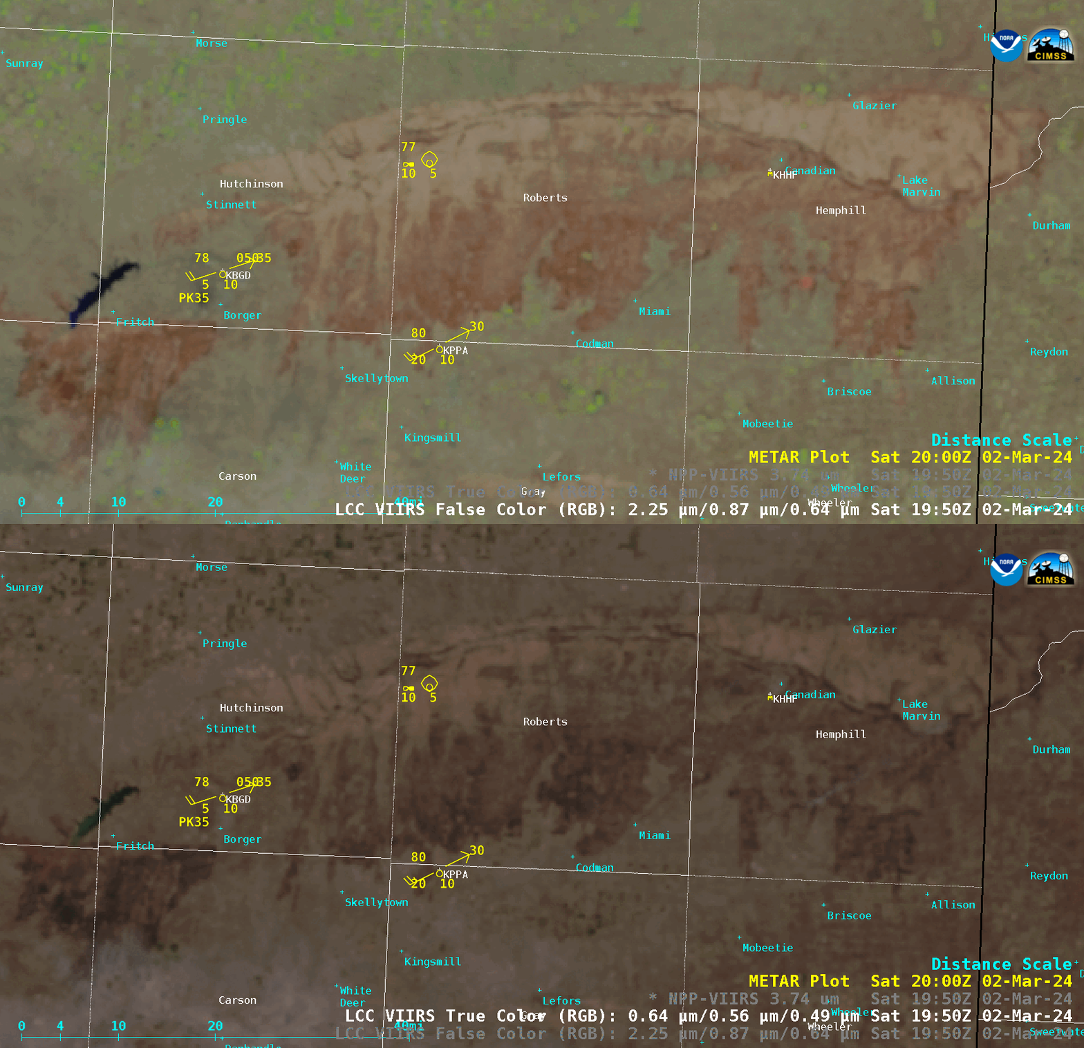
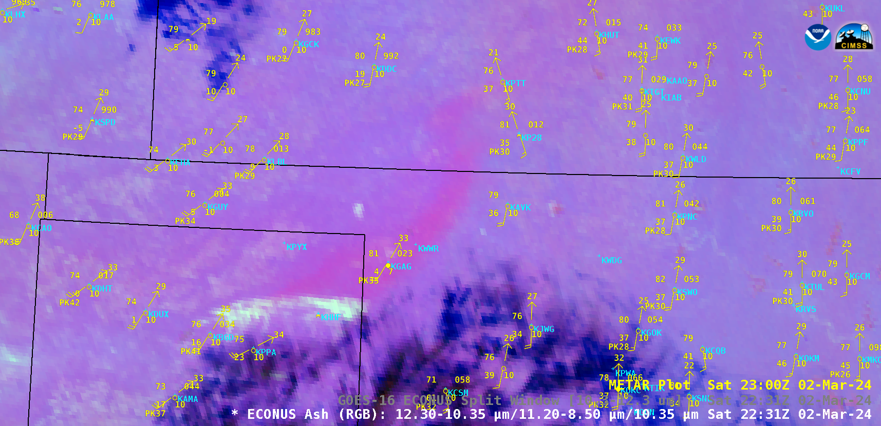
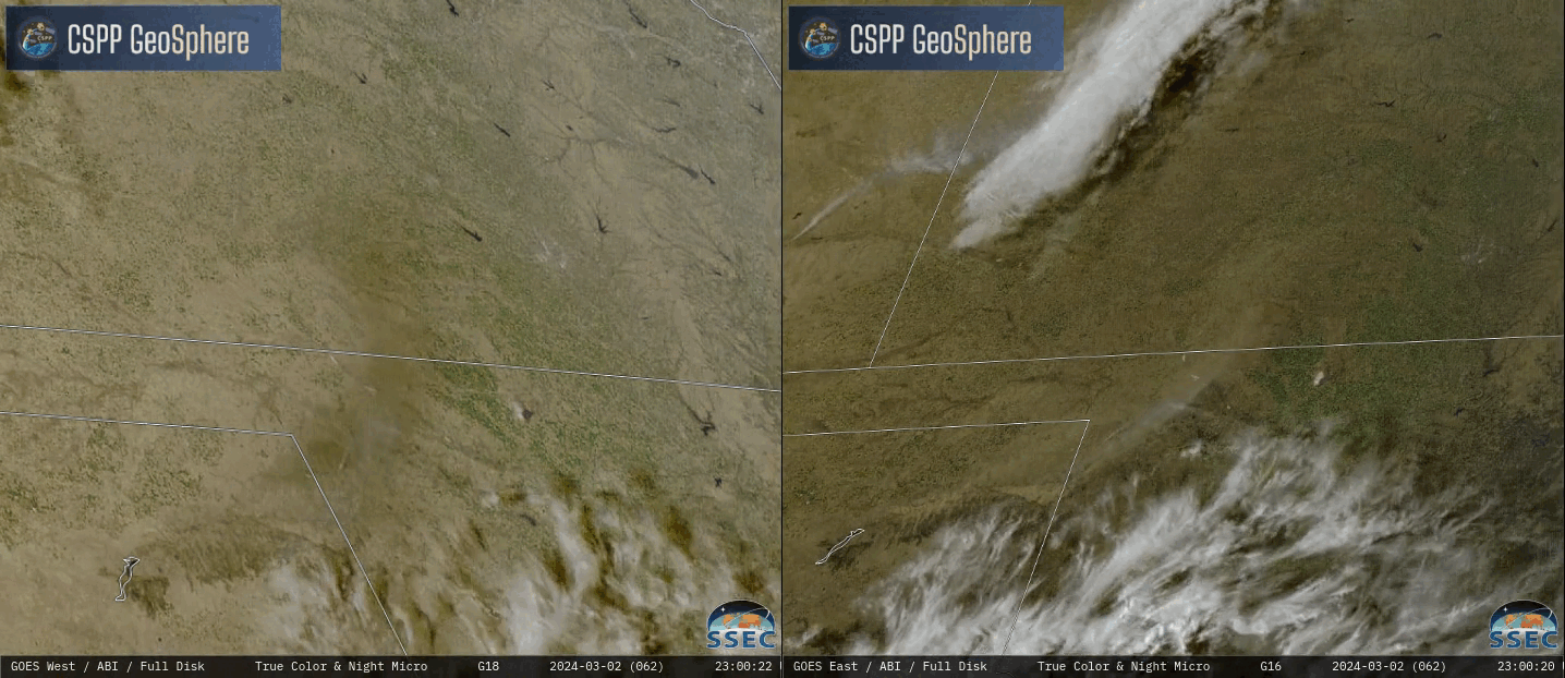
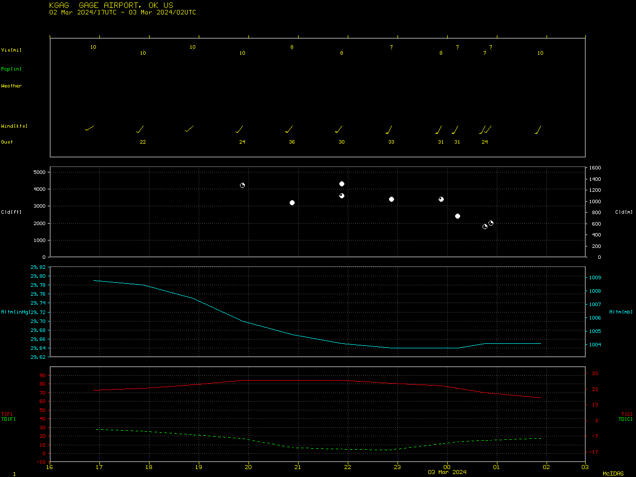
A toggle between Suomi-NPP VIIRS False Color RGB and True Color RGB images (above) displayed the areal extent of burn scars from the Smokehouse Creek Fire and the Windy Deuce Fire — which began burning in the Texas Panhandle on 26 February, as discussed in this blog post — at 1955 UTC on 02 March 2024. Surface reports at that time were showing southwesterly winds with gusts of 30-35 knots at Pampa (KPPA) and Borger (KBGD). GOES-16 (GOES-East) Ash RGB and Split Window Difference (10.3-12.3 µm) images (above) revealed a plume of ash (from burned vegetation and structures) that was being lofted from the burn scars by the strong SW winds — gusting as high as 41 knots or 47 mph at Borger, Texas — and transported across northwest Oklahoma to central Kansas. The ash plume (brighter shades of pink in Ash RGB and shades of yellow in the Split Window Difference imagery) passed over Gage, Oklahoma (KGAG), reducing the surface visibility to 7 miles at times; ceilometer data indicated that the base of the thicker ash layer aloft was in the 2000-4000 ft range (below). GOES-18 (GOES-West) and GOES-16 (GOES-East) True Color RGB + Nighttime Microphysics RGB images from the CSPP GeoSphere site (below) showed the ash plume (which was mixed with some smoke) as it was transported across Oklahoma and Kansas. The plume appeared brighter in GOES-16 True Color imagery, due to enhanced forward scattering later in the day — but in GOES-18 True Color imagery, the ash plume exhibited a darker appearance because of the absence of forward scattering during the afternoon and early evening hours. After sunset, the plume exhibited shades of pink — and clusters of darker purple pixels denoted thermal signatures of fire activity.Categories: Air quality, GOES-16, GOES-18, Red-Green-Blue (RGB) images, Suomi NPP, VIIRS