Not quite so wet in the south Pacific

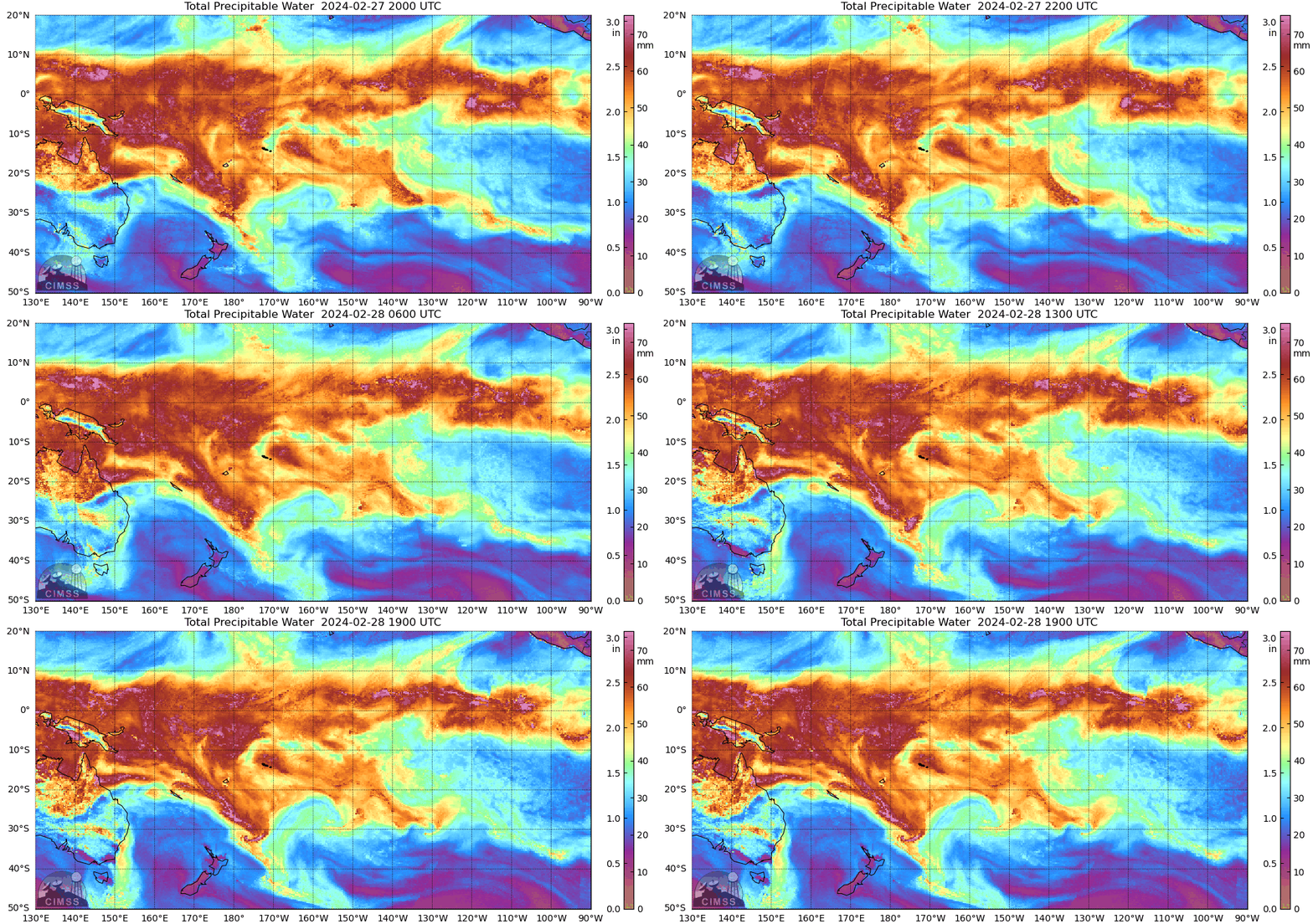
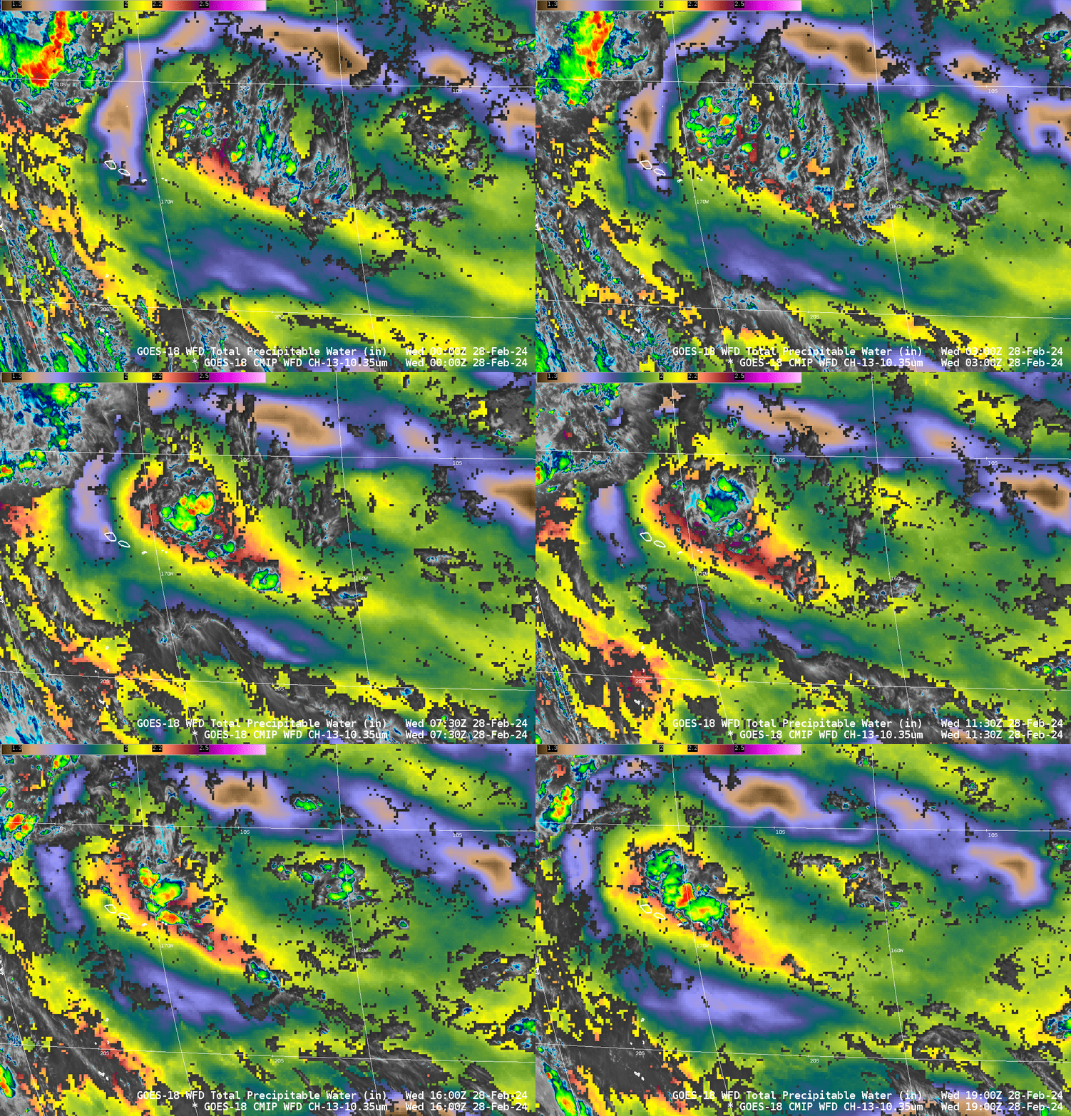
December 2023 through February 2024 was a period of exceptional wetness over the Samoan Islands. Pago Pago received 68″ of rain during that period (this was the 4th greatest total since the 1950s!!). In the past week, however, the moisture of the South Pacific Convergence Zone has shifted away from American Samoa. The relatively clear skies that have followed mean a couple things. Pago Pago had record heat on 27 February (96oF), and Level 2 products that require clear skies are useful again. The animation above shows MIMIC Total Precipitable Water for the 24 hours endings at 1900 UTC on 28 February. The animation below shows GOES-West Band 13 imagery overlain with Level 2 Total Precipitable Water, scaled from 1.2 to 2.7 inches. Note the trench of lower precipitable water values apparent in the MIMIC fields above has an echo in the Level 2 product. In general, convection is absent in that region but more prevalent in the higher values of total precipitable water that the trench of lower values surrounds.

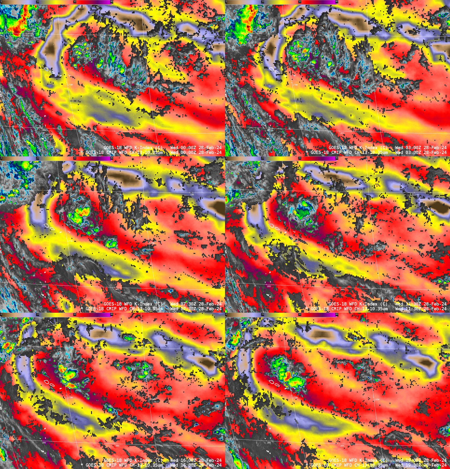
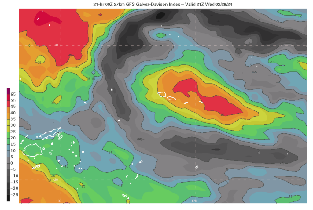
The Level 2 K Index, below, has a structure very similar to the Total Precipitable Water fields above. K-index is related to the Galvez-Davison Index (as shown in this blog post). The 21-h forecast of GDI is shown at bottom. There are great similarities in the structure of the K-Index, the TPW, and the GDI.


Level 2 Products from GOES-18 can be used to approximate the Galvez-Davison Index.

