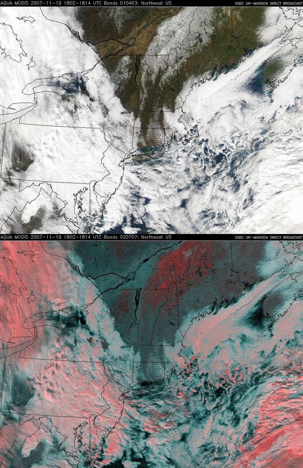
Snow cover in New England
A comparison of the MODIS “true color” RGB image (Red=channel 01, Green=channel 04, Blue=channel 03) and the corresponding “false color” RGB image (Red=channel 02, Green=channel 07, Blue=channel 07) from 19 November 2007 (above) shows snow cover over parts of New York, Vermont, New Hampshire, and Maine (extending northward into portions of southern Quebec in Canada). Both snow cover and clouds appear white on the true color image, but deep snow cover appears as darker shades of red (with clouds composed of ice crystals appearing as a lighter shades of red) on the false color image — this makes it relatively easy to discriminate snow cover from supercooled water droplet clouds (which appear as shades of white on the false color image). In fact, a few small patches of supercooled water droplet cloud can be seen over the region of deeper snow clover (along and just north of the US/Canada border). Snow depth data from the NOAA National Operational Hydrologic Remote Sensing Center (NOHRSC) indicated a number of sites reporting 5-10 inches (13-25 cm) of snow on the ground that morning.


