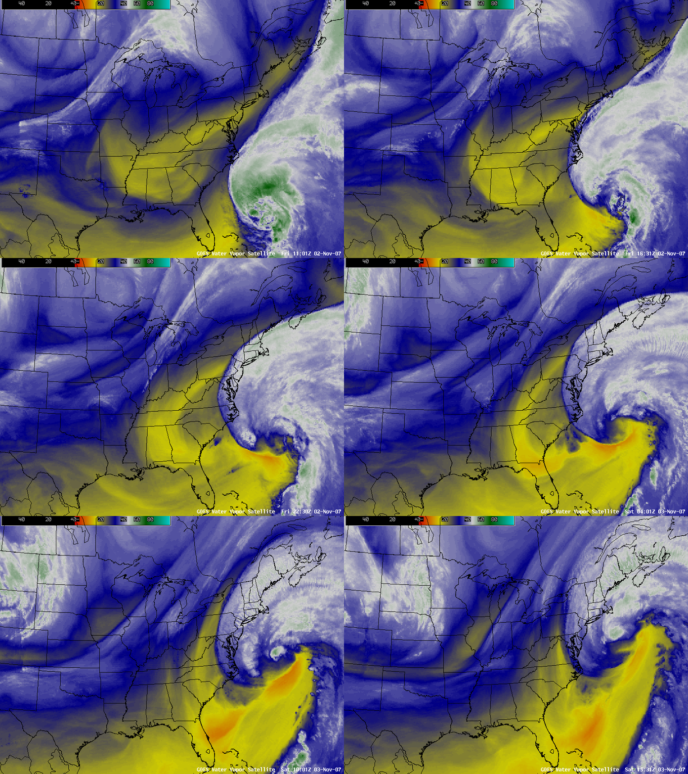
Noel transitions to an extratropical cyclone
As Hurricane Noel made the transition to an extratropical cyclone during the 02 to 03 November 2007 period, it remained a very large and very powerful storm system that significantly impacted the Atlantic coast regions of the northeastern US and southeastern Canada with hurricane force winds (91 mph at Horseshoe Shoal MA), heavy rain (4.83 inches at Bass Harbor ME), high seas (46.0 foot waves at Buoy 44011), and even heavy snow (6.0 inches at Fort Kent ME). AWIPS images of the GOES-12 6.5 µm “water vapor” channel (above) showed a very pronounced warm/dry band (orange enhancement) just south of the main cloud shield along the southern quadrant of the storm. This particular water vapor signature often indicates a potential for very strong winds at the surface as momentum from aloft is transferred downward into the boundary layer; the southern flank is also a favored area for strong surface winds in an extratropical cyclone.
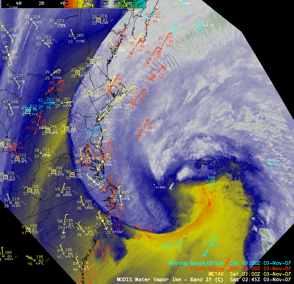
An AWIPS image of the 6.7 µm MODIS water vapor channel around 02:45 UTC (below) with 03 UTC surface reports reveals that Fixed Buoy 41048 (located west of Bermuda, station ID TXKF) was situated near the leading edge of the water vapor dry band, and experienced a peak wind gust (from the south) of 62 knots near the time of the MODIS image. Buoy 41048 recorded a peak wind gust of 69 mph at 01:50 UTC, and a peak wave height of 37.1 feet at 02:50 UTC.


