Foehn gap and orographic crest cloud downwind of the Sierra Nevada
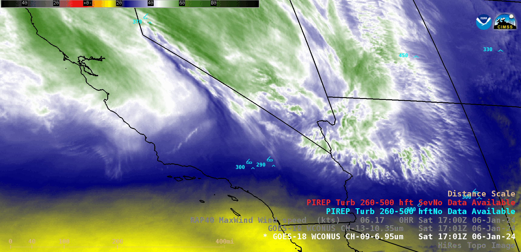
GOES-18 Mid-level Water Vapor (6.9 µm) images, with pilot report (PIREP) plots of turbulence [click to play animated GIF | MP4]
The corresponding GOES-18 “Clean” Infrared Window (10.3 µm) images are shown below.
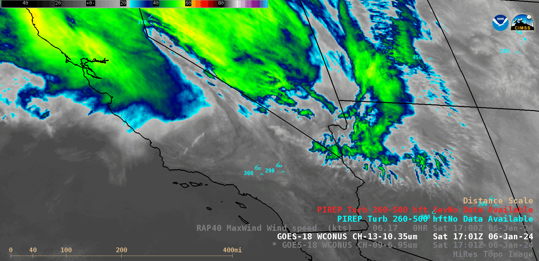
GOES-18 “Clean” Infrared Window (10.3 µm) images, with pilot report (PIREP) plots of turbulence [click to play animated GIF | MP4]
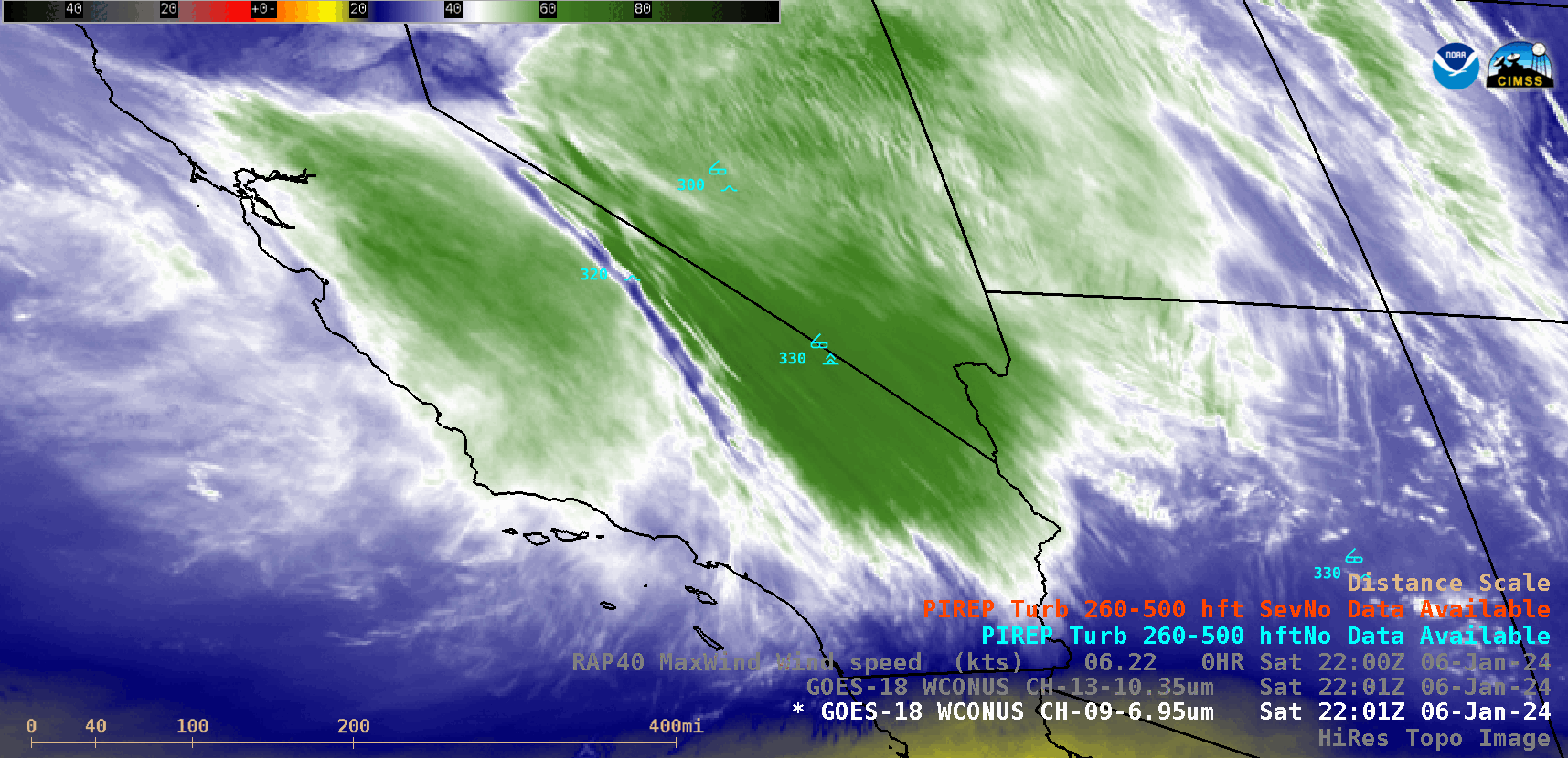
GOES-18 Water Vapor and Infrared images at 2201 UTC + Topography [click to enlarge]
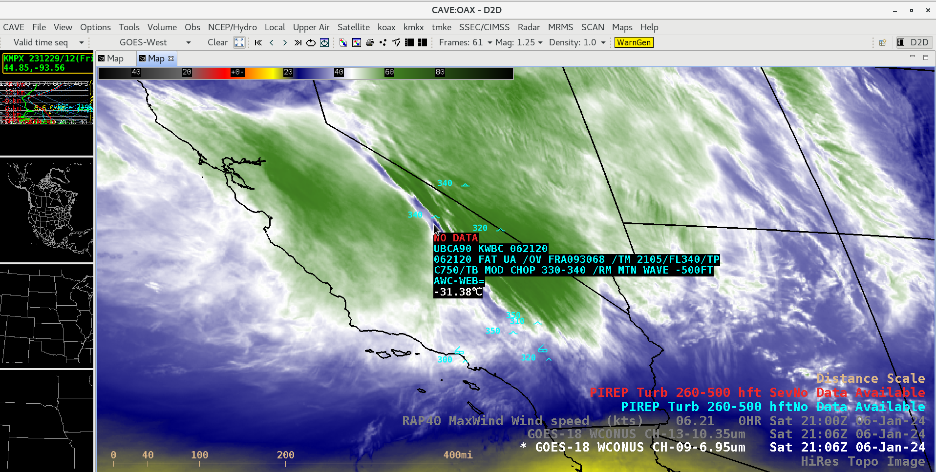
GOES-18 Water Vapor image at 2106 UTC, with a Pilot Report of a Mountain Wave at 2105 UTC [click to enlarge]
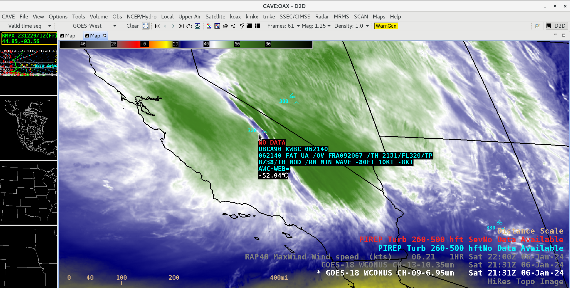
GOES-18 Water Vapor image at 2131 UTC, with a Pilot Report of a Mountain Wave at 2131 UTC [click to enlarge]
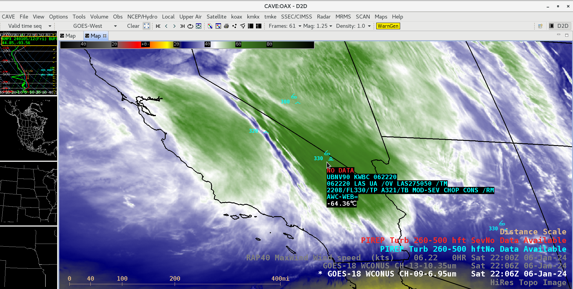
GOES-18 Water Vapor image at 2206 UTC, with a Pilot Report of Moderate to Severe Turbulence at 2208 UTC [click to enlarge]
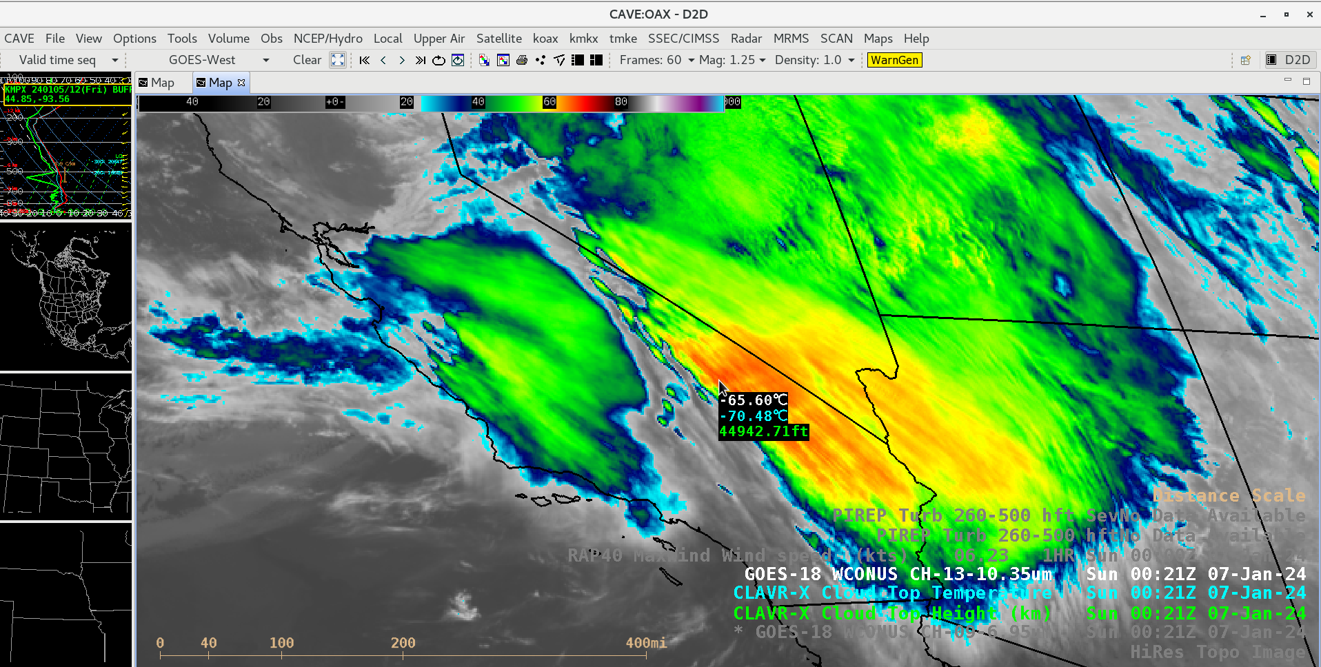
Cursor sample of GOES-18 10.3 µm brightness temperature (white), CLAVR-x Cloud Top Temperature derived product (cyan) and CLAVR-x Cloud Top Height derived product (green) at 0021 UTC [click to enlarge]