Comparing Day Cloud Phase Distinction, Cloud Phase, and Snow observations
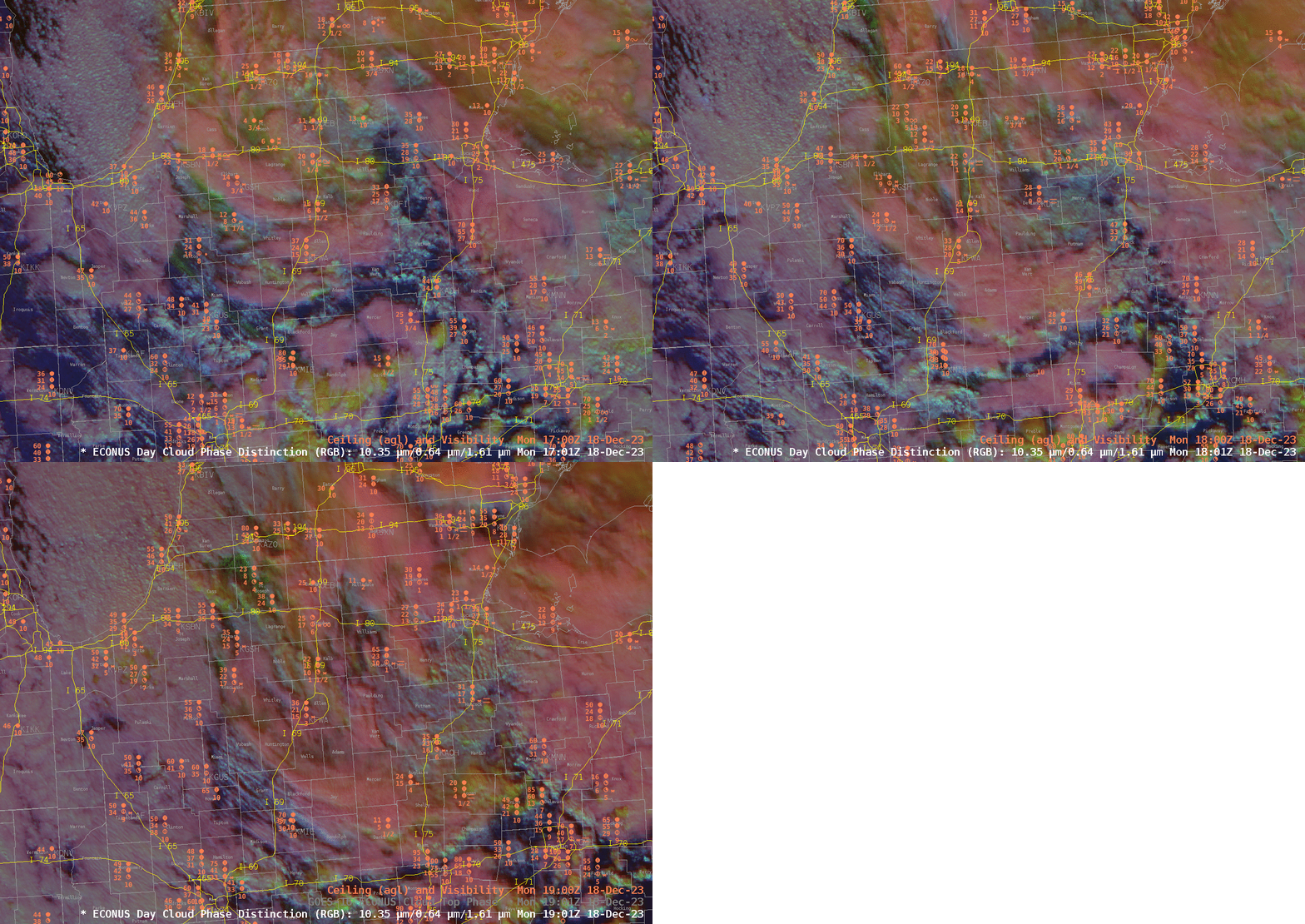
The National Weather Service forecast office in Wilmington OH (Twitter link) has noted via tweets during the day on 18 December 2023 (link, link, link) that road visibility conditions are variable in the extreme as snow showers move through Indiana and Ohio. The Day Cloud Phase distinction imagery below at 1701, 1801 and 1901 UTC on 18 December suggests that the color of the RGB might be related to snowfall. This can occur because the Day Cloud Phase Distinction RGB color signature changes as a cloud glaciates. Consider, for example, the reddish cloud that extends at 1701 UTC from Benton Harbor MI (KBEH) to the east of South Bend (KSBN) and through Goshen (KGSN) and Fort Wayne (KFWA); note that snow is associated with that cloud. What might you expect to be occurring in Paulding County (the east of Fort Wayne) or in Jay County (to the south of Fort Wayne) where a similar-colored signal exists?

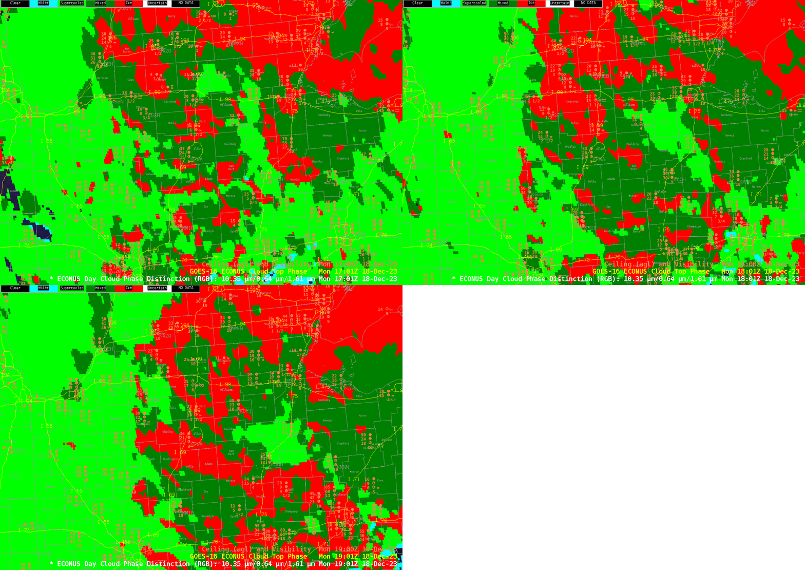
Cloud Top Phase for the same 3 hours as above, shown below, indicate (in dark green) mixed-phase clouds (that is, liquid and ice co-existing) and ice clouds (in red) over the region where snow is occurring. This should not surprise: appreciable snow requires the presence of ice within the cloud for ice crystals to grow at the expense of small water droplets. Of greater interest is the back edge of the mixed phase/ice region; by 1901 UTC most of the cloud tops over eastern Indiana are shown (light green) to be entirely supercooled liquid water. Will snow continue to occur in such conditions? There have been cases where supercooled cloud-top droplets nevertheless supported snowfall (blog post; FDTD Satellite Applications webinar). At 1901 UTC, however, there were not many observations of snow underneath clouds that were supercooled.

The Slider Juxtaposes below compare Day Cloud Phase Distinction and Level Cloud Top Phase a 1701 UTC (below) and 1901 UTC (bottom).
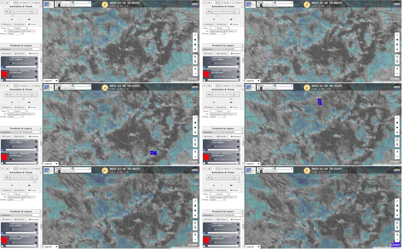
The GOES-16 GLM instrument has occasionally observed lightning over southern Ohio and West Virginia during the afternoon. How did LightningCast Probabiity do in predicting the flashes? Imagery from 1901 to 1951 UTC on the 18th, below, from this website, doesn’t show large values of LightningCast probability in regions where GLM observations occurred. However, small LightningCast probabilities are noted occasionally within the environment that is spawning occasional GLM observations.

These snow showers and lightning events occurred on the back side of a very large extratropical cyclones that moved up the east coast of the United States, bringing heavy rains from Georgia to Maine. The 2-day animation of GOES-16 hourly airmass RGB images (created using geo2grid), below, shows the evolution of the system. On 18 December, a strong potential vorticity anomaly was present over the Ohio River Valley as suggested by the orange color in the RGB. (Click here to see a model cross section at 1800 UTC — the corresponding airmass RGB is here) in the midwest, created from the awesome TropicalTidbits website that confirms that suspicion).


