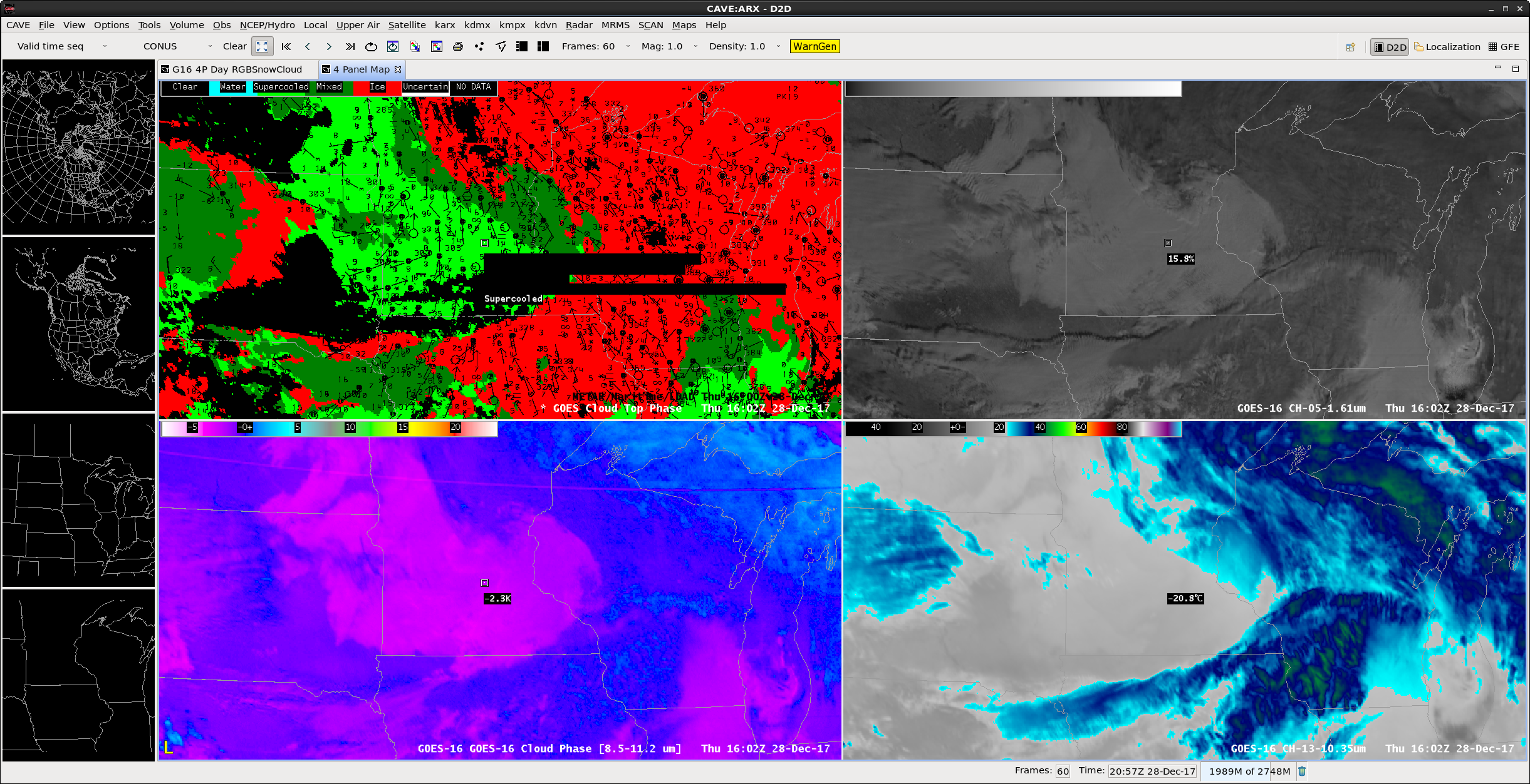
Mixed-phase stratiform clouds in an arctic air mass

AWIPS screen capture of GOES-16 Cloud Top Phase product (top left), Near-Infrared “Snow/ice” (1.61 µm, top right), Cloud Phase brightness temperature difference (8.5 – 11.2 µm, bottom left) and “Clean” Infrared Window (10.3 µm, bottom right) images [click to enlarge]
An animation of GOES-16 Snow/Ice (1.61 µm) imagery (below) showed that the high reflectance (brighter white) signature of the lower-altitude stratiform cloud deck persisted across southern Minnesota into western Wisconsin and northern Iowa during the daylight hours, along with widespread surface reports of light snow. In contrast, higher-altitude clouds composed predominantly or entirely of ice crystals exhibited a darker gray appearance (since ice crystals, as well as surface snow cover and frozen lakes/rivers, are strong absorbers of radiation at the 1.61 µm wavelength).
GOES-16 Near-Infrared “Snow/Ice” (1.61 µm) images, with hourly surface-observed precipitation type plotted in yellow [click to play MP4 animation]
GOES-16 “Clean” Infrared Window (10.3 µm) images, with hourly surface-observed precipitation type plotted in yellow [click to play MP4 animation]
Thanks to Mike Pavolonis (NOAA/NESDIS/CIMSS) and Jordan Gerth (CIMSS) for their insightful explanations regarding cloud phase — and thanks to the NWS La Crosse staff for bringing this interesting case to our attention!


![Rawinsonde data from Aberdeen, South Dakota [click to enlarge]](https://cimss.ssec.wisc.edu/satellite-blog/wp-content/uploads/sites/5/2017/12/171228_12utc_kabr_raob.png)
![Rawinsonde data from Chanhassen, Minnesota [click to enlarge]](https://cimss.ssec.wisc.edu/satellite-blog/wp-content/uploads/sites/5/2017/12/171228_12utc_kmpx_raob.png)