Cyclone Tej in the Arabian Sea
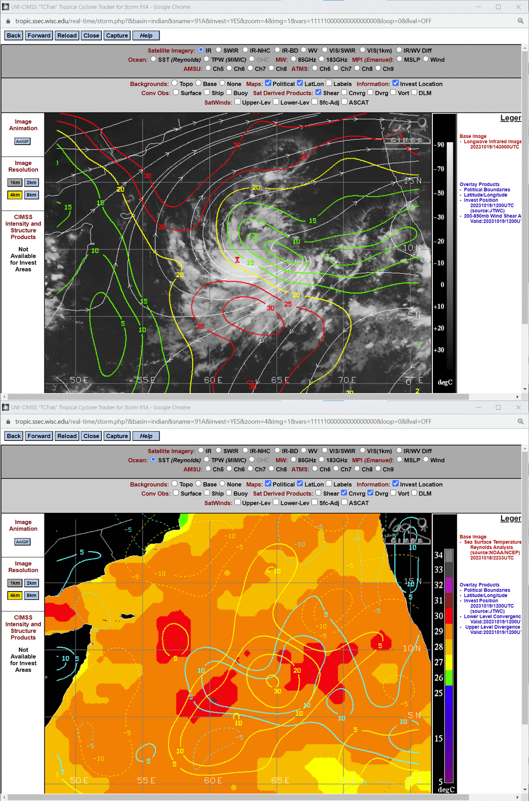
MIMIC Total Precipitable Water (TPW) fields, below, show a band a rich moisture over the northern Indian Ocean between the Equator and 15oN Latitude. By 17 October in the animation, cyclonic motion is diagnosed in the TPW fields between 60o and 70o E Longitude. By 18 October, an invest was declared. The toggle below (imagery from the CIMSS/SSEC Tropical Weather Website) shows shear values, Sea-Surface Temperatures, and low-level convergence and upper-level divergence. Shear values are favorable, and a good divergence/convergence couplet over warm waters is apparent.
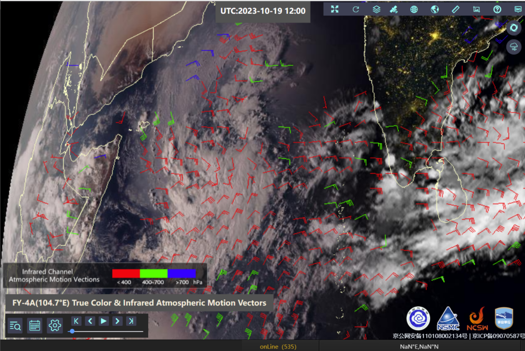
Metop-B overflew the system shortly after 0500 UTC on 19 October (link) and a closed circulation was apparent near 11oN, 63oE. Imagery and winds derived from FY-4A, below, (from this NSMC website) show strong diffluence above the developing system at 1200 UTC on 19 October. The upper-level wind barbs (in red) and mid-tropospheric wind barbs (in green) are nearly parallel, suggesting low shear values.
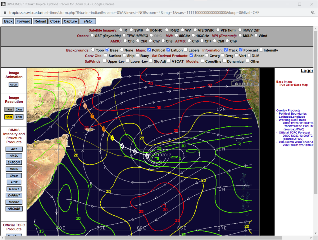
By 1200 UTC on 20 October, below, a storm has formed in the region of low shear, and landfall on the southern shore of the Arabian Peninsula is forecast.
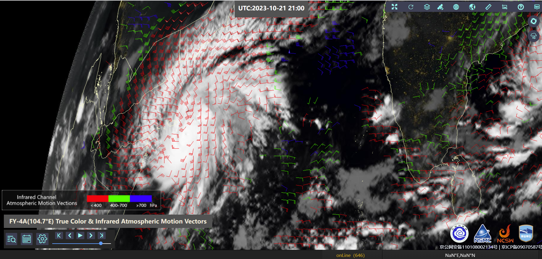
By 2100 UTC on 21 October 2023, below, a well-developed system was present. Satellite-derived winds suggest an outflow jet to the east along the northern perimeter of the storm.
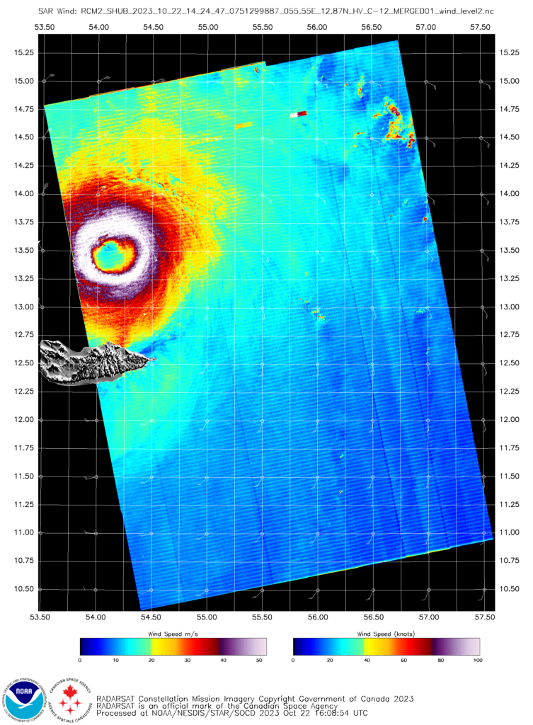
RCM-2 overflew Tej shortly after 1400 UTC on 22 October 2023 (link). The SAR wind analysis, below, shows a well-defined eye structure at that time to the north of Socotra Island. The wind analysis (here) shows peak winds over 100 knots.
