Tropical Storm Calvin forms in the eastern Pacific
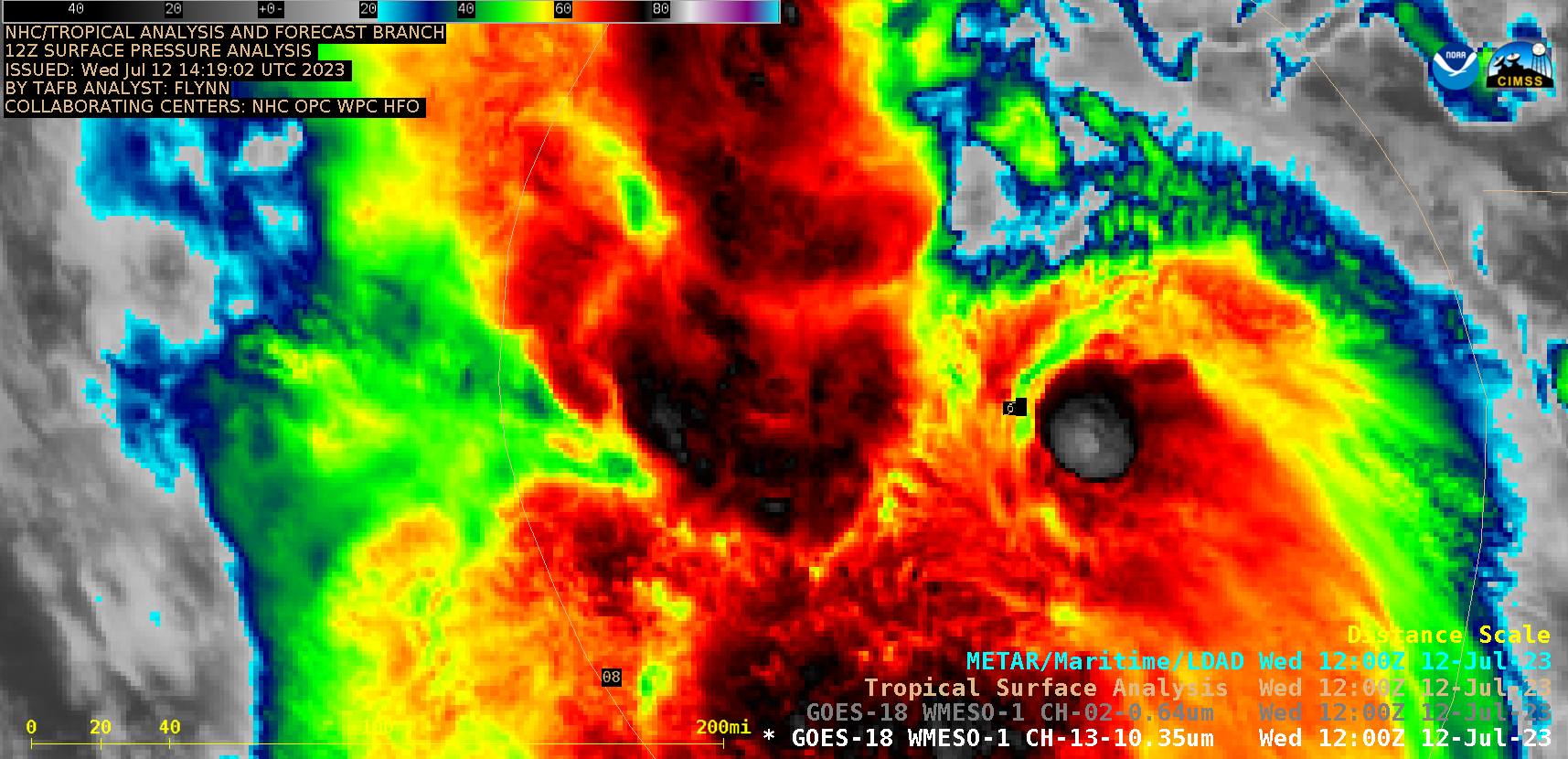
The third named storm of the Eastern Pacific tropical season has formed. (Click here for NHC‘s public advisory on the naming of Calvin) The mp4 animation above (click here for an animated gif) shows the evolution of the system for the 24 hours ending at 1210 UTC on 12 July as it gradually acquired rotation, evolving from a large convective complex at the start of the animation while it traveled over very warm waters.

GOES-18 Infrared (10.3 µm) and Visible (0.64 µm) images, 0900-1500 UTC on 12 July (courtesy Scott Bachmeier, CIMSS) [click to play animated GIF | MP4]
1-minute Mesoscale Domain Sector GOES-18 Infrared and Visible images (above) showed the period from 0900-1500 UTC (1315-1500 UTC for the Visible imagery), as Tropical Depression Three-E intensified along the Monsoon Trough to become Tropical Storm Calvin. A few convective bursts were evident near the storm center, with overshooting tops exhibiting infrared brightness temperatures as cold as -86ºC at 1441 UTC.
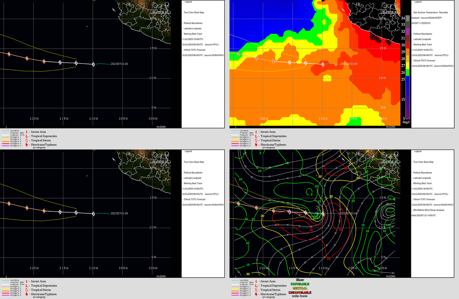
Calvin is now in a favorable environment for strengthening. The toggle below (using imagery from this website) shows the forecast path, the sea-surface temperatures, and the diagnosed atmospheric shear.

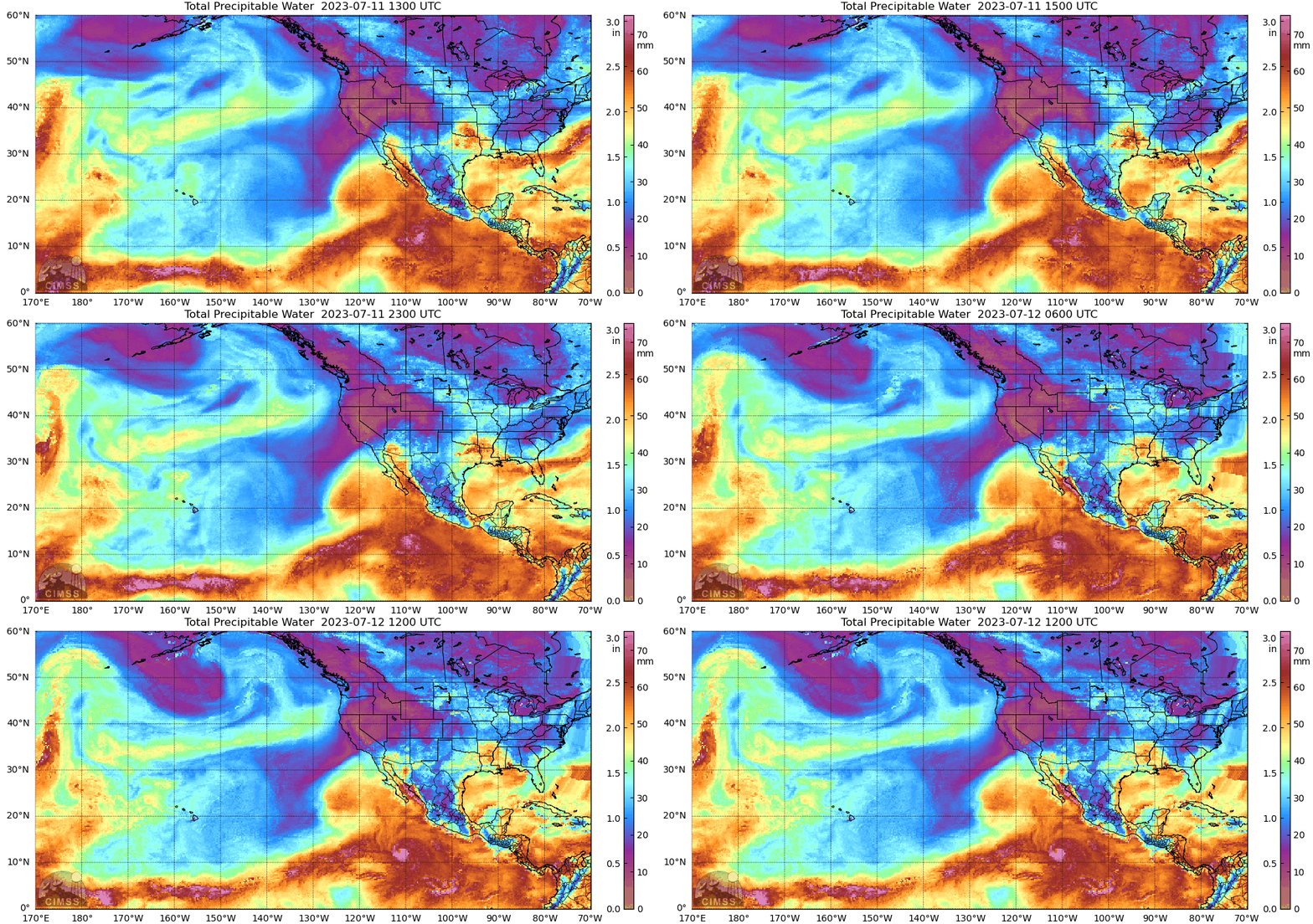
Abundant moisture surrounding Calvin is depicted in the MIMIC Total Precipitable Water animation shown below. The circulation of Calvin is apparent just west of 110oW Longitude.

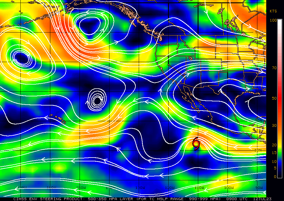
Atmospheric steering flow, shown below as the 850-500mb mean layer wind, takes the system on a westerly course. Long-range forecasts have the system (or its remnant moisture) affecting the Hawai’ian islands in the middle of next week. The movement and evolution of anticyclones to the northeast and northwest of Hawai’i shown below will be steering Calvin as that happens.

For the latest on Calvin, refer to the webpages of the National Hurricane Center.

