Using microwave data to distinguish between rain and just cloudy underneath clouds
Widespread clouds can easily hide the location of active precipitation. When that happens, well-timed microwave information can show where precipitation is most likely. In the slider example above, Aqua MODIS infrared imagery with a grey-scaled enhancement (collected over Guam just before 0350 UTC on 9 July) shows regions of convection west and south of Guam (circled in yellow). Where are the heaviest rains located, and where are the stratiform rains, and what regions are mostly dry, but under clouds? GCOM-W1 AMSR-2 data (collected over Guam around 0403 UTC on 9 July) can give information to address those questions. In this case, it reveals the regions underneath the clouds where strongest convection is most likely. This example highlights why JPSS data can be so vital in regions where radar coverage is lacking (or when the radar goes down!): because the microwave data can give important information about what’s going on underneath the cloud canopy.
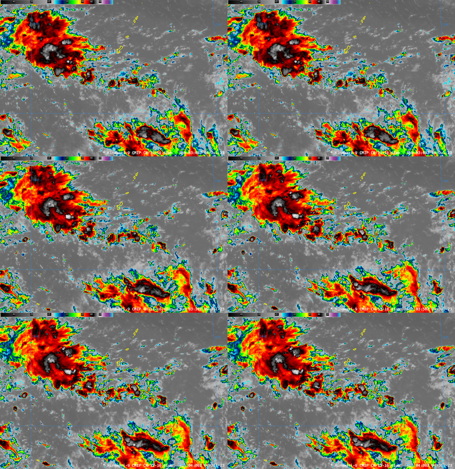
Of course, enhancements to the infrared imagery can also provide information, especially about how things are evolving with time. That’s shown in Himawari-9 infrared imagery (Clean window, Band 13 — 10.4 µm — and Upper-level Water Vapor, Band 8 — 6.25 µm) shown below. Note the appearance and decay of multiple cold cloud tops in the infrared data as convective towers evolve with time. A best practice is to combine the information gained by the snapshot given by the microwave data and use that information to infer what is occurring underneath the clouds in the geostationary data.


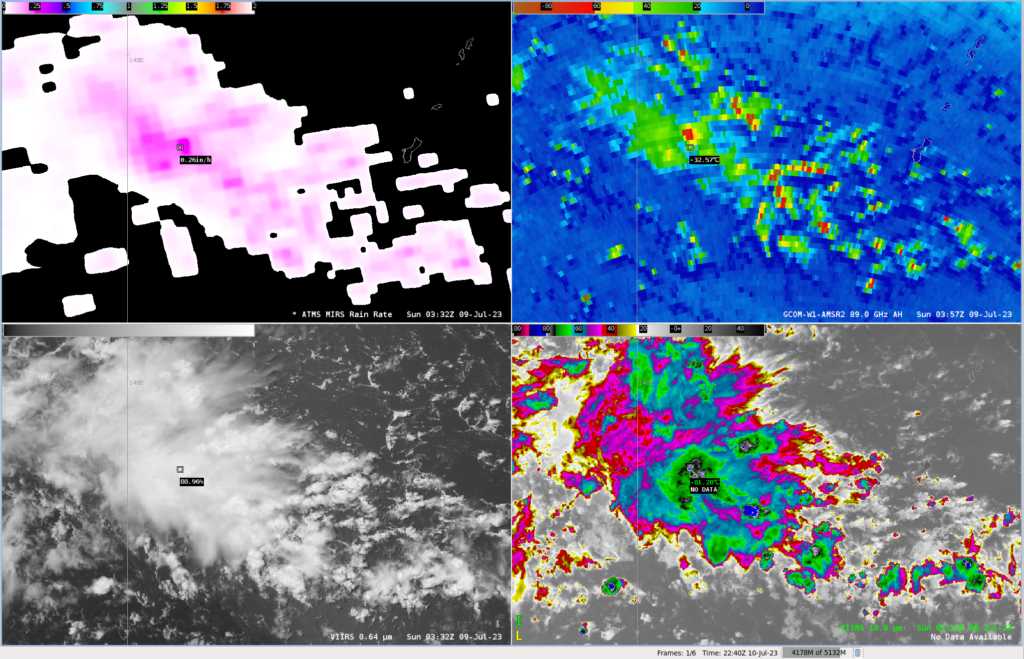
The imagery below compares NOAA-20 VIIRS imagery and rain rate derived from ATMS (at 0322 UTC) to the same GCOM AMSR-2 imagery as shown above.

Many thanks to Brandon Aydlett, Science and Operations Officer, WFO Guam, for the Aqua MODIS, Suomi-NPP and GCOM-W1 AMSR-2 imagery that was downloaded at the WFO GUM L/X Band direct broadcast antenna and processed with CSPP software.

