Eruption of Kilauea
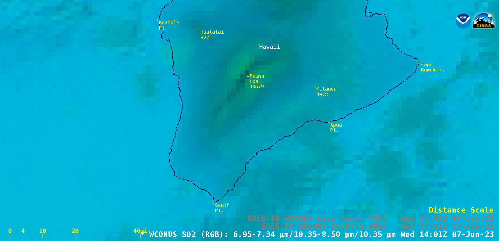
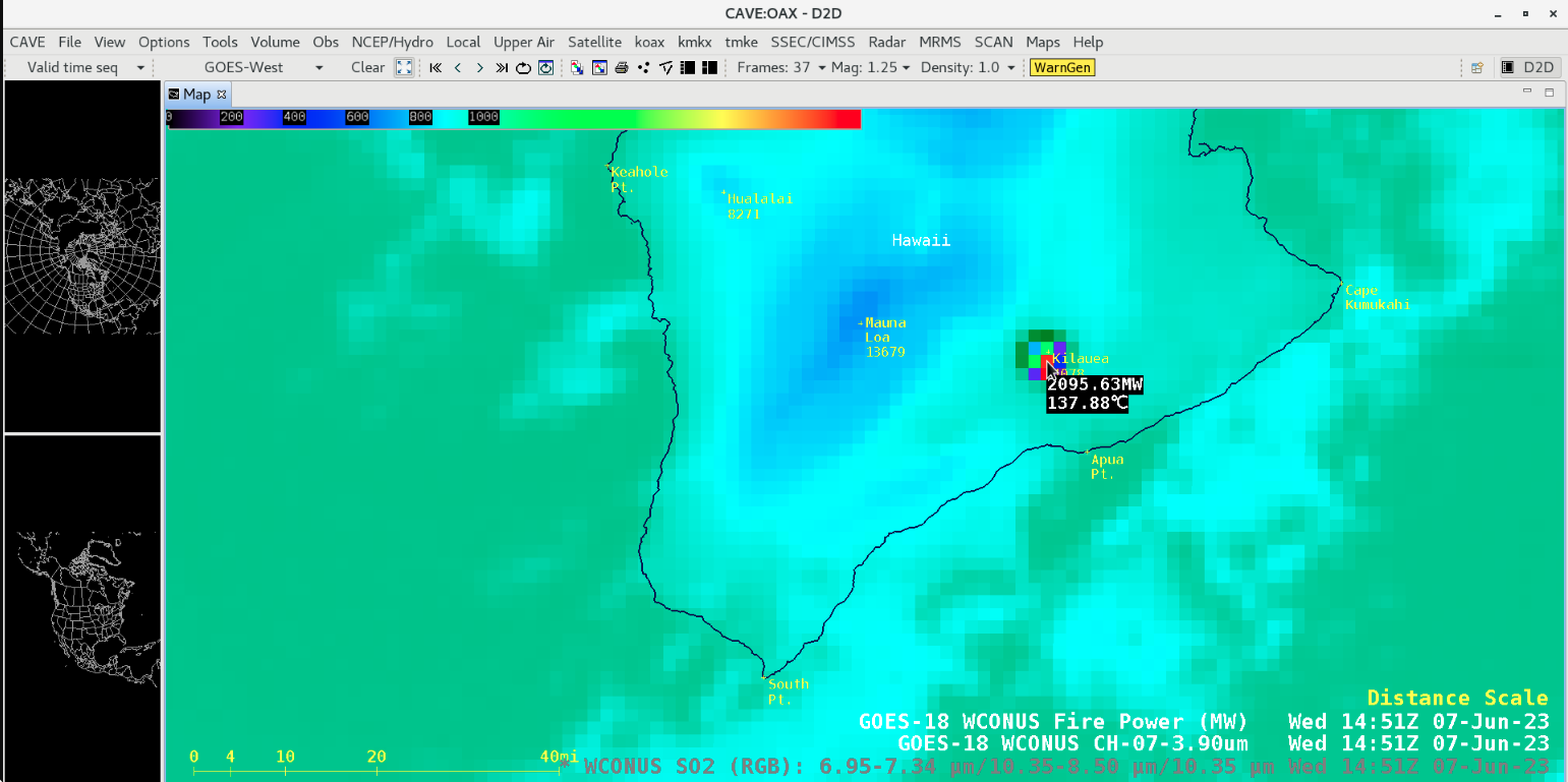
GOES-18 SO2 RGB, Shortwave Infrared (3.9 µm) and Fire Power derived product images [click to play animated GIF | MP4]
The thermal signature was also evident in Nighttime Microphysics RGB imagery from the CSPP GeoSphere site — and after sunrise the hazy SO2-rich volcanic plume could be seen in True Color RGB images, drifting southwestward away from Kilauea and the Big Island of Hawai`i.
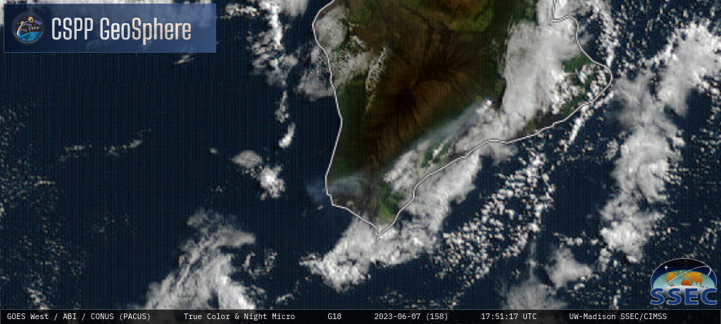
GOES-18 Nighttime Microphysics RGB and True Color RGB images [click to play MP4 animation]
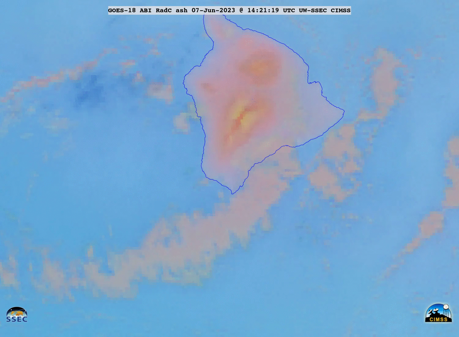
GOES-18 Ash RGB images [click to play animated GIF | MP4]