Polar Hyperspectral Soundings in numerical model output at the Hazardous Weather Testbed
From a NOAA Email: The first in-person Satellite Proving Ground experiment at the Hazardous Weather Testbed (HWT) in Norman OK since 2019 is underway! We have 7 NWS forecasters helping to evaluate 5 products that involve satellite data, focusing specifically on severe storms and their environment. One of the products being evaluated is output from a model that has been initialized with assimilated Polar Hyperspectral Soundings (both infrared and microwave) from NOAA-20 and NOAA-21 and from MetopB and MetopC. Forecaster-developed blog posts on the various products, including PHSnMWnABI model output (PHS for short) can be found at this site: https://goesrhwt.blogspot.com. Model output for HWT is within AWIPS, but it is also available online here.
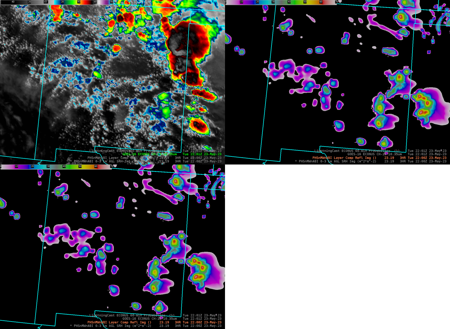
Consider the GOES-16 Clean Window Infrared (Band 13, 10.3 µm) image below from 2200 UTC on 23 May 2023 (the color bar has been altered from the default; the coldest cloud top temperature is -80oC rather than the default -109oC). The strongest convection is over eastern New Mexico, but scattered convection is occurring throughout the state, and it also spreads into west Texas.

Three-hour forecasts from the 1900 UTC model run are designed to alert a forecaster to regions where significant weather might occur. That is, it is a short-range situational awareness tool. Because of the addition of temperature and moisture information from the Polar Orbiters (likely MetopB/MetopC for this time), a more accurate initialization is likely. What kind of information can be viewed?
The toggle below compares the Band 13 infrared imagery to low-level storm-relative helicity in the 0-3 km layer. The agreement between the two images varies. The strongest convection over eastern New Mexico and over west Texas has a good counterpart in the helicity fields. Weaker convection through the central part of New Mexico also has corresponding signals in the helicity field. It’s not a perfect one-to-one relationship however.

Model composite reflectivity fields, below, suggest that the modeled storm in west-central Texas is the most vigorous at this timestep.

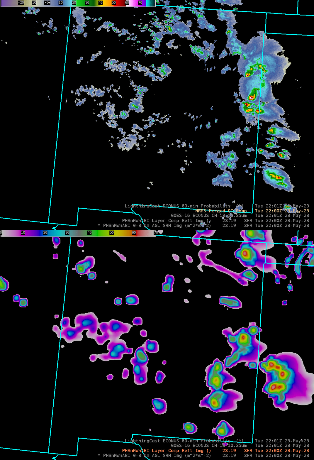
A comparison of the two radar fields at 2200 UTC, observed and simulated, is below. Both show active and more widespread convection over eastern New Mexico and west Texas, with scattered convection over the rest of New Mexico.

The in-person HWT Experiment runs through Friday 26 May. After a one-week break (that includes Memorial Day), two remote weeks occur, from 5-9 June and from 12-16 June.

