Pyrocumulonimbus cloud in Alberta
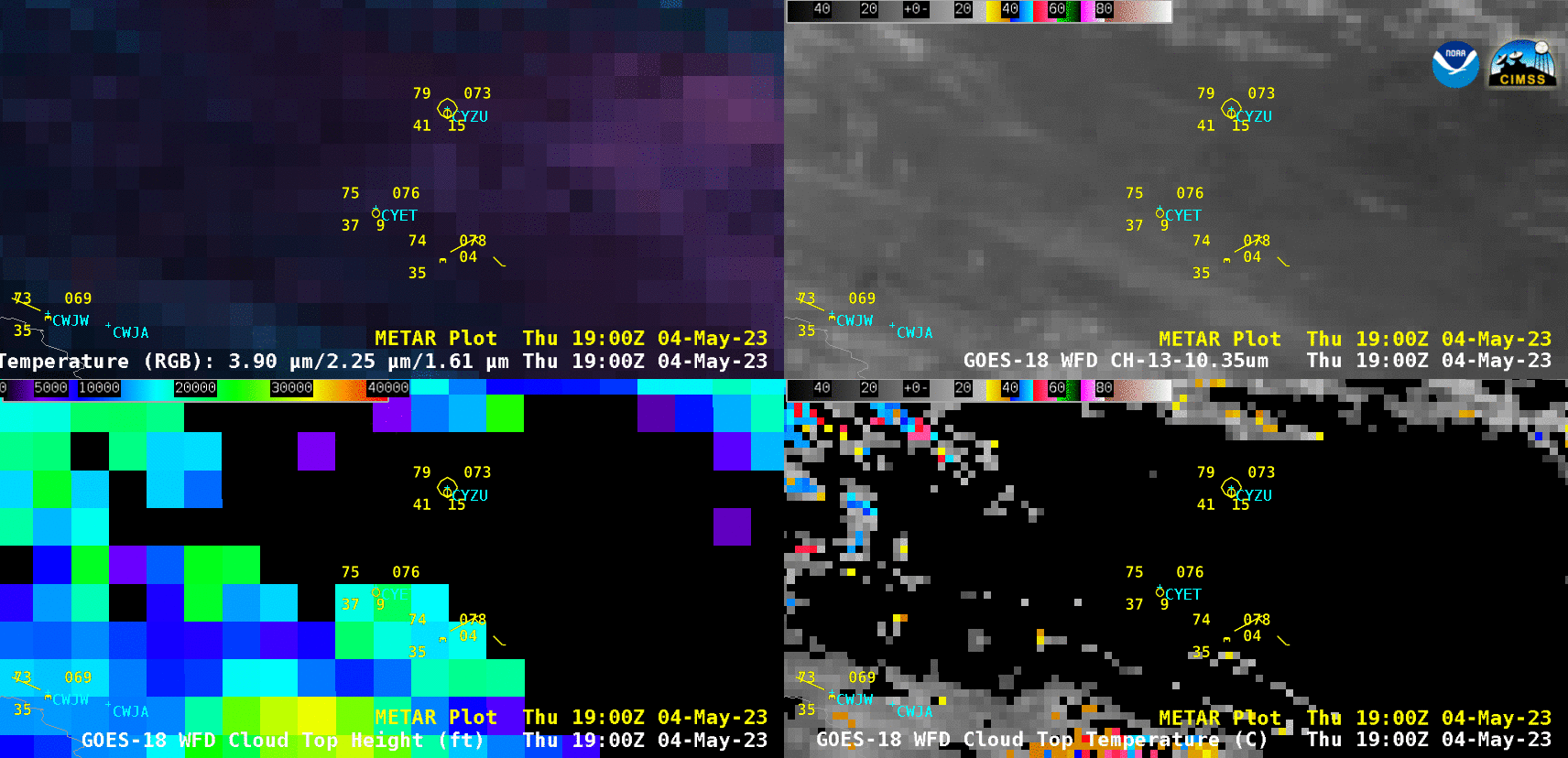
GOES-18 Fire Temperature RGB (top left), “Clean” Infrared Window (10.3 µm, top right), Cloud Top Height (bottom left) and Cloud Top Temperature (bottom right) [click to play animated GIF | MP4]
A plot of 0000 UTC rawinsonde data from Edmonton, Alberta (below) indicated that the pyroCb cloud-top temperatures colder than -60ºC were close to the tropopause temperature, suggesting that some smoke and cloud material may have been injected into the lower stratosphere.
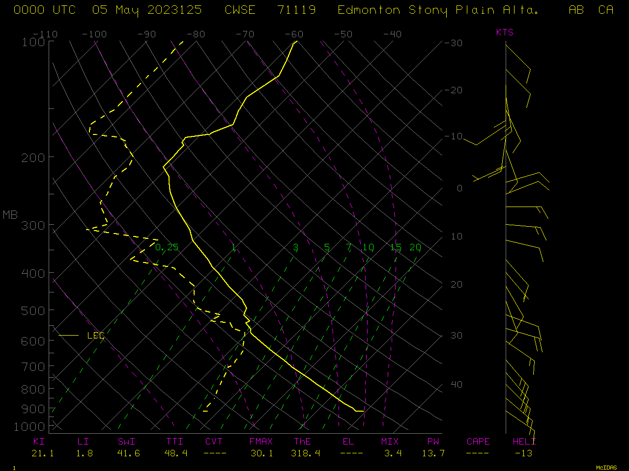
Plot of 0000 UTC rawinsonde data from Edmonton, Alberta [click to enlarge]
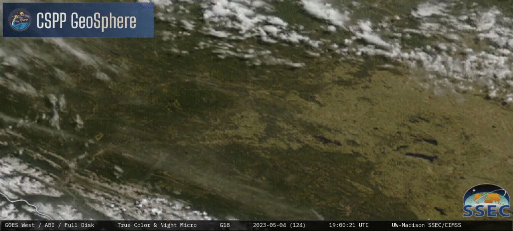
GOES-18 True Color RGB images [click to play animated GIF | MP4]