SAR Winds over American Samoa just west of convection
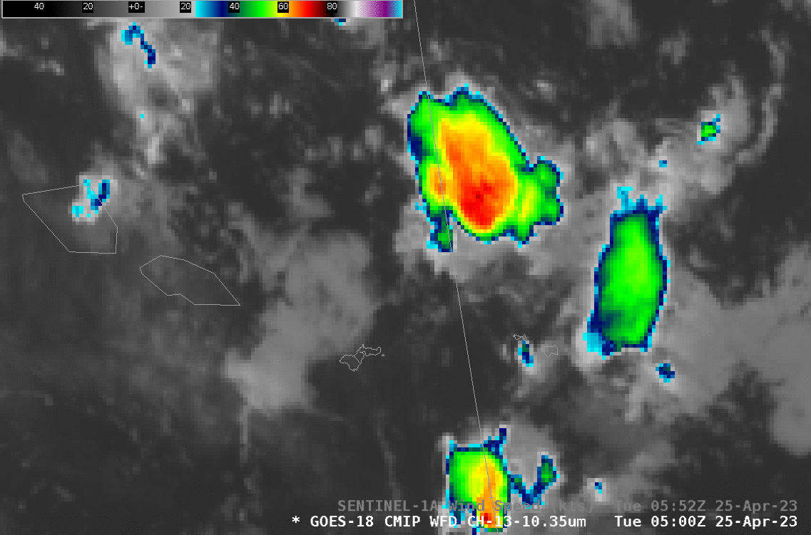
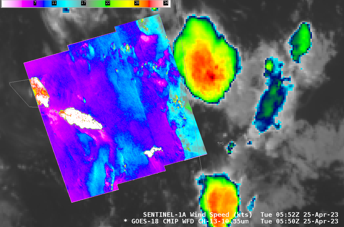
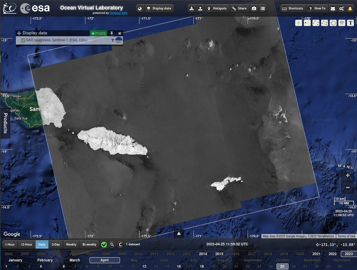
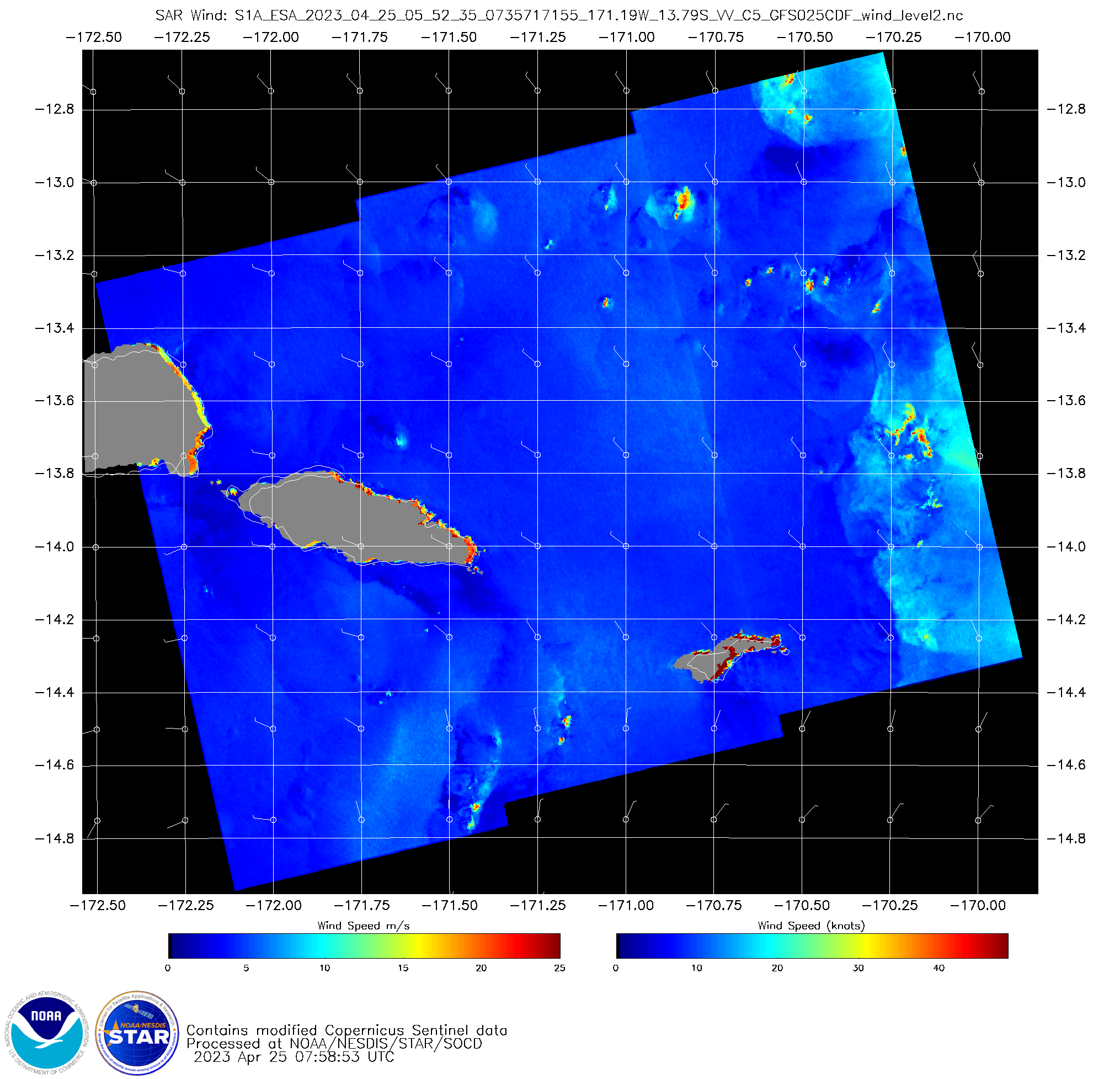
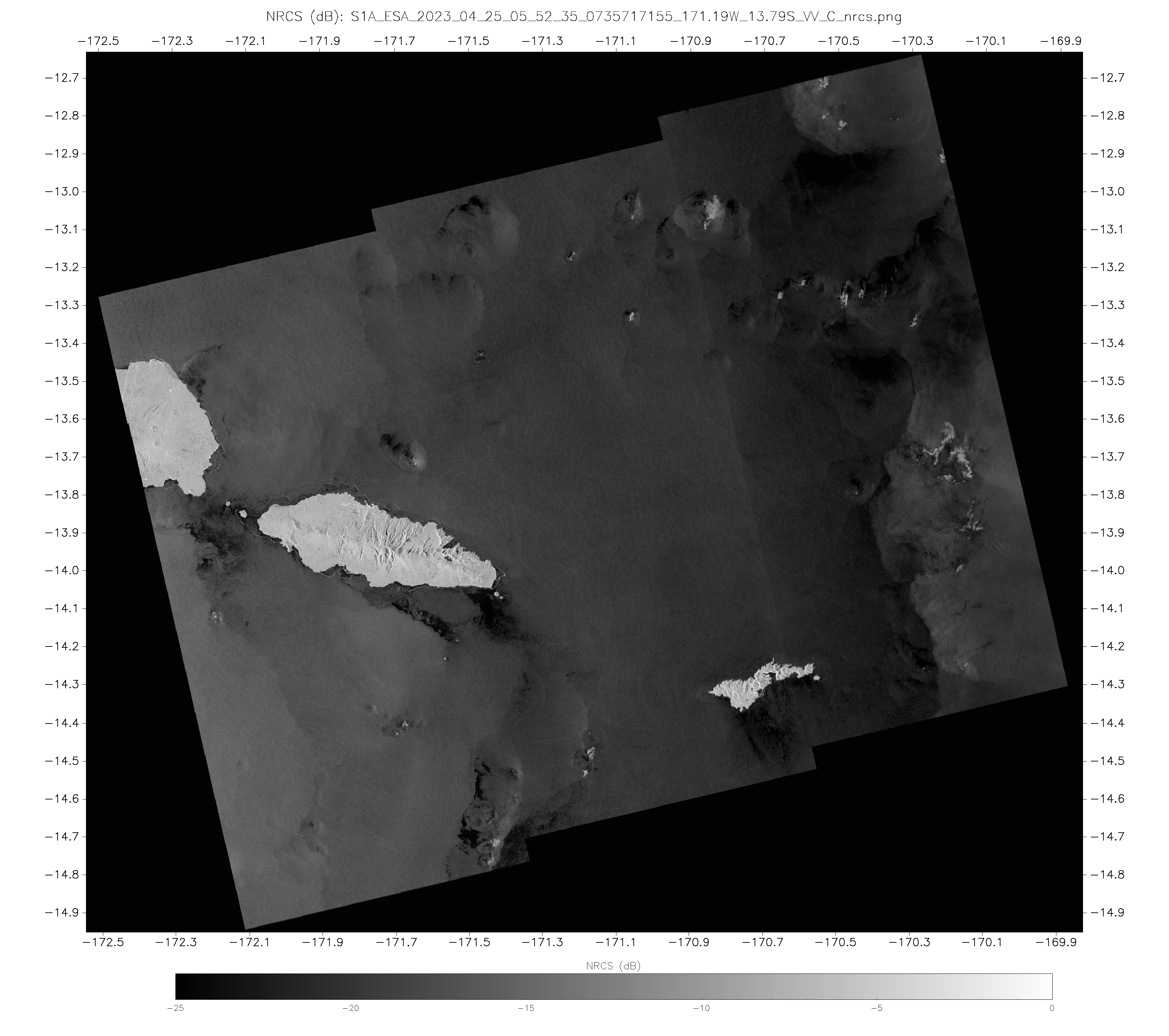
Sentinel-1A overflew Samoan waters just around sunset on 25 April in American Samoa (as it does every 12 days at this time). At the overpass time, strong convection was moving slowly northward just to the east of the Sentinal SAR wind swath. The SAR Winds (shown below) show a wind speed boundary with strongest winds close to the eastern edge of the swath. The strongest winds — isolated spots of very strong winds (red and white in the enhancement) — in the scene below likely arise from a reflection of the SAR signal off abundant ice in the cloud. When the SAR Normalized Radar Cross Section is viewed, the ice “contamination” appears as a feathery structure. That’s shown in the NRCS figure at the bottom, taken from this ESA site; ice features are bright white, and if you zoom in, they’ll have a feathery structure. Sentinel-1A data fields are also available here, including, for this day, winds and NRCS.