Tropical Storm Sanvu in the western Pacific
The mp4 animation above shows the development of Tropical Storm Sanvu out of the Monsoon Trough in the western Pacific ocean on 19-20 April 2023. The ‘Pacific Tropical Airmass RGB’ used in the animation is described in this blog post, and it gives more information about cloud-top features compared to the Airmass RGB (a similar mp4 animation for the airmass RGB is here). An interesting (and suggestive) aspect of the animation is the development of strong outflow to the north of the Monsoon Trough after 18 April that continues through the end of the animation.
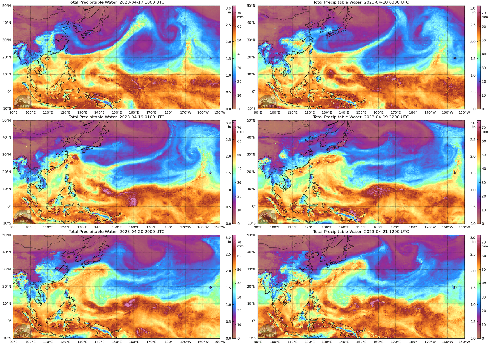
MIMIC Total Precipitable Water fields — that incorporate wind information from the GFS — also show the development of a circulation as the system develops. Note that the storm is near the northern edge of the moist trough; the abundant dry air to its north might affect the future strength of the system.
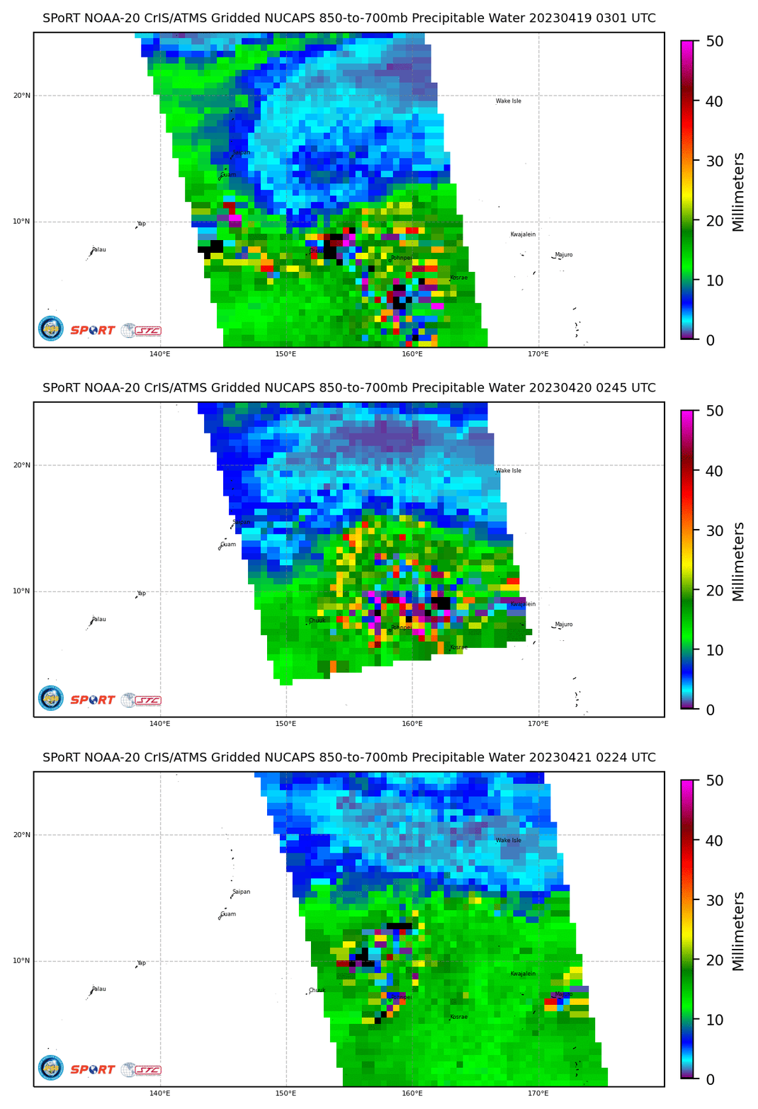
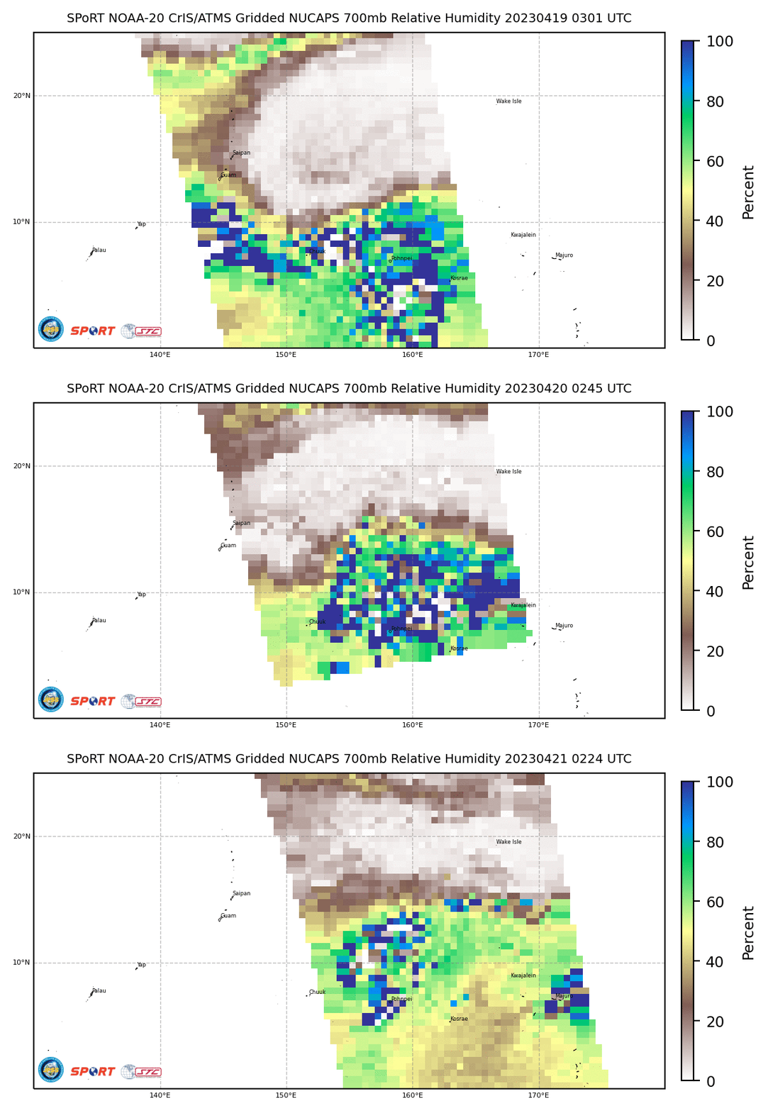
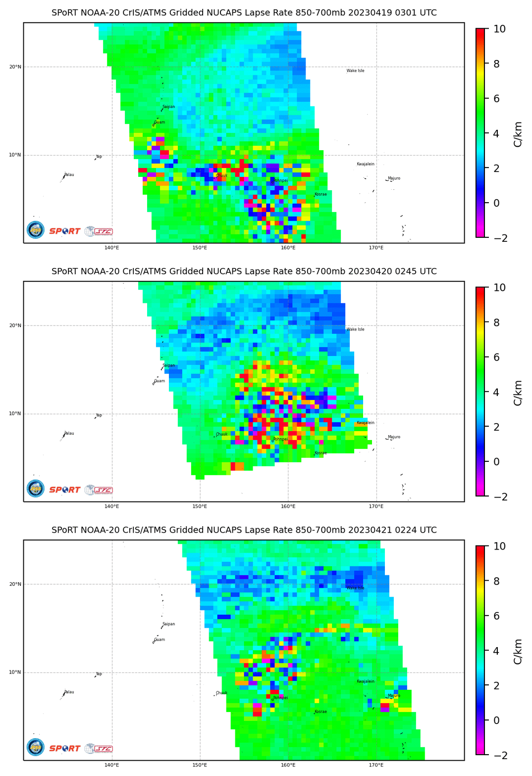
Gridded NUCAPS fields (source) can also give views of the environment that contains the developing tropical cyclone. The three toggles below show the evolution from ca. 0300 UTC on 19 April through ca. 0230 UTC on 21 April 2023. Mid-level Total (850-700mb) Precipitable Water, Relative Humidity at 700 mb, and the 850-700 mb Lapse Rate all testify to the hostile environment (dry and stable) to the north of this developing system.
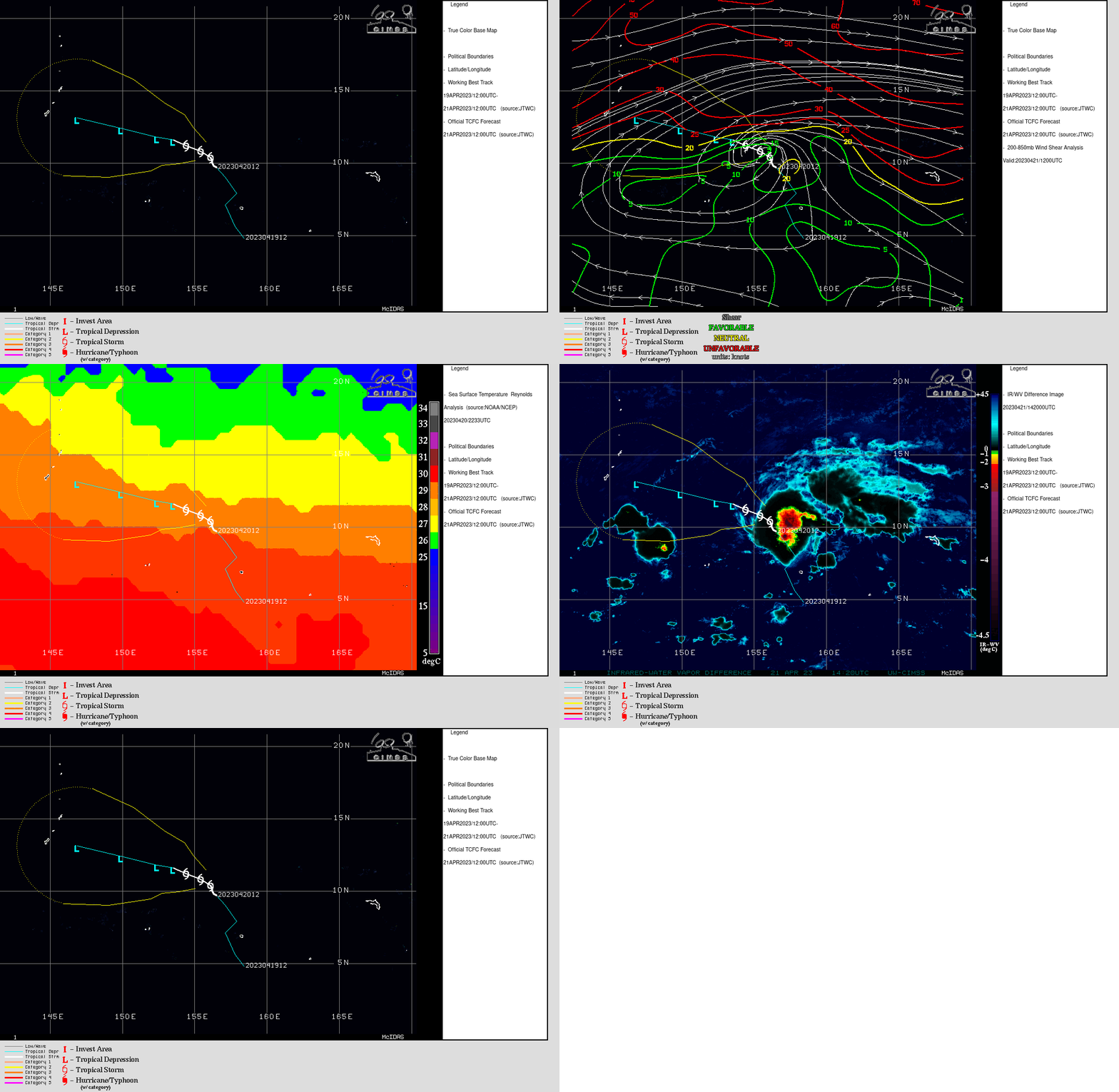
Diagnostics from the SSEC/CIMSS Tropical Weather website for the storm, below, show the system forecast to move towards a region where higher shear now exists.
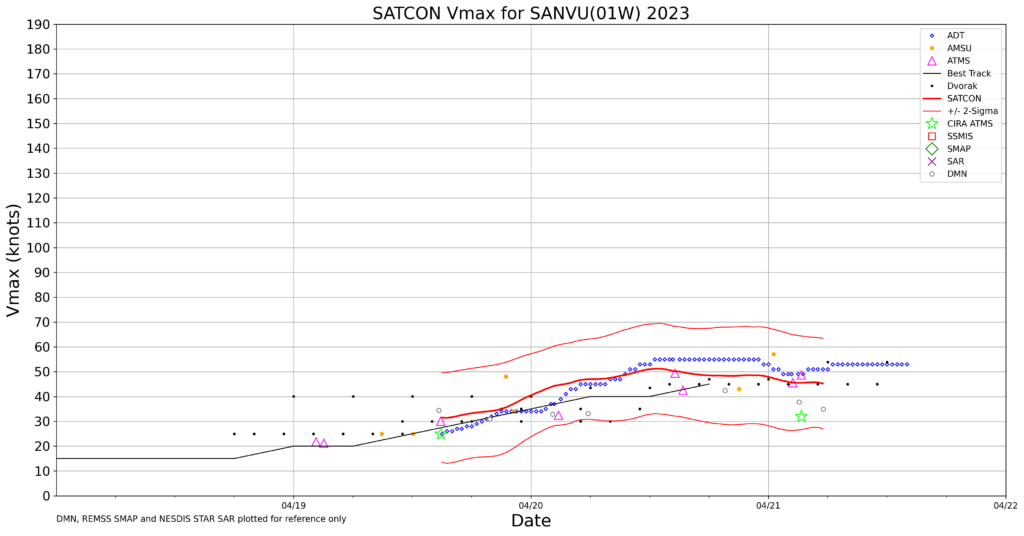
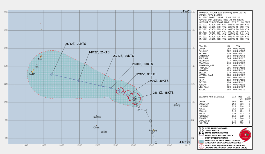
SATCON diagnostics from CIMSS, above, show that an initial period of strengthening has leveled off.The forecast from the Joint Typhoon Warning Center takes Sanvu towards the southern Marianas islands as a system with weak winds (but likely abundant moisture), as shown below.
.
More information on this system is available at the webpages of the National Weather Service in Guam (link).

