Cyclone Yaku off the coast of Peru
GOES-16 daytime True Color RGB and Nighttime Microphysics RGB images, 0200 UTC on 06 March to 0000 UTC on 20 March [click to play MP4 animation]
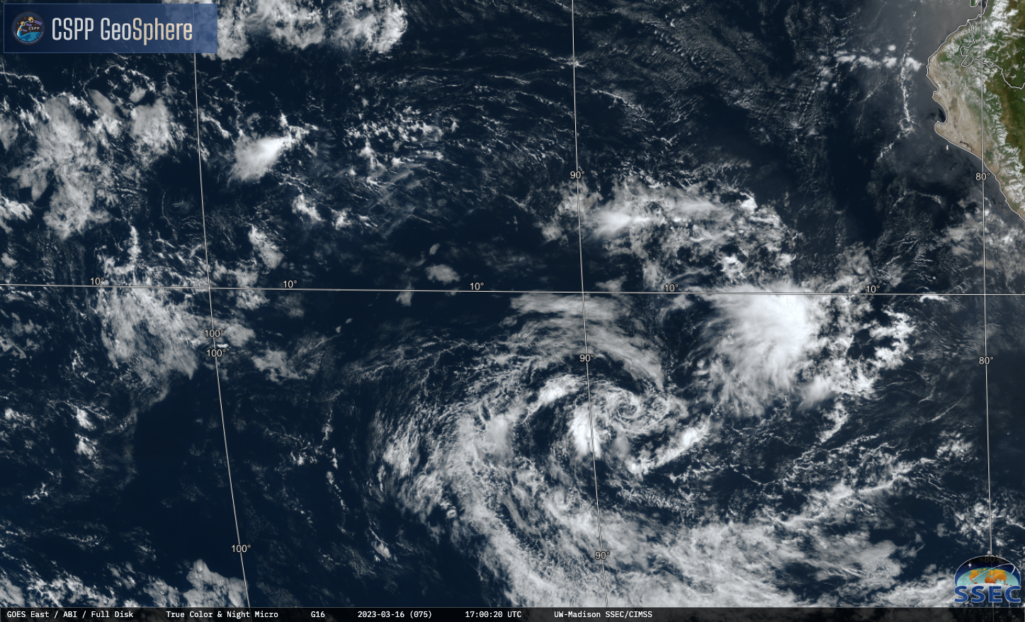
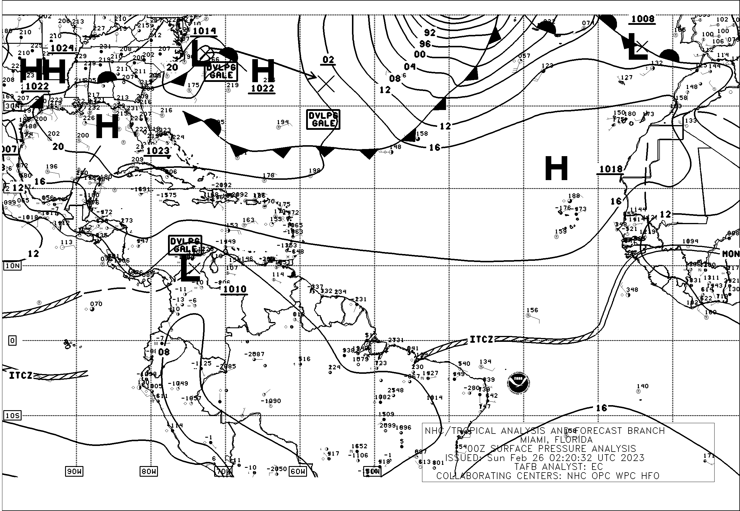
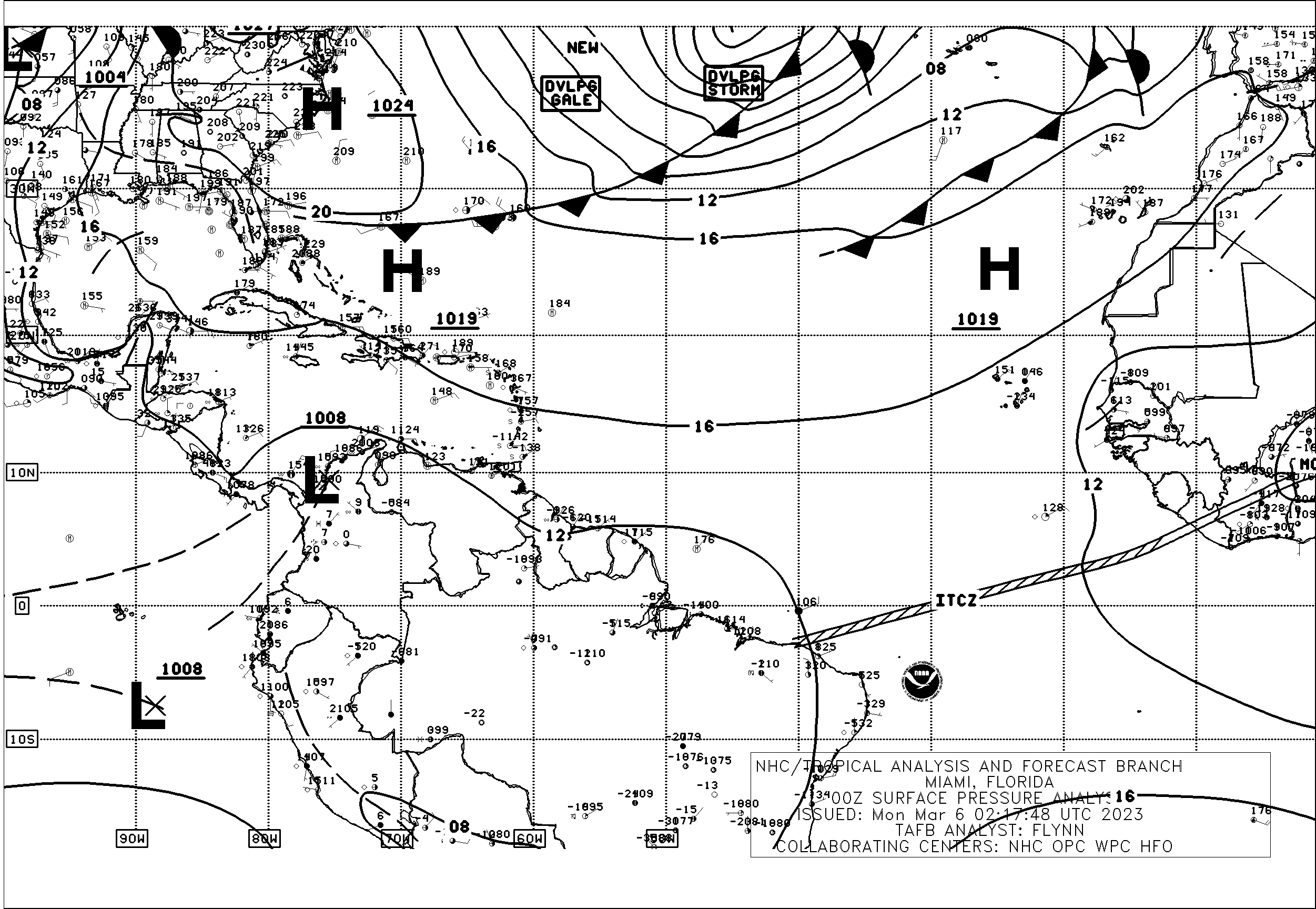
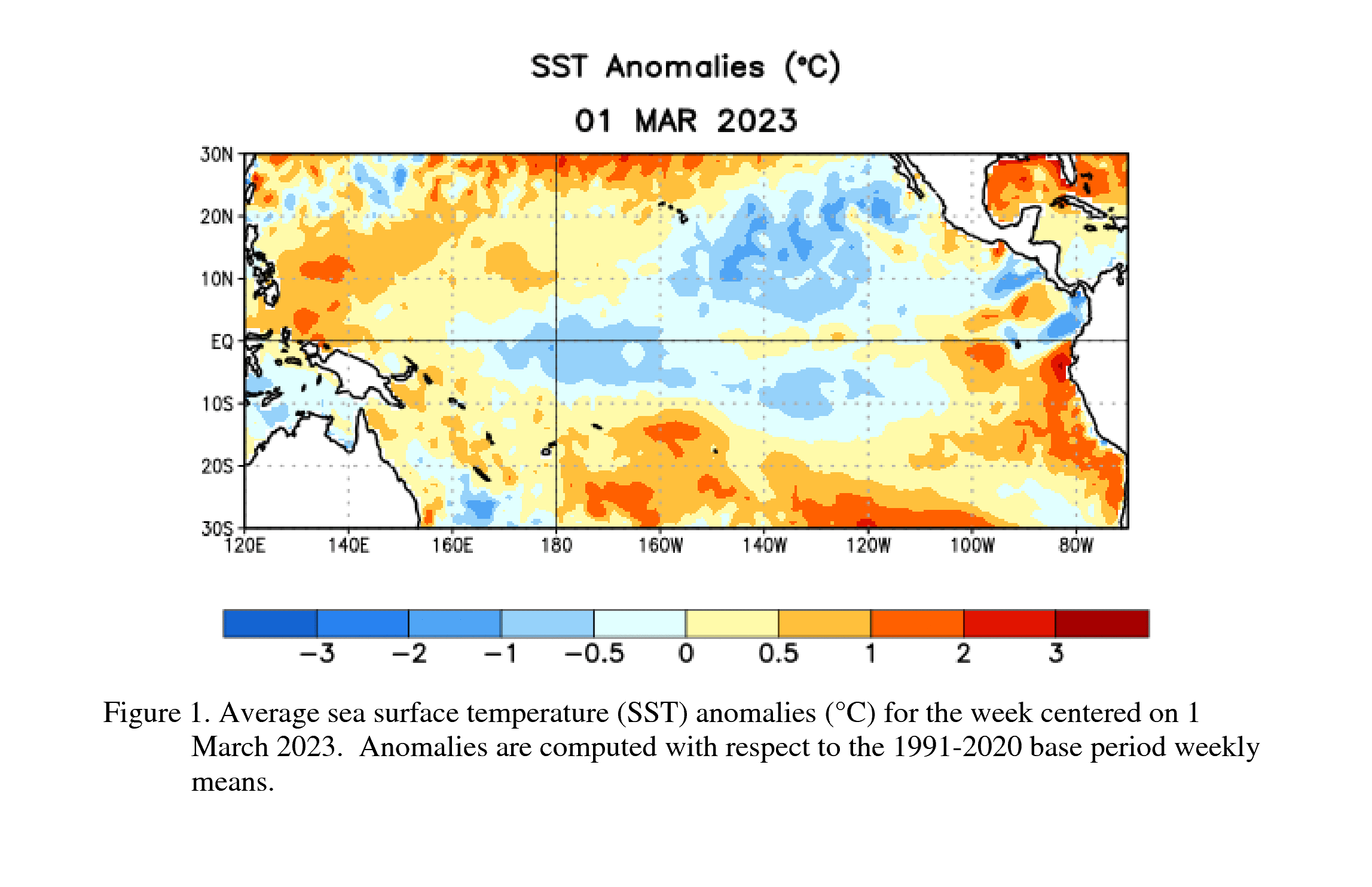
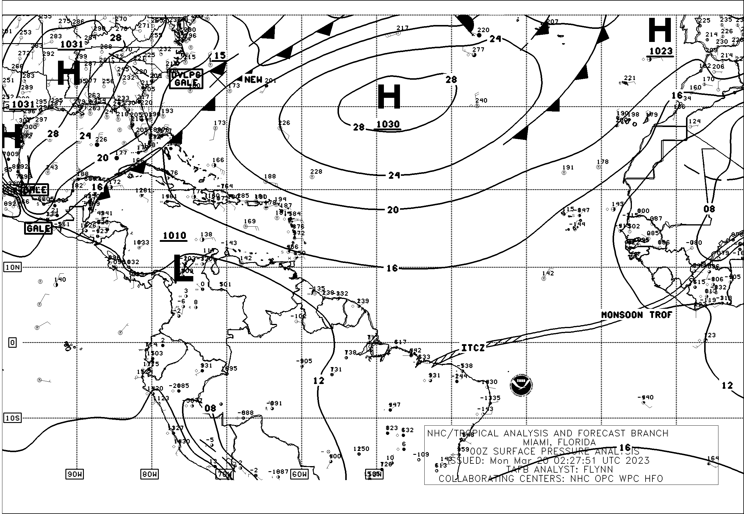
GOES-16 (GOES-East) daytime True Color RGB and Nighttime Microphysics RGB images from the CSPP GeoSphere site (above) covered the period from 0200 UTC on 06 March to 0000 UTC on 20 March 2023 — and eventually showed the circulation of Cyclone Yaku off the coast of Peru (the clockwise circulation of Yaku was initially obscured by deep ITCZ convection, but became more evident around 11 March as the storm approached 10º S latitude). According to surface analyses from the NHC Tropical Analysis and Forecast Branch, Yaku apparently developed along the southern branch of the Eastern Pacific Double ITCZ sometime around 0000 UTC on 06 March (over an area of warm SST anomaly). As Yaku later began to move southward across colder water, deep convection diminished and its low-level circulation became more exposed from 15-19 March — and a distinct circulation was no longer seen by 0000 UTC on 20 March.
The MIMIC Total Precipitable Water product (below) revealed the clockwise circulation of Yaku on/after 04 March.
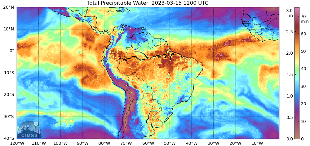
MIMIC Total Precipitable Water product, 0000 UTC on 03 March to 2300 UTC on 19 March [click to play MP4 animation]