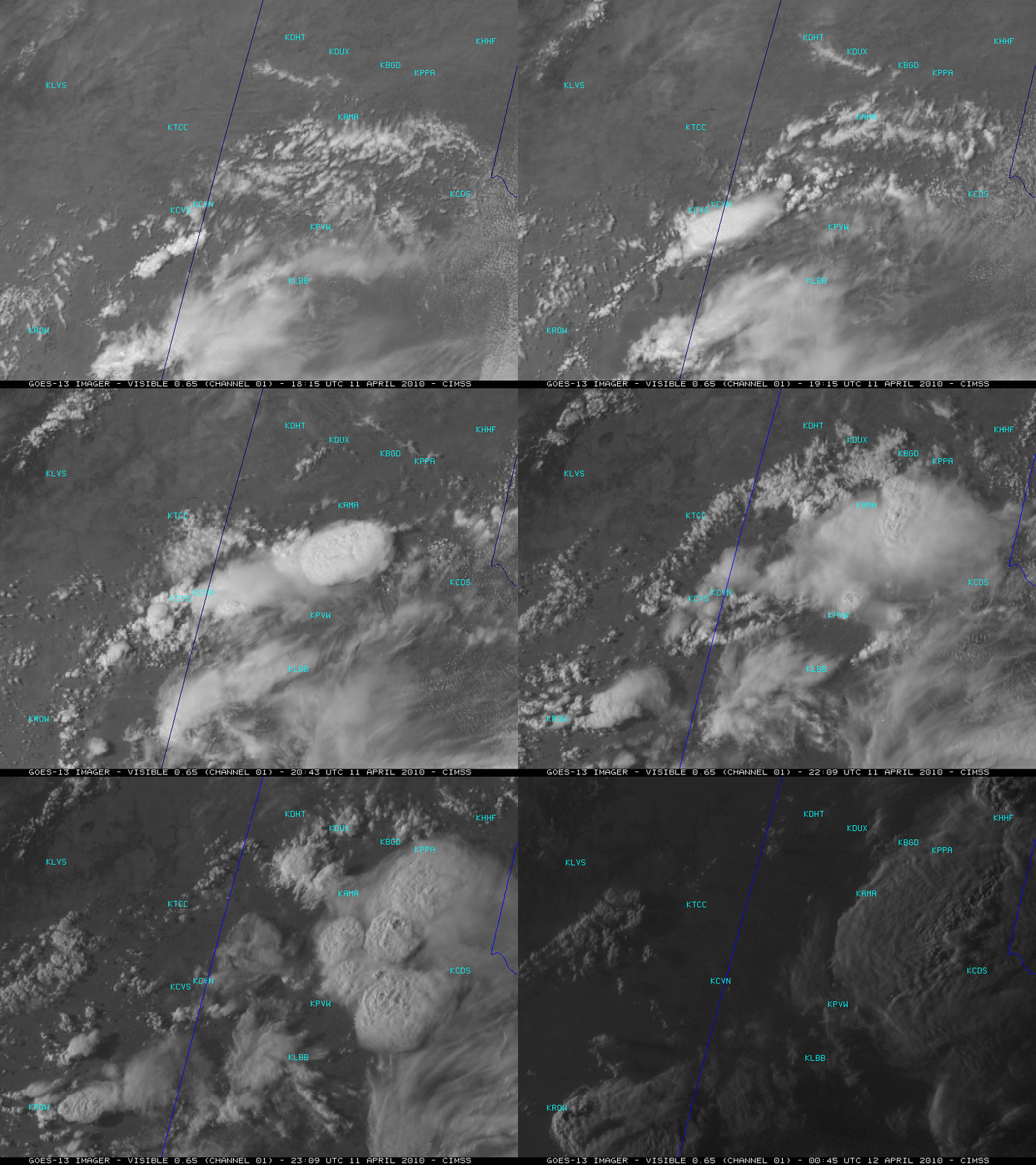
GOES-13 Super Rapid Scan Operations (SRSO) Imagery
For testing purposes, the GOES-13 satellite was placed into Super Rapid Scan Operations (SRSO) mode on 11 April 2010. In SRSO mode, images are available as frequently as every 1 minute during certain time periods. McIDAS images of GOES-13 0.65 µm visible channel data centered just south of Amarillo, Texas (above; also available as a QuickTime animation) showed the development of deep convection that formed a nice arc-shaped outflow boundary which produced some gusty surface winds (as high as 47 mph at Amarillo TX KAMA, and 32 mph at Clovis NM KCVN) — then some of the thunderstorms later dropped hail up to 1.75 inches in diameter in the northern Texas Panhandle region (after dark, additional storms produced hail up to 2.0 inches in diameter). Note the appearance of a number of overshooting tops, which cast small shadows on the tops of the cloud anvil regions.
Farther to the southeast, GOES-13 visible images centered just southwest of Dallas / Fort Worth, Texas (below; also available as a QuickTime animation) revealed what appeared to be an undular bore that was propagating southwestward through the low-level stratus cloud deck that was covering that area. The passage of this undular bore did not seem to have much of an impact on the surface wind direction, suggesting that the wave was being ducted within a temperature inversion aloft (near the altitude of the cloud deck). The Fort Worth TX 12 UTC rawinsonde data did reveal the presence of some strong low-level inversions.
Such frequent rapid scan imaging will be routinely available with the ABI instrument on the upcoming GOES-R satellite, scheduled to be launched in 2015.


