Morning storms in central Texas
A mid-level atmospheric wave with subtle warm-air advection forced some strong thunderstorms in central Texas this morning. The operational high-resolution convection-allowing NWP models did not handle these storms well at all.
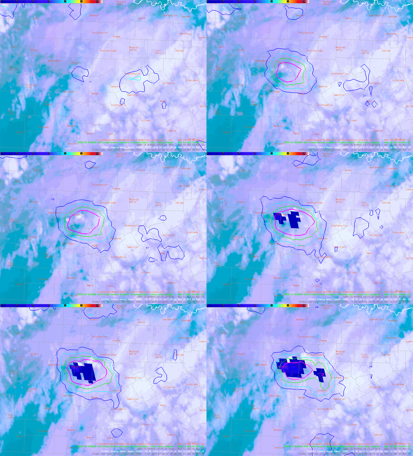
ProbSevere LightningCast, an image-based AI model, picked up on the rapidly growing convection about 15-20 minutes before lightning initiation. LightningCast predicts the probability of lightning in the next 60 minutes at any location using GOES-R ABI reflectance and brightness temperature data.

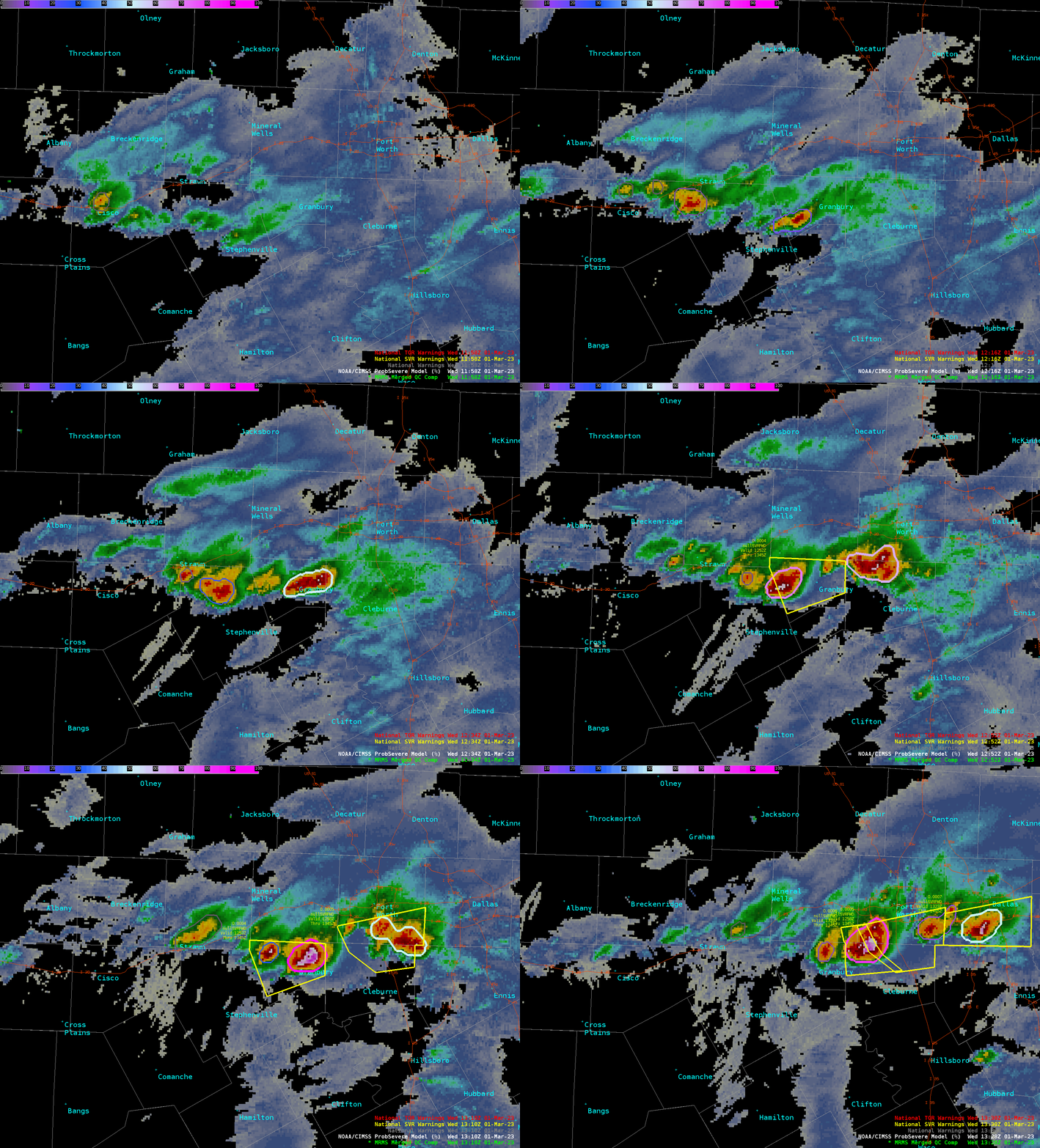
ProbSevere v3 uses machine-learning models to predict next-hour probabilities of severe weather (large hail, damaging wind gusts, tornadoes), by incorporating storm-object tracking and extracting features from radar, satellite, lightning, and short-term NWP data. The animation below shows how the probabilities of any severe weather evolved for these storms as they approached the Dallas-Fort-Worth metro region. Hail up to 1.5″ in diameter was reported.

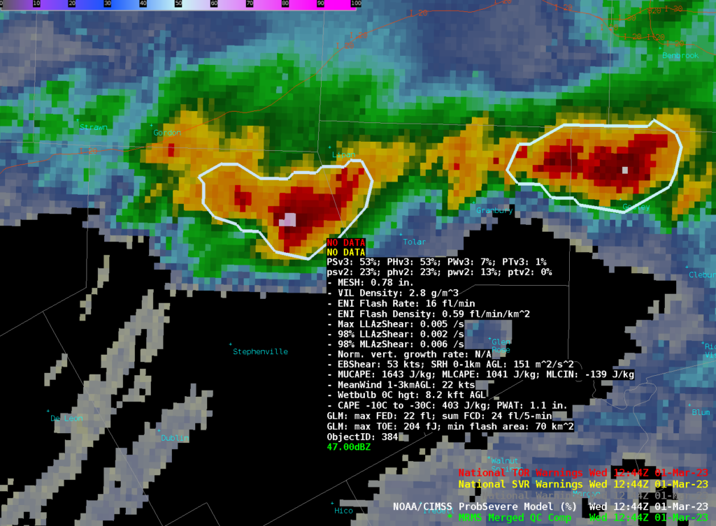
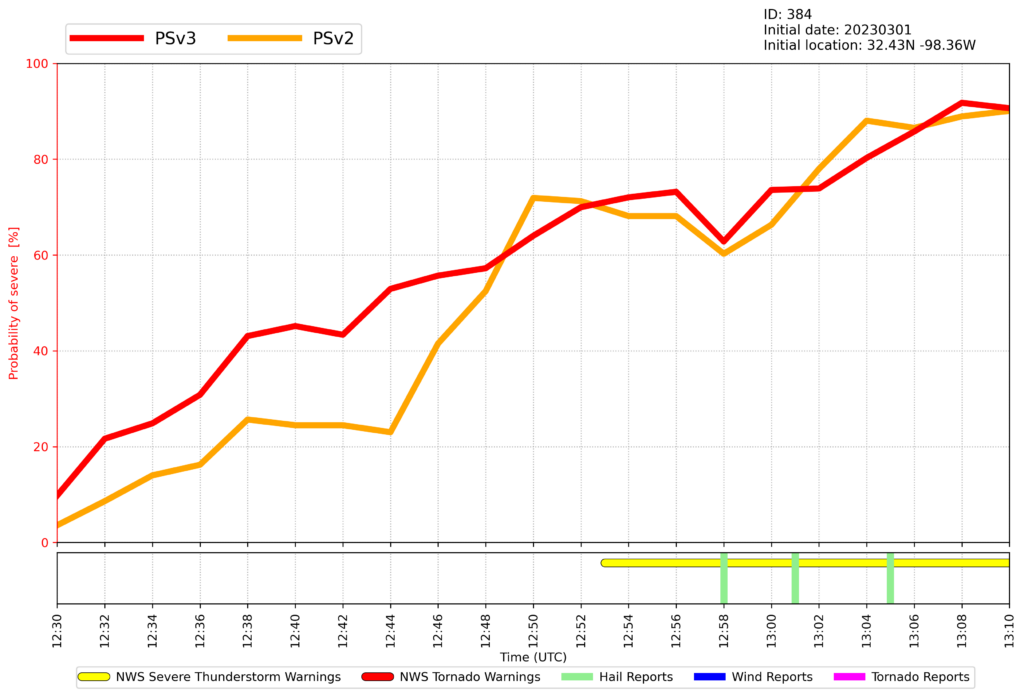
At 12:44 UTC, ProbSevere v3 (PSv3) probability of severe was 53%, vs. 23% for the operational ProbSevere v2 (PSv2), as seen in Figure 3. A post-mortem analysis revealed that, compared to PSv2, the PSv3 model was able to combine the sub-severe MESH (maximum expected size of hail), ENI flash lightning density, and moderate mid-level azimuthal shear in an environment with high effective shear (> 50 kt) to produce a stronger (and more accurate) probability of severe. PSv3 exceeded 50% four minutes before PSv2, and exceeded 40% eight minutes before PSv2 (see Figure 4). Having more accurate and timely probabilistic guidance prior to reported severe weather is critical in helping the NWS issue more accurate and timely severe weather warnings.


Both ProbSevere v3 and LightningCast will be evaluated by NWS forecasters at the 2023 Hazardous Weather Testbed, held in May and June in Norman, OK.

