SAR data over Hawaii on 26/27 February 2023
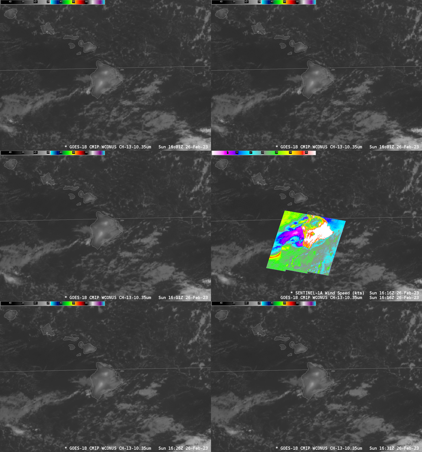
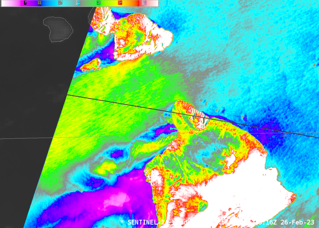
Sentinel-1A overflew the Hawai’ian islands twice, once on 26 February and again on 27 February. The animation above shows the AWIPS presentation of SAR winds at 1616 UTC on 26 February. Images from the NOAA/STAR website for those two footprints are shown below as toggles between the derived wind speed and the Normalized Radar Cross Section at 16:16:24 (top) and 16:16:55 (bottom), i.e., for about 1 second of imagery from Sentinel-1A! The orginal images can be found at the NOAA/STAR Sentinel-1A website link above for 26 February.
One feature stands out in the toggle from 16:16:55 directly above: the band of strong winds seemingly emanating from a point near 18.8oN, 156.67oW. That hourglass appearance in the derived winds indicates a small-scale error in the winds used at the start of the retrieval (as noted in Quick Guide for this product); note the feature is absent in the NRSC fields. The derived winds there are most likely not correct.
A zoomed-in view over the Alenuihaha channel between Hawai’i to the south and Maui to the north, below, shows the very strong winds characteristic of that body of water. Winds of 25-30 knots are widespread, with a small area of winds exceeding 40 knots just off the south coast of Maui! Winds are much weaker in the lee of the islands.
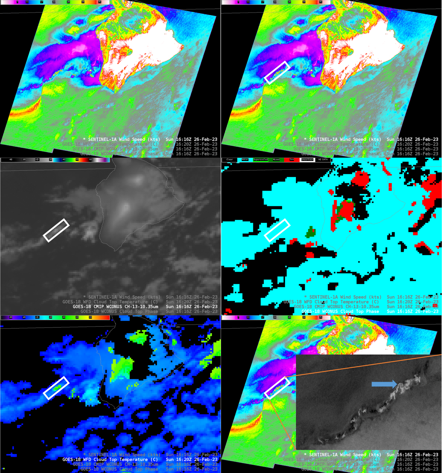
The slow animation below shows a region in the SAR winds where (highlighted) isolated pockets of strong winds are diagnosed. Those strong winds have the look of regions where ice contamination in the retrieval is possible. Note, however, that the GOES-13 Brightness Temperature is only just below 0o C (in the -2o to -4oC range); Cloud-top phase shows only liquid cloud in that region. However, the Level 2 Cloud Top Temperatures shows values colder than -50oC!! (Here’s an AWIPS-sampled example near the coldest cloud top with a large difference between the Band 13 Brightness Temperature and the Derived Cloud-Top temperature!). Consider that It’s possible that the ice features are not quite at the size range of a pixel.
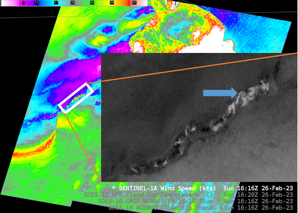
Part of the zoomed-in feature of the downwind-from-Hawai’i NRCS image (available online here) has an anticyclonic swirl that is very reminiscent of a von Kármán vortex feature (such as here), but at much smaller scale!
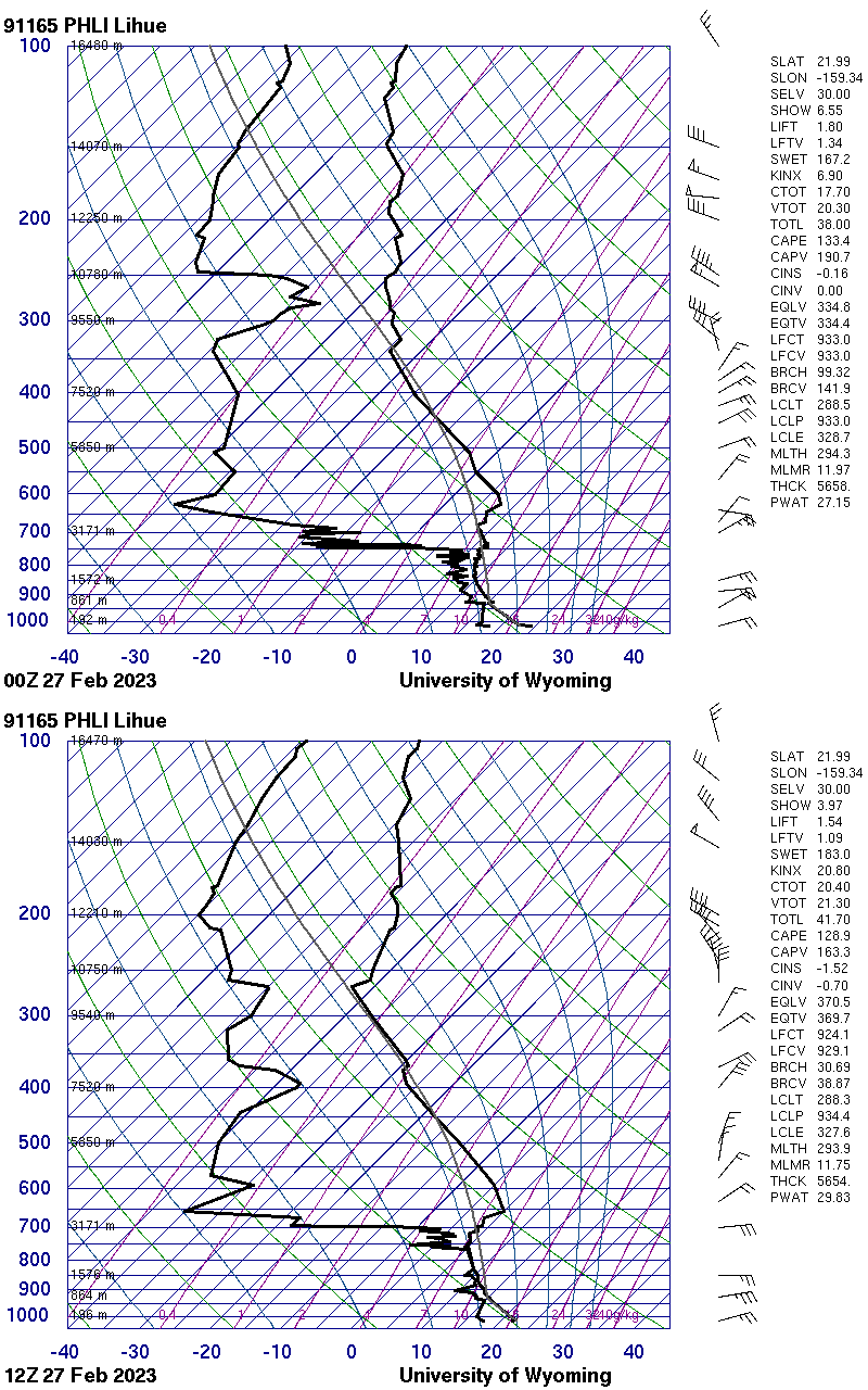
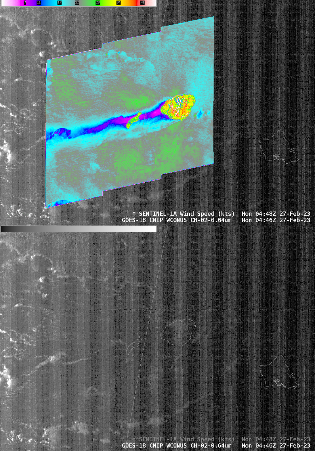
Shortly before 0500 UTC on 27 February, Sentinel-1A again overflew the Hawai’ian island chain, but this time farther west. The toggle at bottom shows the wind distribution downwind of Kauai along with the GOES-18 Band 2 (Visible) imagery (that has been brightened considerably). A noticeable tail of relatively calm winds extends downwind of the island. At the time, based 0000 and 1200 UTC soundings from Lihue, below, from this site, a strong inversion was present at around 700 mb.
