Hurricane Felix – Category 5
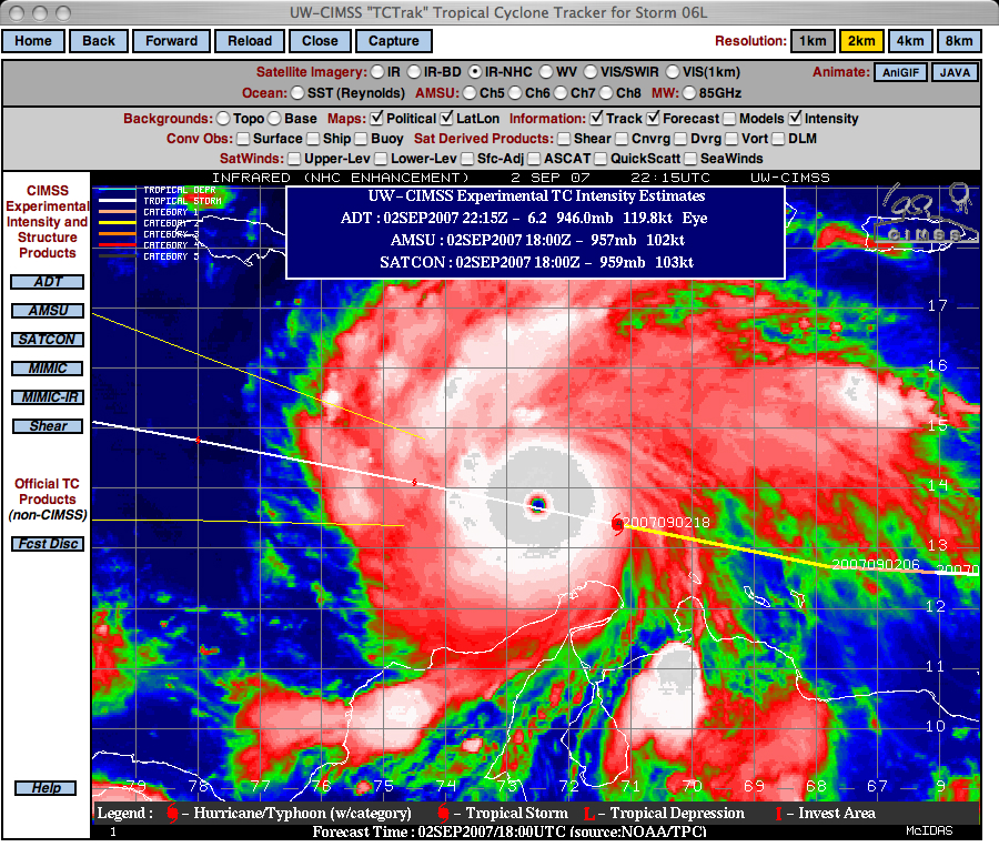
Hurricane Felix rapidly intensified from a Category 4 to a Category 5 storm off the northern coast of Colombia late in the day on 02 September 2007 (becoming the second Category 5 hurricane of the 2007 Atlantic Basin season). A GOES-12 IR image from the CIMSS Tropical Cyclones site (above) shows a well-defined eye surrounded by a ring of cold cloud top brightness temperatures (-70º to -76º C on the corresponding AWIPS IR image) at 22:15 UTC.
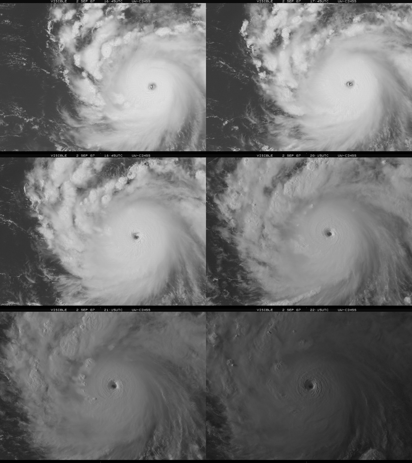
The eye structure was even more spectacular on an animation of GOES-12 visible channel imagery (below). The NOAA Hurricane Hunter aircraft crew reported that the eye exhibited the so-called “stadium effect“ on their reconnaissance flight, and this stadium effect is apparent near the end of the visible image animation (when low the sun angle illuminated the eye region from the side).
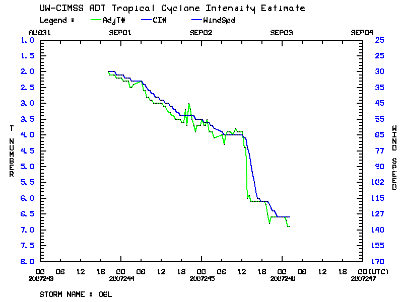
A plot of the CIMSS Advanced Dvorak Technique (below) reveals the trend of very rapid intensification of Hurricane Felix late in the day on 02 September. A National Hurricane Center discussion stated that the central pressure of Felix dropped at a rate of 3.4 millibars per hour in a 7 hour period.


