Aerosol plume moving offshore from the Northeast US
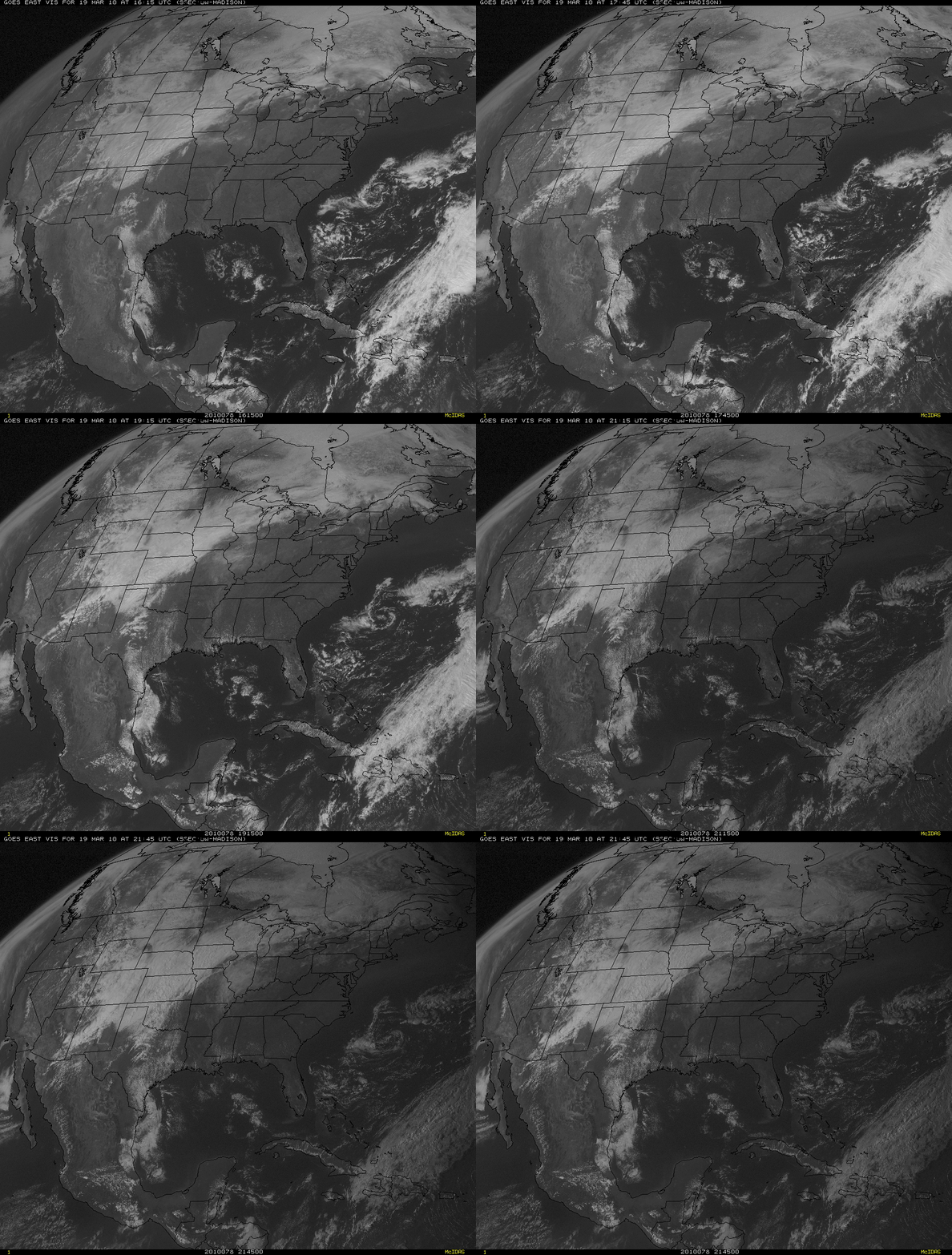
McIDAS images of the GOES-12 0.65 µm visible channel data (above) revealed a large hazy aerosol plume that was moving off the Northeast US and drifting out over the adjacent waters of the Atlantic Ocean on 19 March 2010. This aerosol plume exhibited Aerosol Optical Depth (AOD) values of 0.6 and higher on the GOES Aerosol/Smoke Product (GASP) on the IDEA site. Real-time GASP images are also available from the NOAA/NESDIS/SSD/OSDPD site.
A MODIS true color Red/Green/Blue (RGB) image from the SSEC MODIS Direct Broadcast site (below) showed a better view of the varying structure and optical thickness of the aerosol plume.
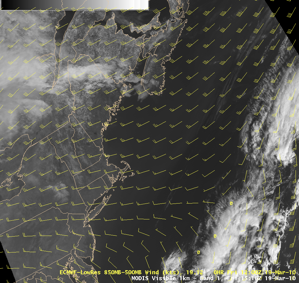
An AWIPS image of the MODIS 0.65 µm visible channel data with an overlay of ECMWF 805-500 hPa layer winds (below) shows that the hazy aerosol plume was being advected eastward by a predominantly westerly flow within that layer.
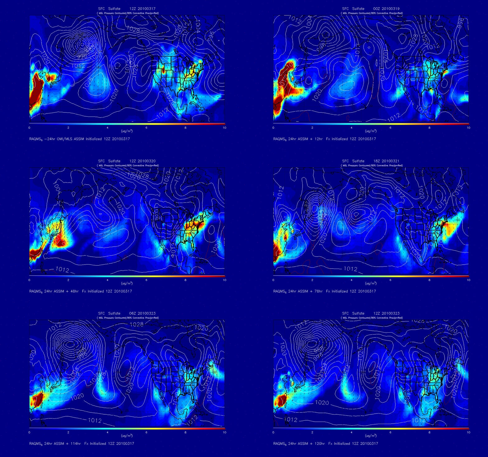
Model output from the Realtime Air Quality Modeling System (RAQMS) shows the mixing ratio of surface sulfate or SO4 (below) — this demonstrates the increase in SO4 levels over the northeastern US during the 17-19 March period, with a forecast that then advects the high levels of SO4 eastward out over the Atlantic.


