Tropical Storm Erin
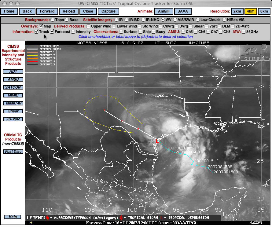
The track of Tropical Storm Erin from the CIMSS Tropical Cyclones site (above) depicts a fairly short-lived history over the Gulf of Mexico during 15 August–16 August 2007. Although wind speeds only reached minimal tropical storm intensity, the more important characteristic of Erin was the high amounts of tropical moisture tapped by the system.
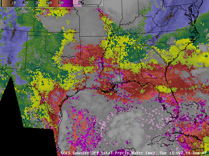
AWIPS images of the GOES Sounder Total Precipitable Water (TPW) derived product (below; QuickTime animation) showed a large area of elevated TPW values ranging from 50-67 mm (2.0-2.6 in) over the Gulf of Mexico around the periphery of Erin, with TPW values greater than 40 mm (1.6 in) inland over much of Texas. Such copious amounts of moisture coupled with slow forward storm motion helped the remnants of Erin to produce very heavy rainfall (as much as 8.6 inches reported, with rainfall rates of 1-3 inches per hour — see radar-estimated storm total precipitation from Houston and Austin/San Antonio) which led to flooding across parts of Texas during the day on 16 August.


