Pyrocumulonimbus clouds in Alaska
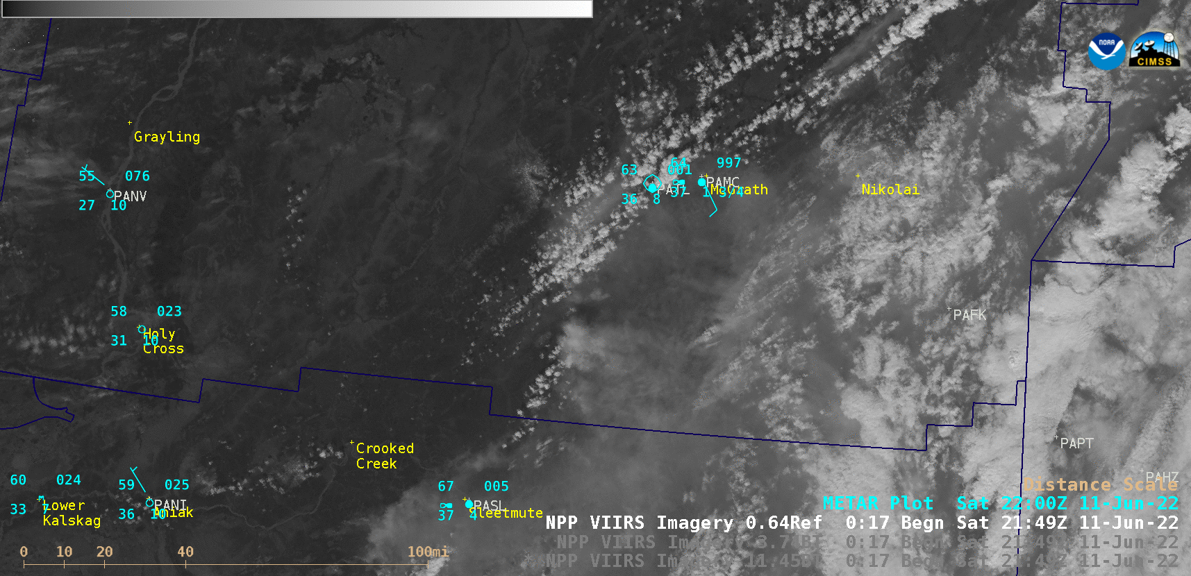
Sequence of Suomi-NPP VIIRS Visible (0.64 µm), Shortwave Infrared (3.74 µm) and Infrared Window (11.45 µm) images at 2149 UTC and 2332 UTC [click to enlarge]
A couple of hours later, preliminary / non-operational GOES-18 “Red” Visible (0.64 µm), Shortwave Infrared (3.9 µm) and “Clean” Infrared Window (10.35 µm) images (below) showed that the Little Hog Butte Fire — located southwest of Lake Minchumina (PAMH) — produced a larger and more long-lived pyroCb cloud, which then drifted east-northeastward from the fire source region. The coldest cloud-top infrared brightness temperature of that pyroCb cloud was around -48C. Smoke from this fire was reducing the surface visibility to 2 miles at times at Lake Minchumina. Particularly noteworthy was the fact that this was the first documented pyroCb over Alaska in 2 years.
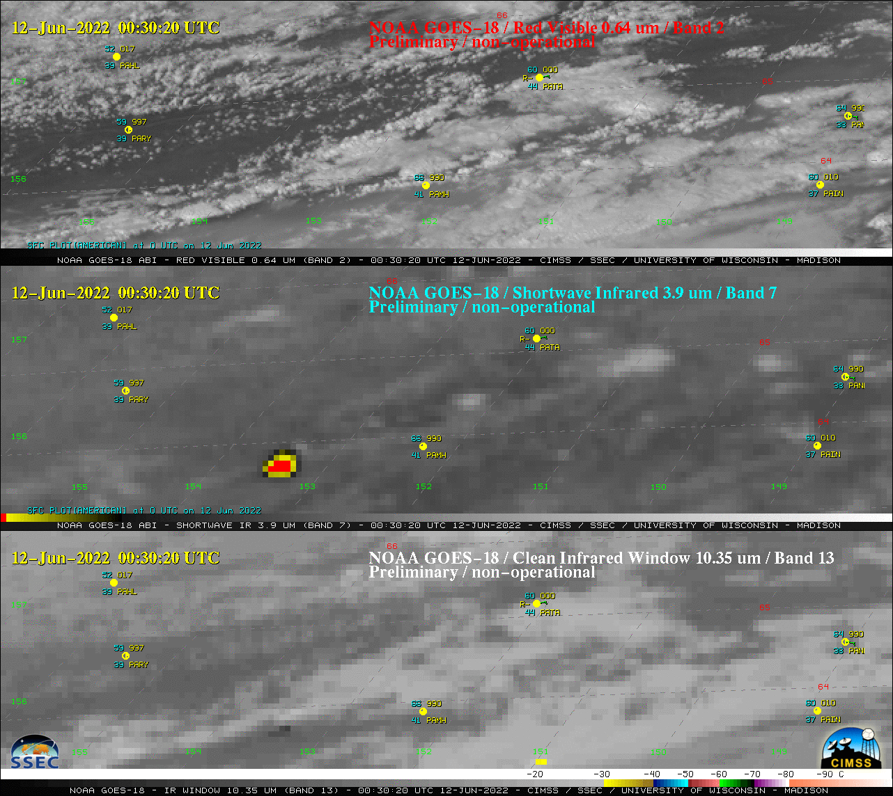
GOES-18 “Red” Visible (0.64 µm, top), Shortwave Infrared (3.9 µm, center) and “Clean” Infrared Window (10.35 µm, bottom) images, with hourly plots of surface reports [click to play animated GIF | MP4]