GOES World

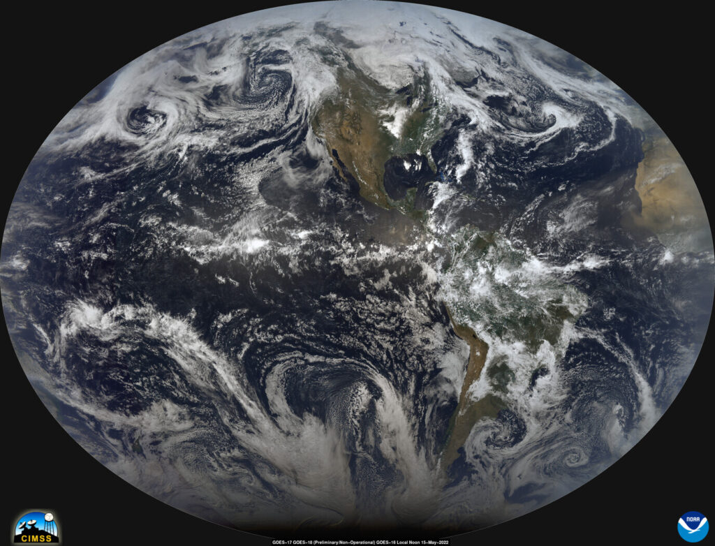
The image above (credit to Rick Kohrs from SSEC/CIMSS) shows Advanced Baseline Imager (ABI) data from GOES-17 (West), GOES-18 (Central, Preliminary/Non-Operational), and GOES-16 (East) on 15 May 2022. This “Local Noon CIMSS Natural Color” image is created by blending vertical strips of true-color imagery at local noon, starting in the east and proceeding westward. This was a rare opportunity for the GOES-R Series as GOES-18 was only at the central location (89.5W) for a limited time. A larger (5509×4207) version of this image is also available.
Other CIMSS Blog entries have introduced GOES-18, the latest in the GOES-R series. NOAA and NASA recently released the first ABI (Advanced Baseline Imager) imagery from GOES-18 (including this 2-min video). GOES-T was launched on 1 March 2022. Currently GOES-18 is “drifting” out west to be near the “West” position. GOES-18 is slated to become NOAA’s operational GOES-West in early 2023 (GOES-18 Post Launch Test and Transition Plan) after a thorough post-launch test period.
SSEC/CIMSS scientists (notably Rick Kohrs) create daily imagery that blends vertical strips of true-color imagery at local Noon, starting near the dateline and proceeding westward. Recent images are available at this website and include data from 5 geostationary satellites: Himawari, GOES-West, GOES-East, Meteosat-Prime, and Meteosat-IODC. There are multiple other blog posts featuring and explaining the local-noon composite.

