Lower-tropospheric vortex north of Hawai’i

GOES-17 “Red” Visible (0.64 µm) images, with and without plots of Derived Motion Winds [click to play animated GIF | MP4]
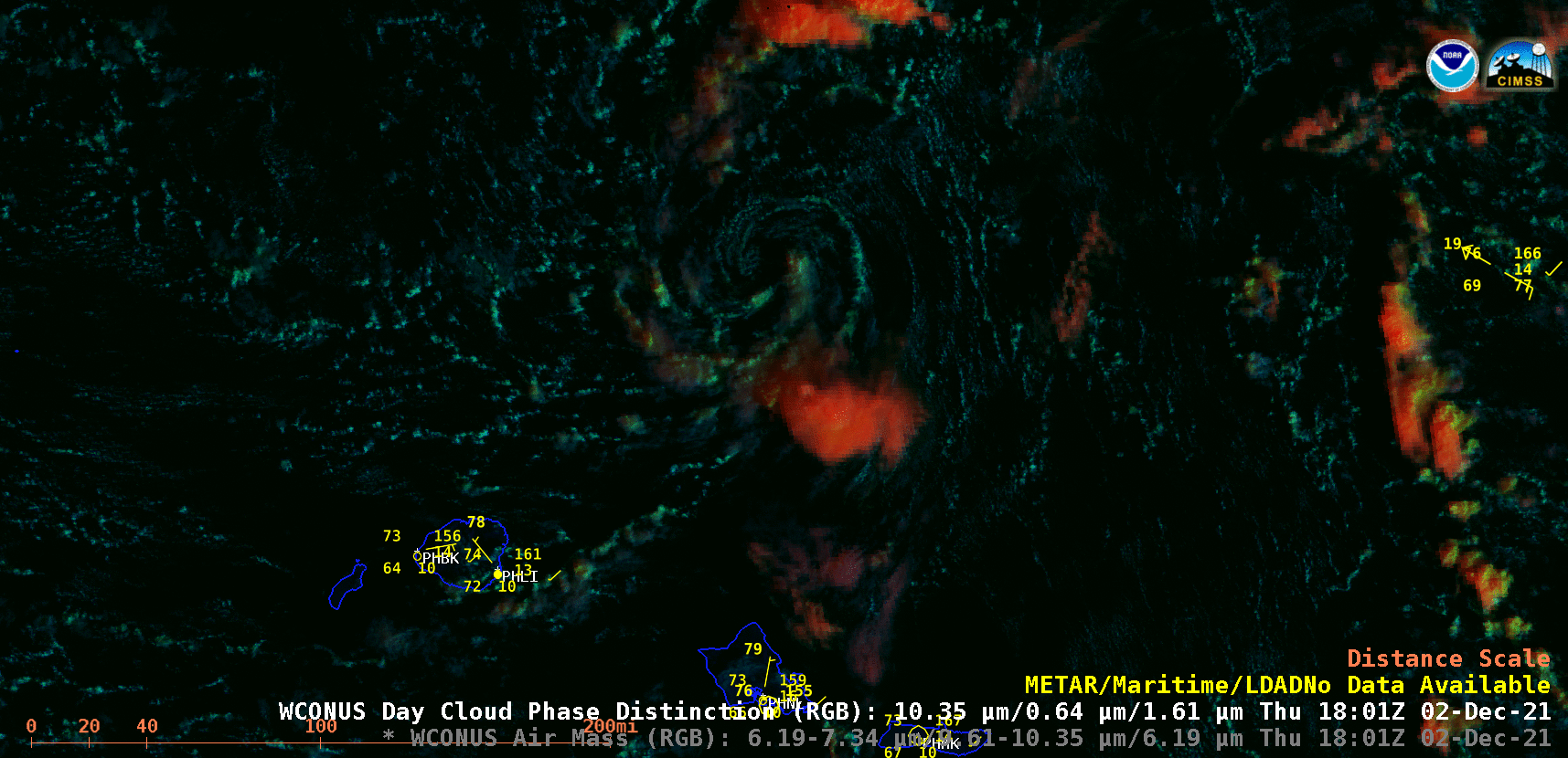
GOES-17 (GOES-West) “Red” Visible (0.64 µm) images, with and without plots of Visible Derived Motion Winds (above) showed a lower-tropospheric vortex propagating west-northwestward to the north of Hawai’i on 02 December 2021. There were no ship or buoy reports in the vicinity of the vortex, but Derived Motion Wind speeds were 20-25 knots or less during this time period.
Convergence near the center of the vortex was aiding in the development of some shallow convection — and GOES-17 Day Cloud Phase Distinction RGB images (below) indicated that the tops of many cloud features comprising the vortex were glaciating (exhibiting shades of green to yellow),
GOES-17 Day Cloud Phase Distinction RGB images [click to play animated GIF | MP4]