Cyclonic Development in the Indian Ocean
A tropical cyclone has developed in the Bay of Bengal and is moving northwest across the Indian subcontinent. The system is forecast to continue bringing heavy rains to Southern India until Thursday. It has already caused damage, flooding, and loss of life in Sri Lanka and India.
Animations showing water vapor data from the Himawari-8 satellite’s Advanced Himawari Imager (AHI) can be found below. The first animation highlights cyclonic structure developing over the past two days every hour. In the final frame, a distinct eye is visible. Similar to the ABI aboard GOES-16/17, AHI collects data every ten minutes. The second animation shows the ten-minute temporal resolution of AHI for a shorter time period, zooming to see the ‘eye’ of the storm.
These animations were made using RealEarth, a free data discovery and visualization platform developed at SSEC/CIMSS at the University of Wisconsin-Madison. It is available to anyone at realearth.ssec.wisc.edu.
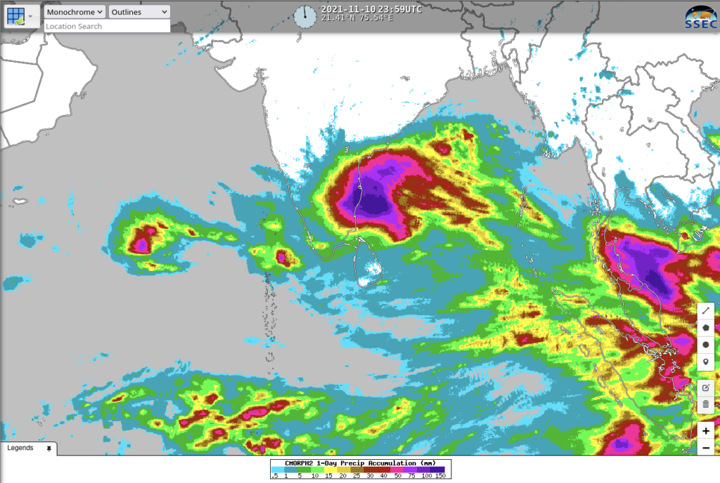
RealEarth also contains CMORPH estimates (hourly, daily and weekly) of precipitation. The daily precipitation from 10 November over the Bay of Bengal is shown below. The highest value in the colorbar is 150 mm — but in reality, the heaviest accumulations over the Bay of Bengal exceeded 300 mm!


