Henri becomes a hurricane off the US East Coast

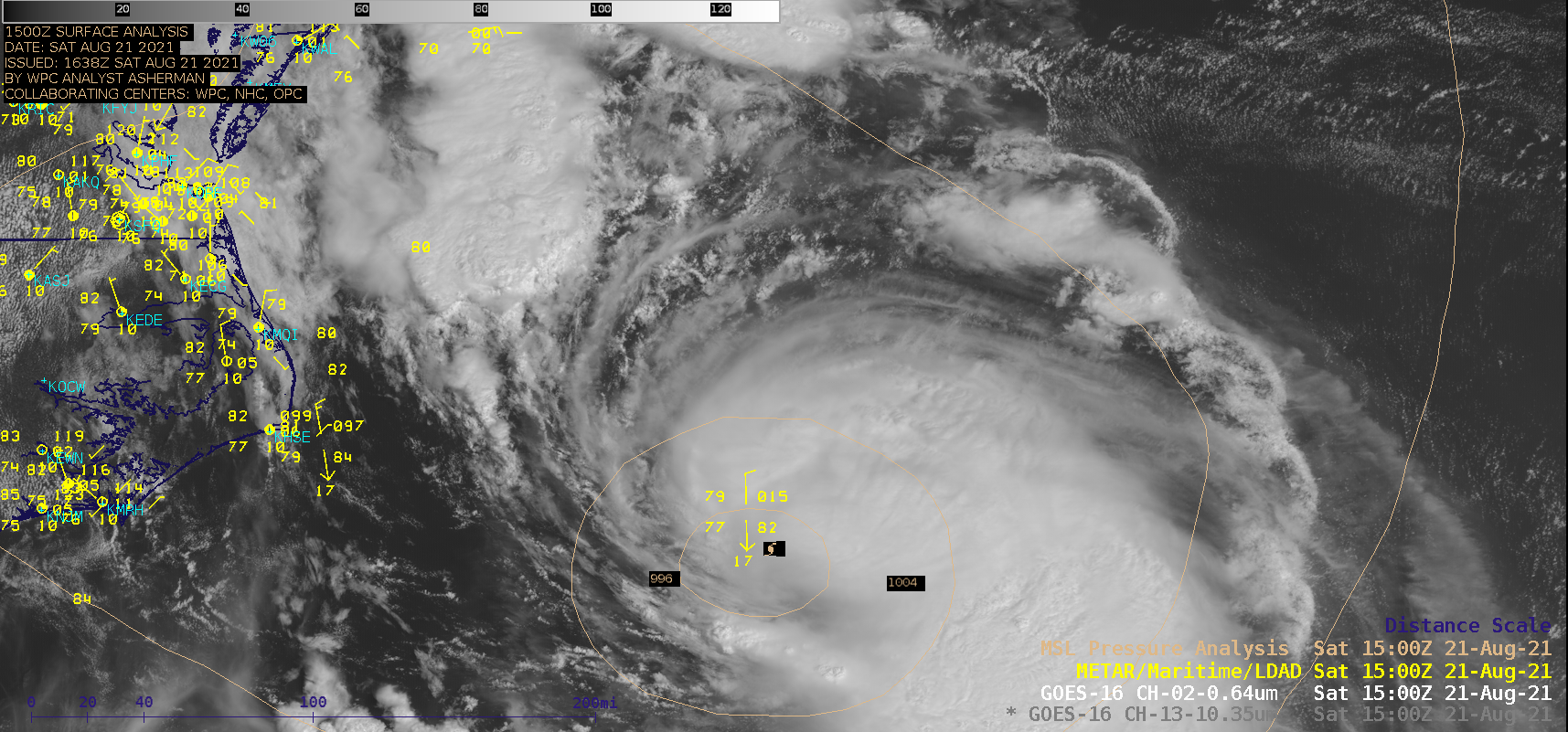
GOES-16 “Red” Visible (0.64 µm) and “Clean” Infrared Window (10.35 µm) images [click to play animation | MP4]
Tropical Storm Henri intensified to become a hurricane at 1500 UTC on 21 August 2021 — and 1–minute Mesoscale Domain Sector GOES-16 (GOES-East) “Red” Visible (0.64 µm) images and “Clean” Infrared Window (10.35 µm) images (above) showed Henri during the 1400-2300 UTC period. Visible images indicated that a small-diameter inner core began to form later in the day.
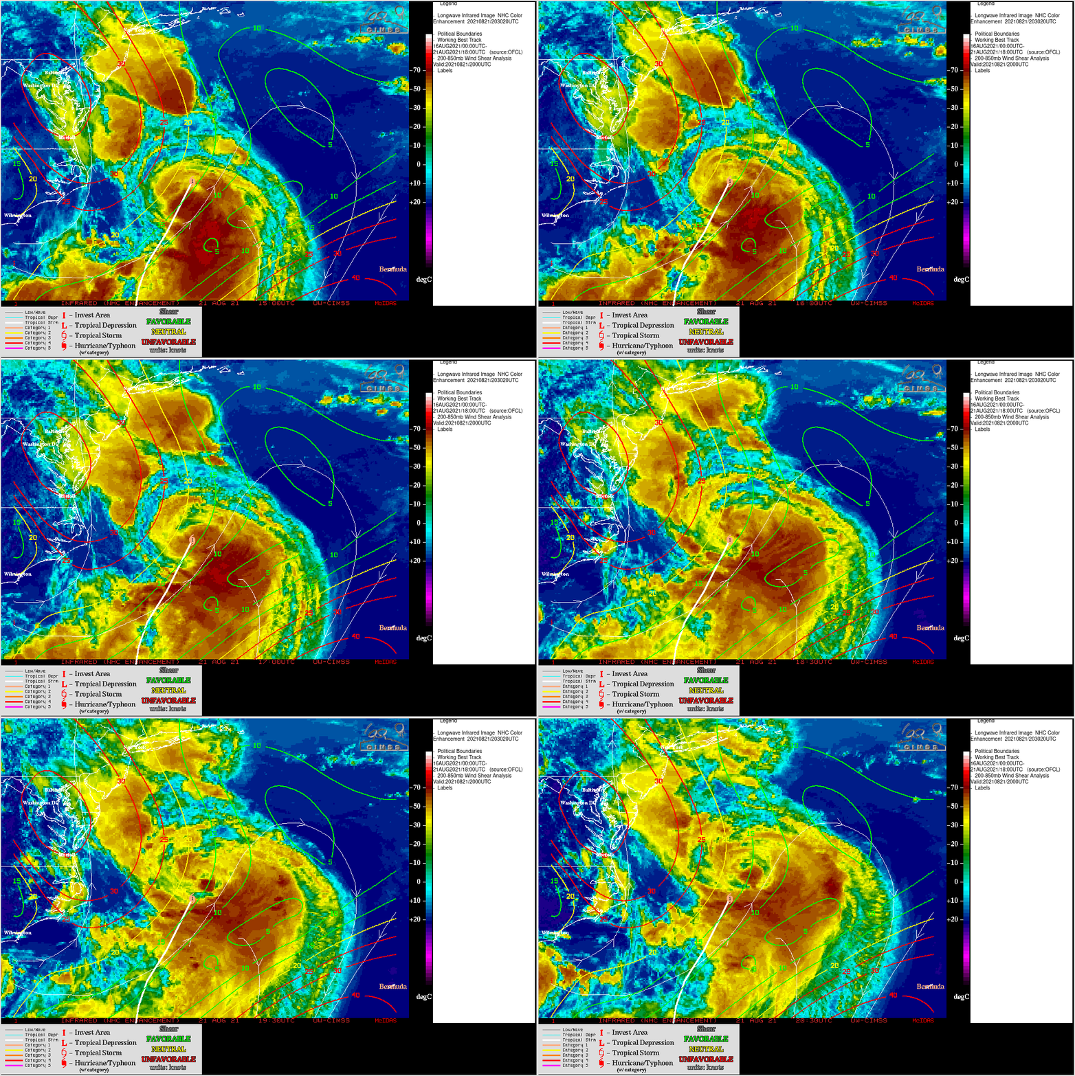
Henri was moving through an environment of light to moderate deep-layer wind shear, as seen in an animation of GOES-16 Infrared images from the CIMSS Tropical Cyclones site (below),
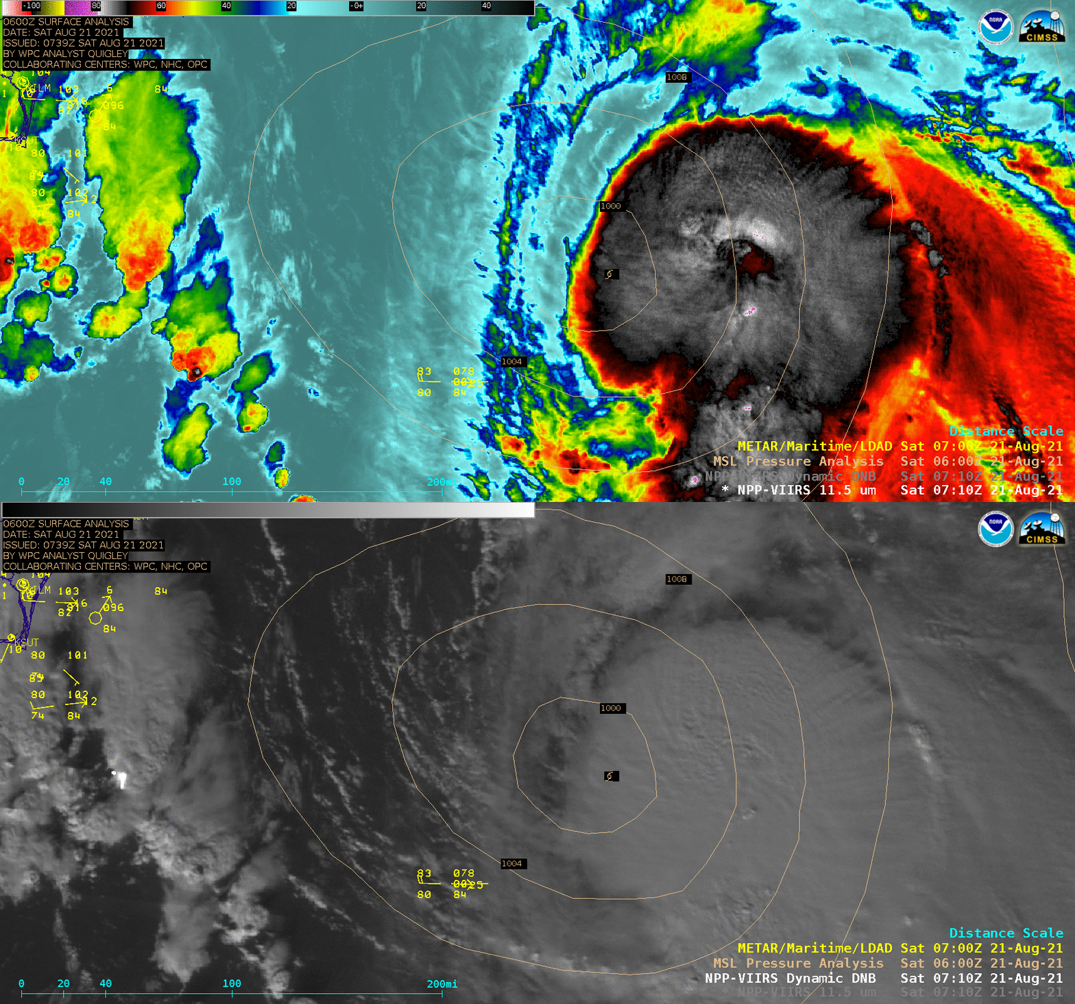
During the preceding nighttime hours, a toggle between Suomi NPP VIIRS Infrared and Day/Night Band images at 0710 UTC (below) showed a large convective burst east of the surface center.


