Near-surface winds over the south Pacific Ocean
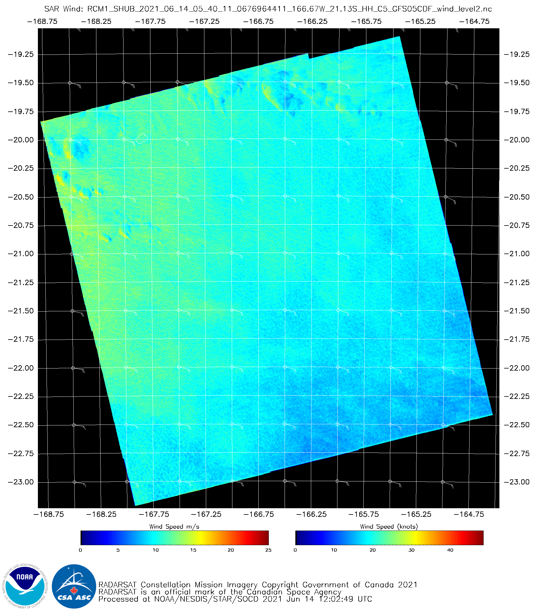
SAR Winds over the South Pacific, latitude/longitudes as indicated, at 0544 UTC on 14 June 2021 (click to enlarge)
Synthetic Aperture Radar (SAR) winds from RCM1 (RADARSAT Constellation Mission 1) over the south Pacific Ocean, from this site, show a gradient in wind speeds between 165 W and 168 W. Are there other ways to view this type of wind change over the open ocean?
GOES-17 Derived Motion wind vectors, below, showing 0500 UTC wind speeds between 950 and 800 mb (a different level than the near-surface winds from the SAR data), from Real Earth, below, do not clearly show the difference in winds over this same domain.
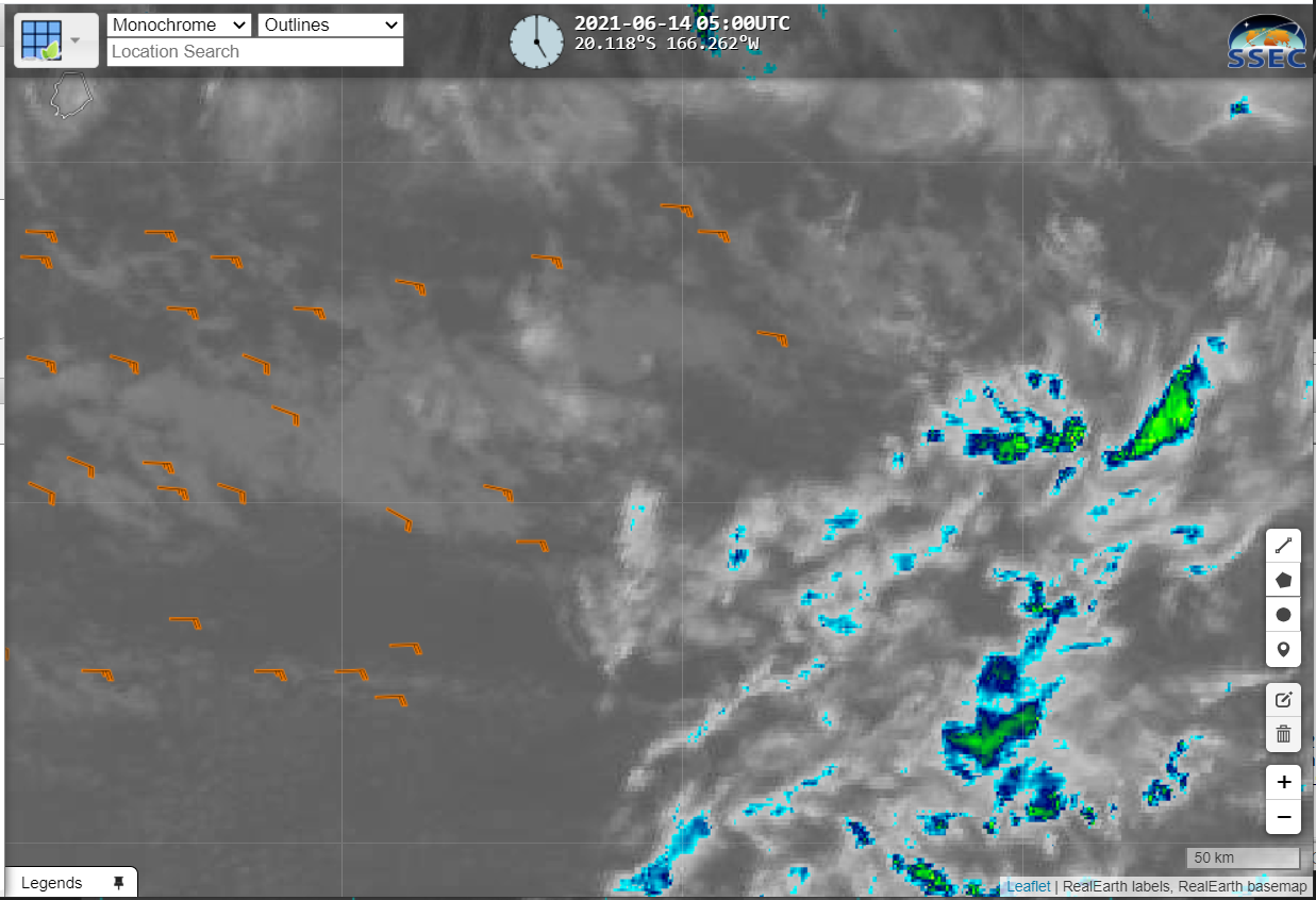
GOES-17 Enhanced window infrared (10.3 µm, Band 13) and 950-800 mb winds, 0500 UTC on 14 June 2021 (click to enlarge). Note that the latitude lines shown are 19.5, 22 and 24.5 South. The cold cloud top feature near the edge of this scene is also apparent at the beginning of the animation below.
GOES-17 Shortwave infrared imagery from the same time in that region, below, shows consistent westward motion at low levels (it’s hard to distinguish from this animation if the low-level wind speeds change across the domain; the cloud motions are all similar) with eastward motion aloft (that, is: considerable shear!)
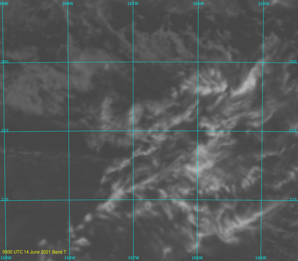
GOES-17 3.9 µm imagery over the South Pacific, latitudes/longitude lines shown, from 0500 to 0600 UTC on 14 June 2021 (Click to enlarge)
SAR winds can give information over the open ocean that is difficult to find in other places.